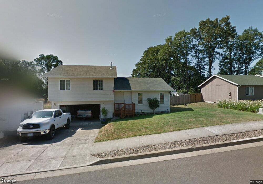
572 Dampier Dr Philomath, OR 97370
Estimated Value: $452,000 - $476,000
3
Beds
2
Baths
1,328
Sq Ft
$350/Sq Ft
Est. Value
About This Home
This home is located at 572 Dampier Dr, Philomath, OR 97370 and is currently estimated at $464,413, approximately $349 per square foot. 572 Dampier Dr is a home located in Benton County with nearby schools including Philomath Elementary School, Clemens Primary School, and Philomath Middle School.
Ownership History
Date
Name
Owned For
Owner Type
Purchase Details
Closed on
Dec 15, 2005
Sold by
Boyd Anthony T
Bought by
Maxey Gina M and Maxey Marc
Current Estimated Value
Home Financials for this Owner
Home Financials are based on the most recent Mortgage that was taken out on this home.
Original Mortgage
$36,000
Interest Rate
6.35%
Mortgage Type
Stand Alone Second
Purchase Details
Closed on
Nov 29, 2002
Sold by
Elias Jim and Elias Laura
Bought by
Boyd Anthony T
Home Financials for this Owner
Home Financials are based on the most recent Mortgage that was taken out on this home.
Original Mortgage
$141,775
Interest Rate
6.28%
Mortgage Type
FHA
Purchase Details
Closed on
Nov 26, 2002
Sold by
Kearsley Steven N
Bought by
Elias Jim and Elias Laura
Home Financials for this Owner
Home Financials are based on the most recent Mortgage that was taken out on this home.
Original Mortgage
$141,775
Interest Rate
6.28%
Mortgage Type
FHA
Create a Home Valuation Report for This Property
The Home Valuation Report is an in-depth analysis detailing your home's value as well as a comparison with similar homes in the area
Home Values in the Area
Average Home Value in this Area
Purchase History
| Date | Buyer | Sale Price | Title Company |
|---|---|---|---|
| Maxey Gina M | $180,000 | Ticor Title | |
| Boyd Anthony T | $144,000 | First American Title | |
| Elias Jim | -- | First American Title |
Source: Public Records
Mortgage History
| Date | Status | Borrower | Loan Amount |
|---|---|---|---|
| Closed | Maxey Gina M | $36,000 | |
| Open | Maxey Gina M | $144,000 | |
| Previous Owner | Boyd Anthony T | $141,775 |
Source: Public Records
Tax History Compared to Growth
Tax History
| Year | Tax Paid | Tax Assessment Tax Assessment Total Assessment is a certain percentage of the fair market value that is determined by local assessors to be the total taxable value of land and additions on the property. | Land | Improvement |
|---|---|---|---|---|
| 2025 | $4,909 | $242,828 | -- | -- |
| 2024 | $4,909 | $235,755 | -- | -- |
| 2023 | $4,653 | $228,888 | $0 | $0 |
| 2022 | $4,518 | $222,221 | $0 | $0 |
| 2021 | $4,390 | $215,749 | $0 | $0 |
| 2020 | $4,351 | $209,465 | $0 | $0 |
| 2019 | $3,865 | $203,364 | $0 | $0 |
| 2018 | $3,958 | $197,441 | $0 | $0 |
| 2017 | $3,721 | $191,690 | $0 | $0 |
| 2016 | $3,459 | $186,107 | $0 | $0 |
| 2015 | $3,324 | $180,686 | $0 | $0 |
| 2014 | $3,171 | $175,423 | $0 | $0 |
| 2012 | -- | $165,353 | $0 | $0 |
Source: Public Records
Map
Nearby Homes
- 803 Main St
- 538 Starlight Way
- 609 Coastal View Dr (Lan
- 609 Coastal View (Land Next To) Dr
- 791 Quail Glenn Dr
- 990 Pippa Ln
- 801 Quail Glenn Dr
- 807 Quail Glenn Dr
- 881 Quail Glenn Dr
- 345 N 11th (351) St
- 852 Marilyn Dr
- 769 N 9th St
- 807 N 12th St
- 223 N 14th St
- 1502 Timothy St
- 1717 Main St
- 760 S 16th St
- 235 S 18th St
- 240 N 19th St
- 688 Wyatt Ln