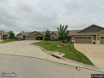
5723 Chimney Rocks Cir Lawrence, KS 66049
Gateway NeighborhoodEstimated Value: $375,557 - $450,000
3
Beds
2
Baths
1,887
Sq Ft
$220/Sq Ft
Est. Value
About This Home
This home is located at 5723 Chimney Rocks Cir, Lawrence, KS 66049 and is currently estimated at $415,389, approximately $220 per square foot. 5723 Chimney Rocks Cir is a home located in Douglas County with nearby schools including Langston Hughes Elementary School, Southwest Middle School, and Lawrence Free State High School.
Ownership History
Date
Name
Owned For
Owner Type
Purchase Details
Closed on
Aug 24, 2017
Sold by
R & H Builders Incorporated
Bought by
Pillar Theodore M and Pillar Diana
Current Estimated Value
Home Financials for this Owner
Home Financials are based on the most recent Mortgage that was taken out on this home.
Original Mortgage
$151,000
Outstanding Balance
$129,753
Interest Rate
4.03%
Mortgage Type
New Conventional
Estimated Equity
$278,467
Create a Home Valuation Report for This Property
The Home Valuation Report is an in-depth analysis detailing your home's value as well as a comparison with similar homes in the area
Home Values in the Area
Average Home Value in this Area
Purchase History
| Date | Buyer | Sale Price | Title Company |
|---|---|---|---|
| Pillar Theodore M | -- | Continental Title Co |
Source: Public Records
Mortgage History
| Date | Status | Borrower | Loan Amount |
|---|---|---|---|
| Open | Pillar Theodore M | $151,000 |
Source: Public Records
Tax History Compared to Growth
Tax History
| Year | Tax Paid | Tax Assessment Tax Assessment Total Assessment is a certain percentage of the fair market value that is determined by local assessors to be the total taxable value of land and additions on the property. | Land | Improvement |
|---|---|---|---|---|
| 2024 | $4,831 | $38,997 | $5,520 | $33,477 |
| 2023 | $5,116 | $39,756 | $5,520 | $34,236 |
| 2022 | $4,432 | $34,270 | $4,025 | $30,245 |
| 2021 | $4,335 | $32,442 | $4,025 | $28,417 |
| 2020 | $4,237 | $31,878 | $4,025 | $27,853 |
| 2019 | $4,215 | $31,740 | $4,025 | $27,715 |
| 2018 | $4,246 | $31,740 | $4,025 | $27,715 |
| 2017 | $898 | $0 | $0 | $0 |
Source: Public Records
Map
Nearby Homes
- 327 Three Forks Dr
- 309 Dean Ct
- 5614 Silverstone Dr
- 5245 Overland Dr
- 927 Drum Dr
- 6208 Blue Nile Dr
- 1120 Stoneridge Dr
- 5608 Plymouth Dr
- 5117 Parker Ct
- 5113 Parker Ct
- 5523 Plymouth Dr
- 6204 Berando Ct
- 1011 New Boston Ct
- 1103 Kanza Dr
- 5012 Congressional Way
- 904 Silver Rain Rd
- 1101 Juniper Ln
- 5227 Stonecreek Ct
- 1116 Douglas Dr
- 237 Landon Ct