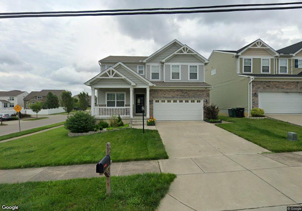
5768 Rhode Island Ave Cincinnati, OH 45237
Bond Hill NeighborhoodEstimated Value: $321,083 - $434,000
Studio
1
Bath
2,010
Sq Ft
$197/Sq Ft
Est. Value
About This Home
This home is located at 5768 Rhode Island Ave, Cincinnati, OH 45237 and is currently estimated at $395,771, approximately $196 per square foot. 5768 Rhode Island Ave is a home with nearby schools including Bond Hill Academy Elementary School, Shroder High School, and Clark Montessori High School.
Ownership History
Date
Name
Owned For
Owner Type
Purchase Details
Closed on
Apr 21, 2017
Sold by
Potterhill Homes Llc
Bought by
Howard James and Howard Marietta
Current Estimated Value
Home Financials for this Owner
Home Financials are based on the most recent Mortgage that was taken out on this home.
Original Mortgage
$179,896
Outstanding Balance
$148,650
Interest Rate
4.3%
Mortgage Type
New Conventional
Estimated Equity
$247,121
Create a Home Valuation Report for This Property
The Home Valuation Report is an in-depth analysis detailing your home's value as well as a comparison with similar homes in the area
Home Values in the Area
Average Home Value in this Area
Purchase History
| Date | Buyer | Sale Price | Title Company |
|---|---|---|---|
| Howard James | $35,000 | Springdale Title | |
| Potterhill Homes Llc | $36,000 | -- |
Source: Public Records
Mortgage History
| Date | Status | Borrower | Loan Amount |
|---|---|---|---|
| Open | Howard James | $179,896 |
Source: Public Records
Tax History
| Year | Tax Paid | Tax Assessment Tax Assessment Total Assessment is a certain percentage of the fair market value that is determined by local assessors to be the total taxable value of land and additions on the property. | Land | Improvement |
|---|---|---|---|---|
| 2025 | $782 | $100,037 | $11,375 | $88,662 |
| 2023 | $782 | $100,037 | $11,375 | $88,662 |
| 2022 | $918 | $77,651 | $12,173 | $65,478 |
| 2021 | $884 | $77,651 | $12,173 | $65,478 |
| 2020 | $888 | $77,651 | $12,173 | $65,478 |
| 2019 | $910 | $56,844 | $11,375 | $45,469 |
| 2018 | $911 | $11,375 | $11,375 | $0 |
| 2017 | $875 | $11,375 | $11,375 | $0 |
| 2016 | $0 | $0 | $0 | $0 |
Source: Public Records
Map
Nearby Homes
- 5716 Section Ave
- 2011 Dale Rd
- 5104 Lillian Dr
- 5447 Grafton Ave
- 2206 Varelman Ave
- 1858 Garden Ln
- 2063 E Seymour Ave
- 1730 Dale Rd
- 2136 Quatman Ave
- 5405 Carthage Ave
- 1933 Northcut Ave
- 2215 Ronda Ave
- 1966 Avonlea Ave
- 1740 Garden Ln
- 5336 Globe Ave
- 5360 Carthage Ave
- 5314 Section Ave
- 2119 Cathedral Ave
- 5256 Warren Ave
- 5310 Globe Ave
- 5764 Rhode Island Ave
- 5760 Rhode Island Ave
- 5840 Rhode Island Ave
- 5756 Rhode Island Ave
- 1930 Portman Ave
- 5801 Rhode Island Ave
- 1928 Portman Ave
- 5801 Destiny Ct
- 5842 Rhode Island Ave
- 5752 Rhode Island Ave
- 1926 Portman Ave
- 2039 Faith St
- 2050 Misty Oak Ln
- 2011 Faith St
- 1924 Portman Ave Unit 3
- 1924 Portman Ave Unit 4
- 1924 Portman Ave
- 5844 Rhode Island Ave
- 1922 Portman Ave
- 2013 Faith Dr
Your Personal Tour Guide
Ask me questions while you tour the home.