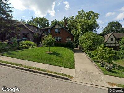
577 Wirham Place Cincinnati, OH 45220
Clifton NeighborhoodEstimated Value: $342,692 - $454,000
3
Beds
3
Baths
1,782
Sq Ft
$228/Sq Ft
Est. Value
About This Home
This home is located at 577 Wirham Place, Cincinnati, OH 45220 and is currently estimated at $406,673, approximately $228 per square foot. 577 Wirham Place is a home located in Hamilton County with nearby schools including Clifton Area Neighborhood School, Robert A. Taft Information Technology High School, and Gilbert A. Dater High School.
Ownership History
Date
Name
Owned For
Owner Type
Purchase Details
Closed on
Sep 16, 1998
Sold by
Robinson Craig D and Robinson Suzanne
Bought by
Linz Robert J
Current Estimated Value
Create a Home Valuation Report for This Property
The Home Valuation Report is an in-depth analysis detailing your home's value as well as a comparison with similar homes in the area
Home Values in the Area
Average Home Value in this Area
Purchase History
| Date | Buyer | Sale Price | Title Company |
|---|---|---|---|
| Linz Robert J | $173,500 | -- |
Source: Public Records
Mortgage History
| Date | Status | Borrower | Loan Amount |
|---|---|---|---|
| Open | Linz Robert J | $143,700 | |
| Closed | Linz Robert J | $30,000 | |
| Closed | Linz Robert J | $150,000 | |
| Closed | Linz Robert J | $129,108 | |
| Closed | Linz Robert J | $25,000 | |
| Closed | Linz Robert J | $114,080 | |
| Closed | Linz Robert J | $118,000 |
Source: Public Records
Tax History Compared to Growth
Tax History
| Year | Tax Paid | Tax Assessment Tax Assessment Total Assessment is a certain percentage of the fair market value that is determined by local assessors to be the total taxable value of land and additions on the property. | Land | Improvement |
|---|---|---|---|---|
| 2024 | $4,887 | $91,921 | $28,392 | $63,529 |
| 2023 | $5,049 | $91,921 | $28,392 | $63,529 |
| 2022 | $4,547 | $75,572 | $25,403 | $50,169 |
| 2021 | $4,362 | $75,572 | $25,403 | $50,169 |
| 2020 | $5,099 | $75,572 | $25,403 | $50,169 |
| 2019 | $4,976 | $67,473 | $22,680 | $44,793 |
| 2018 | $4,984 | $67,473 | $22,680 | $44,793 |
| 2017 | $4,735 | $67,473 | $22,680 | $44,793 |
| 2016 | $4,918 | $69,104 | $22,176 | $46,928 |
| 2015 | $4,434 | $69,104 | $22,176 | $46,928 |
| 2014 | $4,466 | $69,104 | $22,176 | $46,928 |
| 2013 | $4,130 | $62,822 | $20,160 | $42,662 |
Source: Public Records
Map
Nearby Homes
- 541 Ludlow Ave
- 558 Terrace Ave
- 3308 Morrison Ave
- 3517 Middleton Ave
- 3431 Telford St
- 521 Martin Luther King Dr W
- 526 Riddle Crest Ln
- 511 Mcalpin Ave
- 3507 Clifton Ave
- 725 Riddle Rd
- 522 Riddle Rd
- 2966 W McMicken Ave
- 347 Mcalpin Ave
- 345 Mcalpin Ave
- 610 Riddle Rd
- 892 Clifton Crest Terrace
- 896 Clifton Crest Terrace
- 877 Ludlow Ave
- 2946 W McMicken Ave
- 3068 Henshaw Ave
- 577 Wirham Place
- 575 Wirham Place
- 579 Wirham Place
- 3343 Gano Ave
- 576 Howell Ave
- 583 Wirham Place
- 580 Howell Ave
- 582 Howell Ave
- 568 Howell Ave
- 576 Wirham Place
- 585 Wirham Place
- 584 Wirham Place
- 584 Howell Ave
- 3355 Gano Ave
- 588 Wirham Place
- 560 Howell Ave
- 570 Howell Ave
- 3340 Gano Ave
- 596 Howell Ave
- 3338 Gano Ave