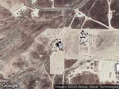
57715 Highway 58 Mc Kittrick, CA 93251
Estimated Value: $101,000 - $314,000
3
Beds
1
Bath
1,100
Sq Ft
$230/Sq Ft
Est. Value
About This Home
This home is located at 57715 Highway 58, Mc Kittrick, CA 93251 and is currently estimated at $253,030, approximately $230 per square foot. 57715 Highway 58 is a home located in Kern County with nearby schools including McKittrick Elementary School and Taft Union High School.
Ownership History
Date
Name
Owned For
Owner Type
Purchase Details
Closed on
Jun 22, 2023
Sold by
Lutz Arnold
Bought by
Irving Michael
Current Estimated Value
Purchase Details
Closed on
Jun 28, 2017
Sold by
Brock Charles M
Bought by
Brock Charles M and Brock Michael E
Purchase Details
Closed on
May 28, 2016
Sold by
Brock Charles M
Bought by
Brock Charles M and Brock Michael E
Home Financials for this Owner
Home Financials are based on the most recent Mortgage that was taken out on this home.
Original Mortgage
$72,000
Interest Rate
3.66%
Purchase Details
Closed on
Sep 28, 2010
Sold by
Brock Linda and Brock Charles M
Bought by
Brock Charles M and Brock Linda R
Purchase Details
Closed on
Apr 6, 2010
Sold by
Cinquegrani Josephine
Bought by
E & B Natural Resources Management Corpo
Purchase Details
Closed on
Jan 15, 2010
Sold by
Estate Of Juanita Whitehill
Bought by
E & B Natural Resources Management Corpo
Purchase Details
Closed on
Sep 16, 2009
Sold by
Parker William Rankin
Bought by
E & B Natural Resources Management Corpo
Purchase Details
Closed on
Aug 20, 2009
Sold by
Estate Of Raechel R Parker
Bought by
E & B Natural Resources Management Corpo
Purchase Details
Closed on
Aug 19, 2009
Sold by
Prickett Margaret
Bought by
E & B Natural Resources Management Corpora
Purchase Details
Closed on
Aug 18, 2009
Sold by
Zitnik Jacqueline
Bought by
E & B Natural Resources Management Corpora
Purchase Details
Closed on
Jul 13, 2009
Sold by
Beard Alice R and Beard Alice Rankin
Bought by
E & B Natural Resources Management Corpora
Purchase Details
Closed on
Aug 11, 2005
Sold by
Windes Ronald A
Bought by
Brock Charles M and Brock Linda
Home Financials for this Owner
Home Financials are based on the most recent Mortgage that was taken out on this home.
Original Mortgage
$62,500
Interest Rate
5.64%
Create a Home Valuation Report for This Property
The Home Valuation Report is an in-depth analysis detailing your home's value as well as a comparison with similar homes in the area
Home Values in the Area
Average Home Value in this Area
Purchase History
| Date | Buyer | Sale Price | Title Company |
|---|---|---|---|
| Irving Michael | $2,000 | None Listed On Document | |
| Brock Charles M | -- | None Available | |
| Brock Charles M | $28,000 | None Available | |
| Brock Charles M | -- | None Available | |
| E & B Natural Resources Management Corpo | -- | None Available | |
| E & B Natural Resources Management Corpo | -- | None Available | |
| E & B Natural Resources Management Corpo | -- | None Available | |
| E & B Natural Resources Management Corpora | -- | None Available | |
| E & B Natural Resources Management Corpo | -- | None Available | |
| E & B Natural Resources Management Corpora | -- | None Available | |
| E & B Natural Resources Management Corpora | -- | None Available | |
| E & B Natural Resources Management Corpora | -- | None Available | |
| Brock Charles M | $75,000 | Financial Title Company |
Source: Public Records
Mortgage History
| Date | Status | Borrower | Loan Amount |
|---|---|---|---|
| Previous Owner | Brock Michael E | $215,710 | |
| Previous Owner | Brock Charles M | $72,000 | |
| Previous Owner | Brock Linda | $12,000 | |
| Previous Owner | Brock Charles M | $7,000 | |
| Previous Owner | Brock Charles M | $62,500 |
Source: Public Records
Tax History Compared to Growth
Tax History
| Year | Tax Paid | Tax Assessment Tax Assessment Total Assessment is a certain percentage of the fair market value that is determined by local assessors to be the total taxable value of land and additions on the property. | Land | Improvement |
|---|---|---|---|---|
| 2024 | $1,673 | $145,803 | $39,442 | $106,361 |
| 2023 | $1,673 | $142,945 | $38,669 | $104,276 |
| 2022 | $1,374 | $122,487 | $40,822 | $81,665 |
| 2021 | $1,312 | $120,086 | $40,022 | $80,064 |
| 2020 | $1,312 | $118,856 | $39,612 | $79,244 |
| 2019 | $1,250 | $118,856 | $39,612 | $79,244 |
| 2018 | $1,207 | $114,243 | $38,075 | $76,168 |
| 2017 | $1,170 | $112,004 | $37,329 | $74,675 |
| 2016 | $1,110 | $100,000 | $21,000 | $79,000 |
| 2015 | $502 | $47,717 | $15,904 | $31,813 |
| 2014 | $504 | $47,717 | $15,904 | $31,813 |
Source: Public Records
Map
Nearby Homes
- 23270 2nd St
- 23359 Cloud Ave
- 23321 Baker Ave
- 0 099-322-23-00-4 West Side Hwy 33 Unit IG25046108
- 0 W No St Unit 202502100
- 0 No Site Address Unit OC24216937
- 0 09932223004 West Side Hwy
- 123 Front St
- 0 Dargatz Rd
- 0 Almanor Rd Unit ND24244632
- 0 Arlight Trail Unit NS24234003
- 0 Atolia Rd Unit TR25054428
- 0 Hwy 58 & Old Tracy Ave Unit 202500916
- 0 Highway 58 & Old Tracy Ave Unit 202208571
- 0 Alleghany Rd Unit PW22026512
- 0 Annette Trail Unit PI25079291
- 0 Angwin Trail Unit SW24195314
- 0 Angwin Trail Unit SC23145926
- 14555 Bellflower Rd
- 184 W 1st St
