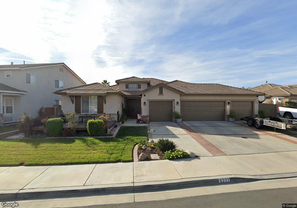
5777 Territory Ln Corona, CA 92880
Estimated Value: $885,521 - $950,000
4
Beds
3
Baths
2,655
Sq Ft
$349/Sq Ft
Est. Value
About This Home
This home is located at 5777 Territory Ln, Corona, CA 92880 and is currently estimated at $925,380, approximately $348 per square foot. 5777 Territory Ln is a home located in Riverside County with nearby schools including Harada Elementary School, River Heights Intermediate School, and Eleanor Roosevelt High School.
Ownership History
Date
Name
Owned For
Owner Type
Purchase Details
Closed on
May 6, 2020
Sold by
Walker Larry A and Walker Karen H
Bought by
Walker Lawrence A and Walker Karen H
Current Estimated Value
Purchase Details
Closed on
Apr 21, 2003
Sold by
Regent Norco Llc
Bought by
Walker Larry A and Walker Karen H
Home Financials for this Owner
Home Financials are based on the most recent Mortgage that was taken out on this home.
Original Mortgage
$263,508
Outstanding Balance
$113,949
Interest Rate
5.84%
Estimated Equity
$811,431
Create a Home Valuation Report for This Property
The Home Valuation Report is an in-depth analysis detailing your home's value as well as a comparison with similar homes in the area
Home Values in the Area
Average Home Value in this Area
Purchase History
| Date | Buyer | Sale Price | Title Company |
|---|---|---|---|
| Walker Lawrence A | -- | None Available | |
| Walker Larry A | $329,500 | Stewart Title |
Source: Public Records
Mortgage History
| Date | Status | Borrower | Loan Amount |
|---|---|---|---|
| Open | Walker Larry A | $263,508 |
Source: Public Records
Tax History Compared to Growth
Tax History
| Year | Tax Paid | Tax Assessment Tax Assessment Total Assessment is a certain percentage of the fair market value that is determined by local assessors to be the total taxable value of land and additions on the property. | Land | Improvement |
|---|---|---|---|---|
| 2025 | $6,790 | $417,992 | $108,608 | $309,384 |
| 2023 | $6,790 | $401,763 | $104,392 | $297,371 |
| 2022 | $6,604 | $393,887 | $102,346 | $291,541 |
| 2021 | $6,476 | $386,165 | $100,340 | $285,825 |
| 2020 | $6,390 | $382,207 | $99,312 | $282,895 |
| 2019 | $6,269 | $374,714 | $97,365 | $277,349 |
| 2018 | $6,133 | $367,367 | $95,457 | $271,910 |
| 2017 | $6,001 | $360,165 | $93,586 | $266,579 |
| 2016 | $5,902 | $353,103 | $91,751 | $261,352 |
| 2015 | $5,799 | $347,801 | $90,374 | $257,427 |
| 2014 | $5,618 | $340,990 | $88,604 | $252,386 |
Source: Public Records
Map
Nearby Homes
- 5764 Territory Ln
- 12745 Longhorne Dr
- 5800 Hamner Ave Unit 249
- 5800 Hamner Ave Unit 237
- 5800 Hamner Ave Unit 159
- 5800 Hamner Ave Unit 354
- 5722 Canoe Dr
- 5986 Dr
- 6388 Pictor
- 4613 S Amherst Privado
- 416 Hamner Ave
- 6064 Bryce Dr
- 12931 Royale Dr
- 12865 Auburn Dr
- 4062 E Fincastle St
- 6046 Fairfax Dr
- 6052 Fairfax Dr
- 6045 Fairfax Dr
- 6053 Fairfax Dr
- 6055 Fairfax Dr
- 5785 Territory Ln
- 5769 Territory Ln
- 12733 Longhorne Dr
- 12682 Bridgewater Dr
- 5793 Territory Ln
- 5772 Territory Ln
- 5780 Territory Ln
- 5788 Territory Ln
- 12694 Bridgewater Dr
- 5796 Territory Ln
- 12726 Longhorne Dr
- 12714 Longhorne Dr
- 5771 Cairo Ct
- 12738 Longhorne Dr
- 12757 Longhorne Dr
- 12702 Longhorne Dr
- 12685 Longhorne Dr
- 5779 Cairo Ct
- 5787 Cairo Ct
- 5763 Cairo Ct