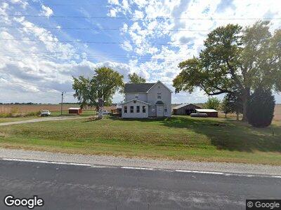
5785 Highway 22 SE Lone Tree, IA 52755
Estimated Value: $219,000 - $306,000
3
Beds
1
Bath
1,434
Sq Ft
$173/Sq Ft
Est. Value
About This Home
This home is located at 5785 Highway 22 SE, Lone Tree, IA 52755 and is currently estimated at $248,617, approximately $173 per square foot. 5785 Highway 22 SE is a home located in Johnson County with nearby schools including Lone Tree Elementary School and Lone Tree Junior/Senior High School.
Ownership History
Date
Name
Owned For
Owner Type
Purchase Details
Closed on
Nov 29, 2013
Sold by
Jenks Michelle L
Bought by
Jenks Jason L
Current Estimated Value
Home Financials for this Owner
Home Financials are based on the most recent Mortgage that was taken out on this home.
Original Mortgage
$10,711
Interest Rate
4.38%
Mortgage Type
Credit Line Revolving
Create a Home Valuation Report for This Property
The Home Valuation Report is an in-depth analysis detailing your home's value as well as a comparison with similar homes in the area
Home Values in the Area
Average Home Value in this Area
Purchase History
| Date | Buyer | Sale Price | Title Company |
|---|---|---|---|
| Jenks Jason L | -- | None Available |
Source: Public Records
Mortgage History
| Date | Status | Borrower | Loan Amount |
|---|---|---|---|
| Closed | Jenks Jason L | $98,000 | |
| Closed | Jenks Jason L | $100,800 | |
| Closed | Jenks Jason L | $10,711 | |
| Closed | Jenks Jason | $100,550 | |
| Closed | Jenks Jason | $15,000 | |
| Closed | Jenks Jason Lee | $109,909 |
Source: Public Records
Tax History Compared to Growth
Tax History
| Year | Tax Paid | Tax Assessment Tax Assessment Total Assessment is a certain percentage of the fair market value that is determined by local assessors to be the total taxable value of land and additions on the property. | Land | Improvement |
|---|---|---|---|---|
| 2024 | $2,172 | $187,600 | $67,500 | $120,100 |
| 2023 | $2,098 | $187,600 | $67,500 | $120,100 |
| 2022 | $2,074 | $155,000 | $61,200 | $93,800 |
| 2021 | $2,040 | $155,000 | $61,200 | $93,800 |
| 2020 | $2,040 | $145,000 | $51,200 | $93,800 |
| 2019 | $1,970 | $145,000 | $51,200 | $93,800 |
| 2018 | $1,938 | $137,700 | $51,200 | $86,500 |
| 2017 | $1,972 | $137,700 | $51,200 | $86,500 |
| 2016 | $1,870 | $135,200 | $51,200 | $84,000 |
| 2015 | $1,870 | $135,200 | $51,200 | $84,000 |
| 2014 | $1,774 | $126,500 | $45,800 | $80,700 |
Source: Public Records
Map
Nearby Homes
- 202 E Commercial St
- 110 E Linn St
- 513 S Center St
- 104 S Huskins St
- 207 Short St
- 1118 120th St
- 25838 Golden Oak Ln
- 25840 Golden Oak Ln
- 25736 Golden Pond Ln SE
- 25738 Golden Pond Ln SE
- 25832 Golden Oak Ln
- 25836 Golden Oak Ln
- 25824 Golden Oak Ln
- 1210 Davis Ave
- 1437 Terrace Ln
- 1443 Bunker Dr
- 1314 Highway 6
- 4581 Johnson Cedar Rd SE
- 185 Cedar Muscatine Rd
- 219 N Calhoun St