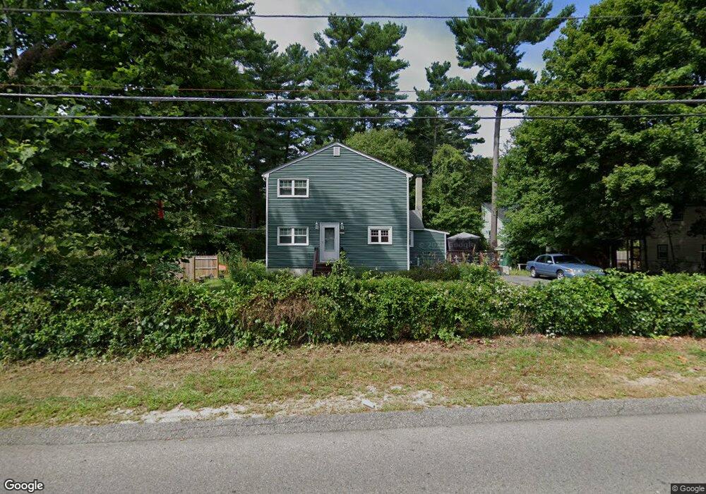
58 Cobb St Norton, MA 02766
Estimated Value: $483,182 - $544,000
3
Beds
1
Bath
1,516
Sq Ft
$344/Sq Ft
Est. Value
About This Home
This home is located at 58 Cobb St, Norton, MA 02766 and is currently estimated at $521,796, approximately $344 per square foot. 58 Cobb St is a home located in Bristol County with nearby schools including J.C. Solmonese Elementary School, Henri A. Yelle Elementary School, and Norton Middle School.
Ownership History
Date
Name
Owned For
Owner Type
Purchase Details
Closed on
Jun 27, 2025
Sold by
Okeeffe Janet M
Bought by
Okeeffe Mollie L
Current Estimated Value
Purchase Details
Closed on
Sep 26, 2016
Sold by
Nagle John T
Bought by
Okeeffe Janet M
Purchase Details
Closed on
Dec 17, 2015
Sold by
Okeeffe Janet M
Bought by
Nagle John T
Purchase Details
Closed on
Jul 29, 1987
Sold by
Maclean Eric W
Bought by
Okeefe Denis M
Create a Home Valuation Report for This Property
The Home Valuation Report is an in-depth analysis detailing your home's value as well as a comparison with similar homes in the area
Home Values in the Area
Average Home Value in this Area
Purchase History
| Date | Buyer | Sale Price | Title Company |
|---|---|---|---|
| Okeeffe Mollie L | -- | -- | |
| Okeeffe Mollie L | -- | -- | |
| Okeeffe Janet M | -- | -- | |
| Okeeffe Janet M | -- | -- | |
| Nagle John T | -- | -- | |
| Nagle John T | -- | -- | |
| Okeefe Denis M | $99,000 | -- |
Source: Public Records
Mortgage History
| Date | Status | Borrower | Loan Amount |
|---|---|---|---|
| Previous Owner | Okeefe Denis M | $256,319 | |
| Previous Owner | Okeefe Denis M | $252,532 |
Source: Public Records
Tax History Compared to Growth
Tax History
| Year | Tax Paid | Tax Assessment Tax Assessment Total Assessment is a certain percentage of the fair market value that is determined by local assessors to be the total taxable value of land and additions on the property. | Land | Improvement |
|---|---|---|---|---|
| 2025 | $5,053 | $389,600 | $160,900 | $228,700 |
| 2024 | $4,806 | $371,100 | $153,300 | $217,800 |
| 2023 | $4,548 | $350,100 | $144,500 | $205,600 |
| 2022 | $4,406 | $309,000 | $131,400 | $177,600 |
| 2021 | $4,198 | $281,200 | $125,200 | $156,000 |
| 2020 | $4,040 | $273,000 | $121,500 | $151,500 |
| 2019 | $3,914 | $262,700 | $116,900 | $145,800 |
| 2018 | $3,772 | $248,800 | $110,400 | $138,400 |
| 2017 | $3,666 | $238,500 | $110,400 | $128,100 |
| 2016 | $3,444 | $220,600 | $103,900 | $116,700 |
| 2015 | $3,320 | $215,700 | $101,800 | $113,900 |
| 2014 | $3,160 | $205,600 | $97,000 | $108,600 |
Source: Public Records
Map
Nearby Homes
- 12 Sylvan Rd
- 0 Brook Pkwy
- 268 Reservoir St
- 15 Patten Rd
- 39 Evergreen Rd
- 10 Ridge Rd
- 21 Juniper Rd
- 23 Indian Rd
- 15 Rock Ln
- 12 Kayak Trail
- 6 Horton Dr
- 18 Columbine Rd
- 8 Johnson Dr
- 93 Mansfield Ave
- 0 Kensington Rd
- 15 Reservoir St Unit 44
- 157 Mansfield Ave Unit 14
- 0 Knollwood & 0 Rear Kensington
- 711 Ware St
- 778 Ware St