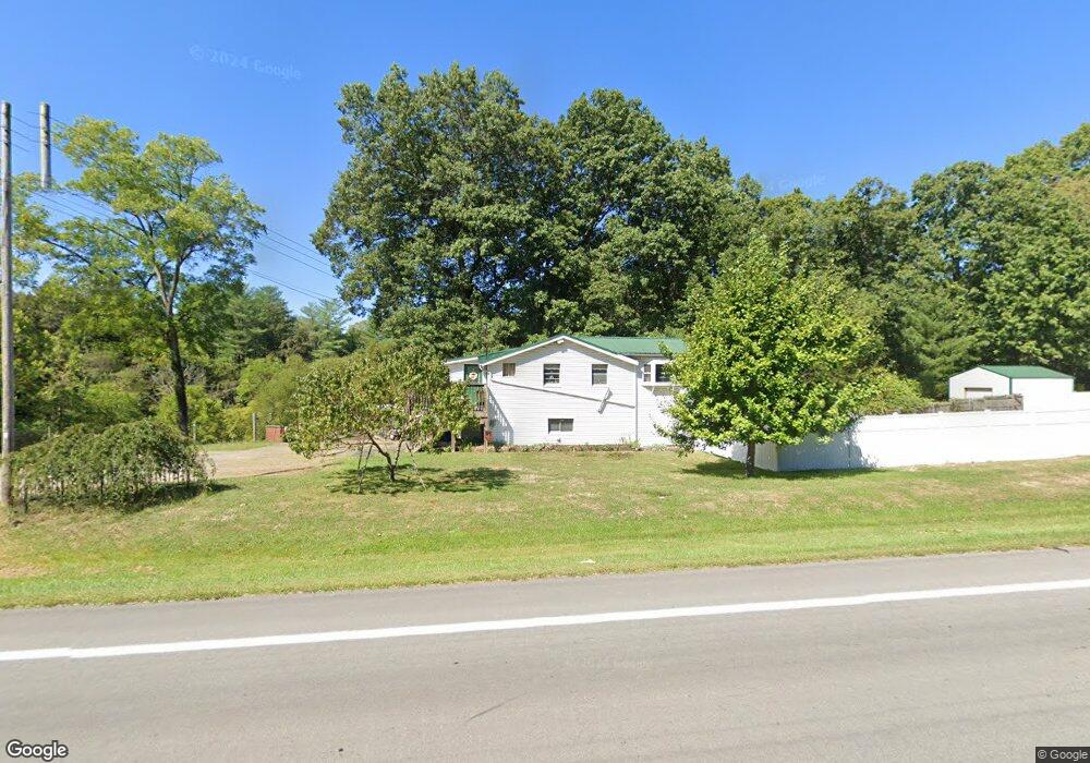
5805 State Route 339 Vincent, OH 45784
Estimated Value: $154,000 - $287,000
2
Beds
1
Bath
976
Sq Ft
$212/Sq Ft
Est. Value
About This Home
This home is located at 5805 State Route 339, Vincent, OH 45784 and is currently estimated at $207,052, approximately $212 per square foot. 5805 State Route 339 is a home located in Washington County with nearby schools including Warren High School.
Ownership History
Date
Name
Owned For
Owner Type
Purchase Details
Closed on
Jul 15, 2010
Sold by
Beneficial Ohio Inc
Bought by
Walker Richard E
Current Estimated Value
Home Financials for this Owner
Home Financials are based on the most recent Mortgage that was taken out on this home.
Original Mortgage
$42,000
Interest Rate
3.94%
Mortgage Type
Future Advance Clause Open End Mortgage
Purchase Details
Closed on
Apr 13, 2010
Sold by
Alexander Forrest D and Alexander Sharon
Bought by
Beneficial Ohio Inc
Purchase Details
Closed on
Oct 19, 2000
Bought by
Alexander Forrest D and Alexander Sh
Purchase Details
Closed on
Jun 17, 1993
Bought by
Brown Gregory D
Purchase Details
Closed on
Jun 11, 1993
Bought by
Delong James F
Purchase Details
Closed on
Aug 11, 1989
Purchase Details
Closed on
Jun 16, 1989
Create a Home Valuation Report for This Property
The Home Valuation Report is an in-depth analysis detailing your home's value as well as a comparison with similar homes in the area
Home Values in the Area
Average Home Value in this Area
Purchase History
| Date | Buyer | Sale Price | Title Company |
|---|---|---|---|
| Walker Richard E | $49,500 | Title First Parkersburg | |
| Beneficial Ohio Inc | $67,160 | Attorney | |
| Alexander Forrest D | $72,000 | -- | |
| Brown Gregory D | $45,000 | -- | |
| Delong James F | -- | -- | |
| -- | $40,000 | -- | |
| -- | $37,500 | -- |
Source: Public Records
Mortgage History
| Date | Status | Borrower | Loan Amount |
|---|---|---|---|
| Previous Owner | Walker Richard E | $42,000 |
Source: Public Records
Tax History Compared to Growth
Tax History
| Year | Tax Paid | Tax Assessment Tax Assessment Total Assessment is a certain percentage of the fair market value that is determined by local assessors to be the total taxable value of land and additions on the property. | Land | Improvement |
|---|---|---|---|---|
| 2024 | $1,423 | $36,620 | $8,580 | $28,040 |
| 2023 | $1,423 | $36,620 | $8,580 | $28,040 |
| 2022 | $1,406 | $36,620 | $8,580 | $28,040 |
| 2021 | $1,234 | $30,670 | $7,010 | $23,660 |
| 2020 | $1,233 | $30,670 | $7,010 | $23,660 |
| 2019 | $1,216 | $30,670 | $7,010 | $23,660 |
| 2018 | $1,152 | $28,200 | $5,610 | $22,590 |
| 2017 | $1,137 | $28,200 | $5,610 | $22,590 |
| 2016 | $1,435 | $28,200 | $5,610 | $22,590 |
| 2015 | $761 | $21,040 | $5,390 | $15,650 |
| 2014 | $1,083 | $21,040 | $5,390 | $15,650 |
| 2013 | $382 | $21,040 | $5,390 | $15,650 |
Source: Public Records
Map
Nearby Homes
- 735 Timberline Dr
- 135 Knob Dr
- 120 Fleming Dr
- 545 Lewis Pointe Dr
- 265 James Ln
- 6570 State Route 339
- 0 Brackenridge Rd Unit 23885979
- 0 Brackenridge Rd Unit 23885976
- 0 Layman Rd Unit 5162075
- 0 Layman Rd Unit 5162072
- 2425 Rocky Point Rd
- 1556 Mcgill Rd
- 10270 Ohio 550
- 28 Mcgill Rd
- 8045 Veto Rd
- 15 Oakmont Dr
- 0 Ohio 550
- 2207 Veto Rd
- 130 Maze Rd
- 190 Maze Rd
- 5805 State Route 339
- 5867 State Route 339
- 45 Timberline Dr
- 45 Timberline Dr
- 55 Timberline Dr
- 85 Timberline Dr
- 60 Timberline Dr
- 115 Timberline Dr
- 98 Timberline Dr
- 5680 Ohio 339
- 740 Brackenridge Rd
- 155 Timberline Dr
- 155 Timberline Dr
- 140 Timberline Dr
- 660 Brackenridge Rd
- 5680 State Route 339
- 590 Brackenridge Rd
- 840 Brackenridge Rd
- 681 Brackenridge Rd
- 769 Brackenridge Rd