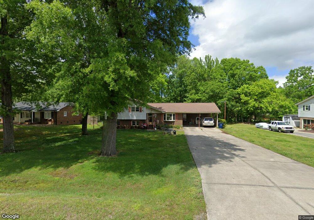
5814 Appling Rd High Point, NC 27263
Estimated Value: $210,000 - $384,000
3
Beds
2
Baths
2,232
Sq Ft
$125/Sq Ft
Est. Value
About This Home
This home is located at 5814 Appling Rd, High Point, NC 27263 and is currently estimated at $278,557, approximately $124 per square foot. 5814 Appling Rd is a home located in Guilford County with nearby schools including Allen Jay Elementary School, Southern Guilford Middle, and Southern Guilford High School.
Ownership History
Date
Name
Owned For
Owner Type
Purchase Details
Closed on
Mar 9, 2021
Sold by
Roland Iva Ruth and Iva Ruth Roland Revocable Trus
Bought by
Barber Brandon C and Barber Chelsea D
Current Estimated Value
Purchase Details
Closed on
Jun 3, 2020
Sold by
Roland Iva Ruth
Bought by
Roland Iva Ruth and Iva Ruth Roland Revocable Trust
Purchase Details
Closed on
Oct 3, 1990
Bought by
Roland John C
Create a Home Valuation Report for This Property
The Home Valuation Report is an in-depth analysis detailing your home's value as well as a comparison with similar homes in the area
Home Values in the Area
Average Home Value in this Area
Purchase History
We collect this data history from publicly available records. To have your information removed, we recommend requesting removal directly through your county’s website.
| Date | Buyer | Sale Price | Title Company |
|---|---|---|---|
| Barber Brandon C | $130,000 | Chicago Title Insurance Co | |
| Roland Iva Ruth | -- | None Available | |
| Roland John C | $88,000 | -- |
Source: Public Records
Tax History
| Year | Tax Paid | Tax Assessment Tax Assessment Total Assessment is a certain percentage of the fair market value that is determined by local assessors to be the total taxable value of land and additions on the property. | Land | Improvement |
|---|---|---|---|---|
| 2025 | $1,767 | $201,500 | $35,000 | $166,500 |
| 2024 | $1,767 | $201,500 | $35,000 | $166,500 |
| 2023 | $1,767 | $201,500 | $35,000 | $166,500 |
| 2022 | $1,767 | $201,500 | $35,000 | $166,500 |
| 2021 | $1,116 | $127,200 | $20,000 | $107,200 |
| 2020 | $1,116 | $127,200 | $20,000 | $107,200 |
| 2019 | $1,116 | $127,200 | $0 | $0 |
| 2018 | $1,110 | $127,200 | $0 | $0 |
| 2017 | $1,082 | $127,200 | $0 | $0 |
| 2016 | $1,058 | $120,900 | $0 | $0 |
| 2015 | $1,064 | $120,900 | $0 | $0 |
| 2014 | $1,076 | $120,900 | $0 | $0 |
Source: Public Records
Map
Nearby Homes
- 6912 Harlow Dr
- 6955 Harlow Dr
- 6318 Gray Farm Rd
- 1513 N Carolina 62
- 6401 Staffordshire Dr
- 7257 Sleepy Hollow Dr
- 7101 Buxenbury Dr
- 1642 R2 Kersey Valley Rd
- 1648 R2 & R3 Kersey Valley Rd Unit R2 & R3
- 312 Oak Ridge Dr
- 1644 Kersey Valley Rd
- 105 Oak Ridge Dr
- 5875 Groometown Rd
- 1164 Nc Highway 62 W
- 3738 Amber Way
- 1147 Nc Highway 62 W
- 4375 Huff Rd
- 108 Brightleaf Ct
- 223 Aldridge Ln
- 3415 Longview Dr
- 5807 Appling Rd
- 6906 Tulane Dr
- 7000 Tulane Dr
- 5816 Appling Rd
- 6904 Tulane Dr
- 5815 Appling Rd
- 7002 Tulane Dr
- 6902 Tulane Dr
- 5816 Checker Rd
- 5812 Appling Rd
- 5902 Checker Rd
- 6900 Tulane Dr
- 5814 Checker Rd
- 6808 Tulane Dr
- 5809 Dancy Rd
- 5812 Checker Rd
- 6002 Checker Rd
- 5903 Checker Rd
- 6006 Checker Rd
- 5807 Dancy Rd
Your Personal Tour Guide
Ask me questions while you tour the home.