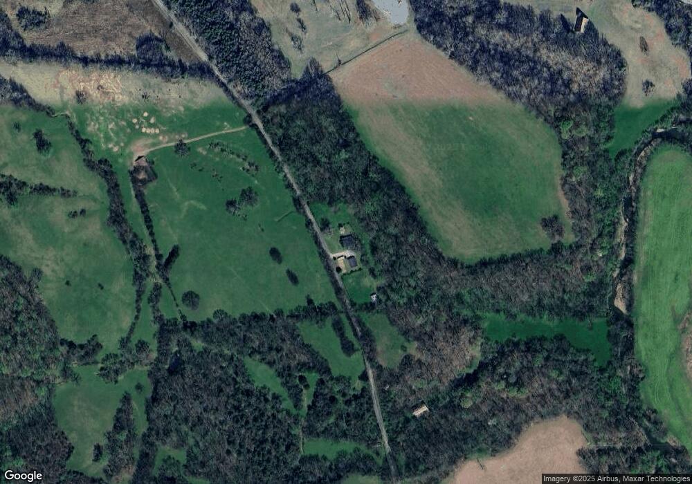
583 Bradshaw Creek Rd Pulaski, TN 38478
Estimated Value: $146,110 - $265,000
Studio
1
Bath
1,646
Sq Ft
$125/Sq Ft
Est. Value
About This Home
This home is located at 583 Bradshaw Creek Rd, Pulaski, TN 38478 and is currently estimated at $205,778, approximately $125 per square foot. 583 Bradshaw Creek Rd is a home located in Giles County with nearby schools including Pulaski Elementary School, Southside Elementary School, and Bridgeforth Middle School.
Ownership History
Date
Name
Owned For
Owner Type
Purchase Details
Closed on
Nov 4, 2022
Sold by
Helton Tommy T
Bought by
Helton Dewey Richard
Current Estimated Value
Purchase Details
Closed on
Apr 3, 2002
Sold by
Clifton Kevin
Bought by
Helton Tommy T
Home Financials for this Owner
Home Financials are based on the most recent Mortgage that was taken out on this home.
Original Mortgage
$64,500
Interest Rate
6.8%
Purchase Details
Closed on
Feb 24, 1997
Sold by
Garner James Randall
Bought by
Clifton Kevin
Home Financials for this Owner
Home Financials are based on the most recent Mortgage that was taken out on this home.
Original Mortgage
$40,823
Interest Rate
7.9%
Purchase Details
Closed on
Dec 13, 1985
Bought by
Garner James Randall and Garner Loretta
Create a Home Valuation Report for This Property
The Home Valuation Report is an in-depth analysis detailing your home's value as well as a comparison with similar homes in the area
Purchase History
| Date | Buyer | Sale Price | Title Company |
|---|---|---|---|
| Helton Dewey Richard | -- | -- | |
| Helton Tommy T | $67,500 | -- | |
| Clifton Kevin | $40,000 | -- | |
| Garner James Randall | -- | -- |
Source: Public Records
Mortgage History
| Date | Status | Borrower | Loan Amount |
|---|---|---|---|
| Previous Owner | Garner James Randall | $64,500 | |
| Previous Owner | Garner James Randall | $40,823 |
Source: Public Records
Tax History
| Year | Tax Paid | Tax Assessment Tax Assessment Total Assessment is a certain percentage of the fair market value that is determined by local assessors to be the total taxable value of land and additions on the property. | Land | Improvement |
|---|---|---|---|---|
| 2025 | $806 | $34,950 | $7,650 | $27,300 |
| 2024 | $694 | $34,950 | $7,650 | $27,300 |
| 2023 | $694 | $34,950 | $7,650 | $27,300 |
| 2022 | $694 | $34,950 | $7,650 | $27,300 |
| 2021 | $608 | $21,525 | $5,075 | $16,450 |
| 2020 | $608 | $21,525 | $5,075 | $16,450 |
| 2019 | $608 | $21,525 | $5,075 | $16,450 |
| 2018 | $608 | $21,525 | $5,075 | $16,450 |
| 2017 | $608 | $21,525 | $5,075 | $16,450 |
| 2016 | $622 | $20,950 | $4,650 | $16,300 |
| 2015 | $581 | $20,950 | $4,650 | $16,300 |
| 2014 | $580 | $20,943 | $0 | $0 |
Source: Public Records
Map
Nearby Homes
- 0 Interstate 65 Access Rd Unit RTC2803426
- 0 Interstate 65 Access Rd Unit RTC2803424
- 0 U S Highway 64
- 780 Bunker Hill Rd
- 750 Bunker Hill Rd
- 5A Young Rd
- 6A Young Rd
- 6 Young Rd
- 5 Young Rd
- 3 Tallent Rd
- 2T Gunter Hollow Rd
- 3T Gunter Hollow Rd
- 4570 Highway 64 E
- 161 Oliver Branch Rd
- 4070 Bunker Hill Rd
- 305 Ingram Rd
- 410 Britton Hollow Rd
- 3165 Pulaski Hwy
- 1 Diana Ridge Rd
- 2 Diana Ridge Rd
- 2154 U S 64
- 2150 U S 64
- 2465 U S 64
- 2847 U S 64
- 2635 U S 64
- 0 Access Rd
- 0 Access Rd Unit 1026255
- 0 Access Rd Unit RTC2628338
- 0 Access Rd Unit RTC2628328
- 0 Access Rd Unit RTC2628319
- 0 Access Rd Unit RTC2628306
- 0 Access Rd Unit RTC2610983
- 0 Access Rd Unit RTC2610970
- 0 Access Rd Unit RTC2610958
- 0 Access Rd Unit RTC2542820
- 0 Access Rd Unit RTC2542818
- 0 Access Rd Unit RTC2542815
- 0 Access Rd Unit RTC2542809
- 0 Access Rd Unit RTC1659179
- 0 Access Rd Unit RTC2530448
