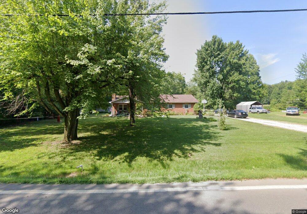
5839 State Route 132 Batavia, OH 45103
Estimated Value: $234,499 - $296,000
2
Beds
1
Bath
1,300
Sq Ft
$205/Sq Ft
Est. Value
About This Home
This home is located at 5839 State Route 132, Batavia, OH 45103 and is currently estimated at $267,125, approximately $205 per square foot. 5839 State Route 132 is a home located in Clermont County with nearby schools including Clermont Northeastern Elementary School, Clermont Northeastern Middle School, and Clermont Northeastern High School.
Ownership History
Date
Name
Owned For
Owner Type
Purchase Details
Closed on
Aug 12, 2005
Sold by
Amann Bryan S and Amann Shannon
Bought by
Gunter John and Gunter Cynthia K
Current Estimated Value
Home Financials for this Owner
Home Financials are based on the most recent Mortgage that was taken out on this home.
Original Mortgage
$101,250
Interest Rate
8.12%
Mortgage Type
Fannie Mae Freddie Mac
Create a Home Valuation Report for This Property
The Home Valuation Report is an in-depth analysis detailing your home's value as well as a comparison with similar homes in the area
Home Values in the Area
Average Home Value in this Area
Purchase History
| Date | Buyer | Sale Price | Title Company |
|---|---|---|---|
| Gunter John | $135,000 | Partners Land Title Agency |
Source: Public Records
Mortgage History
| Date | Status | Borrower | Loan Amount |
|---|---|---|---|
| Closed | Gunter John | $101,250 | |
| Closed | Gunter John | $27,000 |
Source: Public Records
Tax History Compared to Growth
Tax History
| Year | Tax Paid | Tax Assessment Tax Assessment Total Assessment is a certain percentage of the fair market value that is determined by local assessors to be the total taxable value of land and additions on the property. | Land | Improvement |
|---|---|---|---|---|
| 2024 | $2,150 | $54,810 | $13,720 | $41,090 |
| 2023 | $2,151 | $54,810 | $13,720 | $41,090 |
| 2022 | $1,897 | $44,730 | $11,200 | $33,530 |
| 2021 | $1,786 | $44,730 | $11,200 | $33,530 |
| 2020 | $1,785 | $44,730 | $11,200 | $33,530 |
| 2019 | $1,813 | $44,740 | $10,330 | $34,410 |
| 2018 | $1,813 | $44,740 | $10,330 | $34,410 |
| 2017 | $1,814 | $44,740 | $10,330 | $34,410 |
| 2016 | $1,559 | $36,370 | $8,400 | $27,970 |
| 2015 | $1,379 | $36,370 | $8,400 | $27,970 |
| 2014 | $1,379 | $36,370 | $8,400 | $27,970 |
| 2013 | $1,395 | $35,180 | $9,100 | $26,080 |
Source: Public Records
Map
Nearby Homes
- 5979 Belfast Rd
- 1847 Ohio 131
- 1799 Rosewood Ln
- 6203 Willow Cove
- 6206 Willow Cove
- 1802 Oak Cove
- 6300 Trailview Dr
- 6075 Belfast Rd
- 1758 Parkfield Way
- 1760 Parkfield Way
- 1762 Parkfield Way
- 1764 Parkfield Way
- 1766 Parkfield Way
- 1768 Parkfield Way
- 1766 Parkfield Way
- 1764 Parkfield Way
- Fairview Plan at Grove Park
- Nicholas Plan at Grove Park
- Dawson Plan at Grove Park
- Wallace Plan at Grove Park
- 5847 State Route 132
- 5849 State Route 132
- 5819 Stonelick Wms Cor Rd
- 5805 Stonelick Wms Cor Rd
- 5805 Stonelick Williams Corner Rd
- 5836 State Route 132
- 5859 State Route 132
- 5859 Ohio 132
- 5803 Stonelick Wms Cor Rd
- 5803 Stonelick Williams Corner Rd
- 5869 State Route 132
- 5820 State Route 132
- 5809 State Route 132
- 5807 State Route 132
- 5791 Stonelick Wms Cor Rd
- 5790 Stonelick Wms Cor Rd
- 2063 Ohio 131
- 2063 State Route 131
- 2049 State Route 131
- 2049 Ohio 131