Estimated Value: $336,000 - $429,299
3
Beds
1
Bath
2,000
Sq Ft
$200/Sq Ft
Est. Value
About This Home
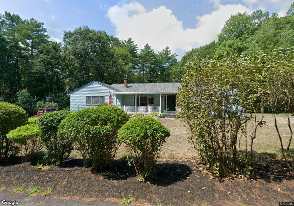
This home is located at 584 Old Keene Rd, Athol, MA 01331 and is currently estimated at $399,325, approximately $199 per square foot. 584 Old Keene Rd is a home located in Worcester County with nearby schools including Athol High School.
Ownership History
Date
Name
Owned For
Owner Type
Purchase Details
Closed on
Nov 18, 2002
Sold by
Guilmette Kimberly S
Bought by
Parker Jeffrey R and Parker Laurie R
Current Estimated Value
Home Financials for this Owner
Home Financials are based on the most recent Mortgage that was taken out on this home.
Original Mortgage
$148,000
Outstanding Balance
$62,036
Interest Rate
6.03%
Mortgage Type
Purchase Money Mortgage
Estimated Equity
$337,289
Create a Home Valuation Report for This Property
The Home Valuation Report is an in-depth analysis detailing your home's value as well as a comparison with similar homes in the area
Home Values in the Area
Average Home Value in this Area
Purchase History
| Date | Buyer | Sale Price | Title Company |
|---|---|---|---|
| Parker Jeffrey R | $185,000 | -- |
Source: Public Records
Mortgage History
| Date | Status | Borrower | Loan Amount |
|---|---|---|---|
| Open | Parker Jeffrey R | $148,000 | |
| Previous Owner | Parker Jeffrey R | $97,500 | |
| Previous Owner | Parker Jeffrey R | $98,200 |
Source: Public Records
Tax History Compared to Growth
Tax History
| Year | Tax Paid | Tax Assessment Tax Assessment Total Assessment is a certain percentage of the fair market value that is determined by local assessors to be the total taxable value of land and additions on the property. | Land | Improvement |
|---|---|---|---|---|
| 2025 | $4,576 | $360,000 | $72,100 | $287,900 |
| 2024 | $4,479 | $349,100 | $72,100 | $277,000 |
| 2023 | $4,302 | $306,400 | $52,100 | $254,300 |
| 2022 | $4,136 | $257,700 | $49,600 | $208,100 |
| 2021 | $5,014 | $239,600 | $45,100 | $194,500 |
| 2020 | $4,060 | $236,300 | $41,100 | $195,200 |
| 2019 | $4,122 | $236,200 | $38,600 | $197,600 |
| 2018 | $4,344 | $214,600 | $35,100 | $179,500 |
| 2017 | $3,805 | $186,500 | $35,100 | $151,400 |
| 2016 | $3,498 | $176,400 | $35,100 | $141,300 |
| 2015 | $3,357 | $176,400 | $35,100 | $141,300 |
| 2014 | $3,251 | $176,400 | $35,100 | $141,300 |
Source: Public Records
Map
Nearby Homes
- 80 Pheasant Ln
- 122 Pheasant Ln
- 10 Pheasant Ln
- 5 Pheasant Ln
- 9 Pheasant Ln
- 4 Pheasant Ln
- 579 Old Keene Rd
- 43 Pheasant Ln
- Lot "A" Miller St
- LOT106 Wallingford Ave
- Lot A2 Lyons Hill Rd
- Lot 54 Daniel Shay Hywy
- LOT B Adams Rd
- LOT A Adams Rd
- LOT C Adams Rd
- LOT Silver Lake St
- LOT Vine St
- LOT51 Old Keene Rd
- LOT51B Old Keene Rd
- LOT199 Yale Ave