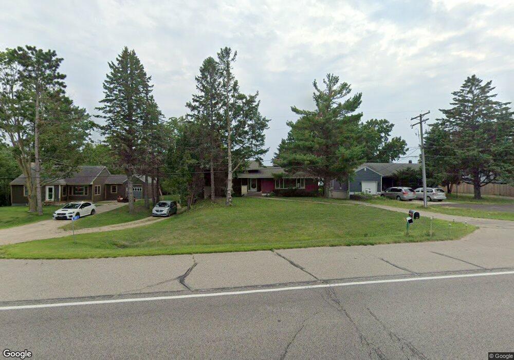
5841 Lonsdale Blvd E Northfield, MN 55057
Estimated Value: $280,000 - $450,000
3
Beds
2
Baths
1,468
Sq Ft
$270/Sq Ft
Est. Value
About This Home
This home is located at 5841 Lonsdale Blvd E, Northfield, MN 55057 and is currently estimated at $395,816, approximately $269 per square foot. 5841 Lonsdale Blvd E is a home located in Rice County with nearby schools including Bridgewater Elementary School, Northfield Middle School, and Northfield Senior High School.
Ownership History
Date
Name
Owned For
Owner Type
Purchase Details
Closed on
Nov 3, 2021
Sold by
Machacek David G and Marilyn J Machacek Family Trus
Bought by
Mckenzie Stephen J
Current Estimated Value
Home Financials for this Owner
Home Financials are based on the most recent Mortgage that was taken out on this home.
Original Mortgage
$276,411
Outstanding Balance
$253,353
Interest Rate
3.01%
Mortgage Type
New Conventional
Estimated Equity
$142,463
Create a Home Valuation Report for This Property
The Home Valuation Report is an in-depth analysis detailing your home's value as well as a comparison with similar homes in the area
Home Values in the Area
Average Home Value in this Area
Purchase History
| Date | Buyer | Sale Price | Title Company |
|---|---|---|---|
| Mckenzie Stephen J | $69,536 | None Available | |
| Mckenzie Stephen J | $250,464 | None Available |
Source: Public Records
Mortgage History
| Date | Status | Borrower | Loan Amount |
|---|---|---|---|
| Open | Mckenzie Stephen J | $276,411 | |
| Closed | Mckenzie Stephen J | $276,411 |
Source: Public Records
Tax History Compared to Growth
Tax History
| Year | Tax Paid | Tax Assessment Tax Assessment Total Assessment is a certain percentage of the fair market value that is determined by local assessors to be the total taxable value of land and additions on the property. | Land | Improvement |
|---|---|---|---|---|
| 2025 | $4,118 | $385,900 | $139,000 | $246,900 |
| 2024 | $4,118 | $351,000 | $122,500 | $228,500 |
| 2023 | $3,302 | $351,000 | $122,500 | $228,500 |
| 2022 | $3,210 | $314,500 | $106,000 | $208,500 |
| 2021 | $3,160 | $275,800 | $95,200 | $180,600 |
| 2020 | $3,064 | $266,800 | $95,200 | $171,600 |
| 2019 | $3,210 | $254,500 | $95,200 | $159,300 |
| 2018 | $2,930 | $257,800 | $100,200 | $157,600 |
| 2017 | $2,646 | $231,900 | $100,200 | $131,700 |
| 2016 | $2,774 | $232,200 | $100,200 | $132,000 |
| 2015 | $3,350 | $234,100 | $100,200 | $133,900 |
| 2014 | -- | $280,000 | $100,200 | $179,800 |
Source: Public Records
Map
Nearby Homes
- 9206 Edgebrook Dr
- 1108 Greenvale Ave W Unit 2
- 904 Forest Ave
- 717 Lincoln St N
- 701 3rd St W
- XXXXX 330th St
- 708 Saint Olaf Ave
- 616 Greenvale Ave W
- 612 Greenvale Ave W
- 602 Greenvale Ave W
- 621 Highland Ave W
- XXXX Harvest Hills Outlook
- 706 Greenvale Ave W
- 812 Ivanhoe Dr
- 1105 Hawthorne Ct
- 620 Greenvale Ave W
- 1000 Cannon Valley Dr Unit 143
- 504 2nd St W
- 511 Kraewood Dr
- 515 Kraewood Dr
- 5829 Lonsdale Blvd E
- 5851 Lonsdale Blvd E
- 5815 Lonsdale Blvd E
- 5789 Lonsdale Blvd E
- 5785 Lonsdale Blvd E
- 5130 5130 90th St E
- 5130 90th St E
- 5204 Echart Ct
- 5208 Echart Ct
- 5216 Echart Ct
- 5190 Echart Ct
- 5231 90th St E
- 5194 Echart Ct
- 5180 Echart Ct
- 5211 90th St E
- 5186 Echart Ct
- 5188 Lonsdale Blvd E
- 5340 90th St E
- 5224 90th St E
- 5174 90th St E