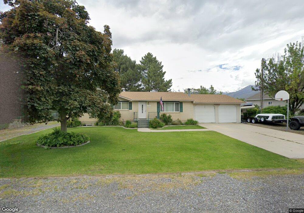
5848 W 9600 N Unit 3 Highland, UT 84003
Estimated Value: $745,000 - $827,000
--
Bed
2
Baths
1,428
Sq Ft
$554/Sq Ft
Est. Value
About This Home
This home is located at 5848 W 9600 N Unit 3, Highland, UT 84003 and is currently estimated at $790,465, approximately $553 per square foot. 5848 W 9600 N Unit 3 is a home located in Utah County with nearby schools including Legacy Elementary School, Mountain Ridge Junior High School, and American Fork High School.
Ownership History
Date
Name
Owned For
Owner Type
Purchase Details
Closed on
Nov 15, 2017
Sold by
Abplanalp David and Abplanalp Diane
Bought by
Abplanalp David D and Abplanalp Diane M
Current Estimated Value
Purchase Details
Closed on
Aug 23, 2000
Sold by
Ricks Wayne J and Ricks Nancy S
Bought by
Abplanalp David and Abplanalp Diane
Home Financials for this Owner
Home Financials are based on the most recent Mortgage that was taken out on this home.
Original Mortgage
$144,000
Outstanding Balance
$51,955
Interest Rate
8.15%
Estimated Equity
$738,510
Create a Home Valuation Report for This Property
The Home Valuation Report is an in-depth analysis detailing your home's value as well as a comparison with similar homes in the area
Home Values in the Area
Average Home Value in this Area
Purchase History
| Date | Buyer | Sale Price | Title Company |
|---|---|---|---|
| Abplanalp David D | -- | Provo Land Title Co | |
| Abplanalp David | -- | Sundance Title Insurance |
Source: Public Records
Mortgage History
| Date | Status | Borrower | Loan Amount |
|---|---|---|---|
| Open | Abplanalp David | $144,000 |
Source: Public Records
Tax History Compared to Growth
Tax History
| Year | Tax Paid | Tax Assessment Tax Assessment Total Assessment is a certain percentage of the fair market value that is determined by local assessors to be the total taxable value of land and additions on the property. | Land | Improvement |
|---|---|---|---|---|
| 2025 | $3,026 | $388,795 | $415,800 | $291,100 |
| 2024 | $3,026 | $373,725 | $0 | $0 |
| 2023 | $2,798 | $372,845 | $0 | $0 |
| 2022 | $2,948 | $380,930 | $0 | $0 |
| 2021 | $2,505 | $482,100 | $235,800 | $246,300 |
| 2020 | $2,341 | $441,800 | $205,000 | $236,800 |
| 2019 | $2,081 | $410,900 | $205,000 | $205,900 |
| 2018 | $2,116 | $397,100 | $200,000 | $197,100 |
| 2017 | $1,955 | $195,800 | $0 | $0 |
| 2016 | $1,942 | $181,775 | $0 | $0 |
| 2015 | $1,987 | $176,275 | $0 | $0 |
| 2014 | $1,833 | $161,150 | $0 | $0 |
Source: Public Records
Map
Nearby Homes
- 35 W 1350 N
- 9780 N 6000 W
- 703 S 850 W
- 179 W 1290 N
- 5973 W 9960 N
- 9947 N Yorkshire Ct
- 287 W 1360 N
- 1201 N 160 E
- 356 W 1300 N
- 5423 W Pebble Ln
- 1071 Timpview Dr
- 1438 N 400 W
- 10197 N 5750 W
- 6190 W 10050 N
- 344 W 1080 N
- 5586 W 10130 N
- 425 W 1120 N
- 11337 N 5950 W Unit 7
- 10238 N 6530 W Unit 15
- 1051 N 390 E Unit 103