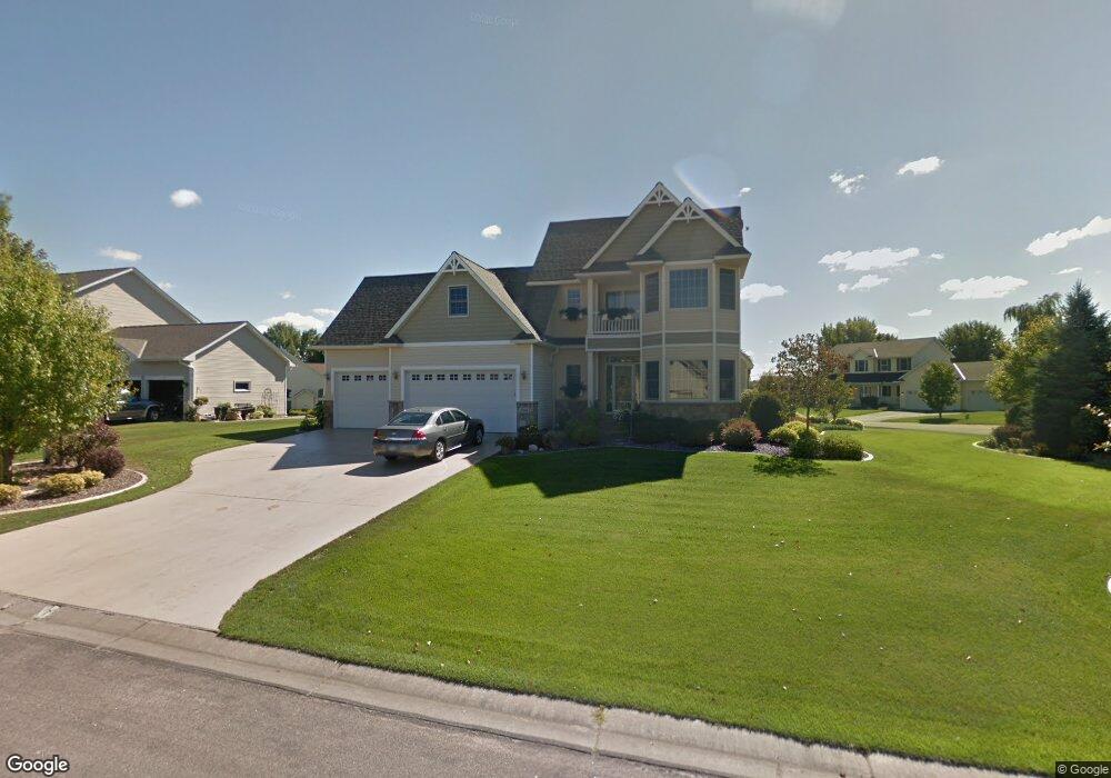
5880 Mallard Ponds Dr Saint Paul, MN 55110
Estimated Value: $518,000 - $580,250
4
Beds
4
Baths
3,437
Sq Ft
$163/Sq Ft
Est. Value
About This Home
This home is located at 5880 Mallard Ponds Dr, Saint Paul, MN 55110 and is currently estimated at $559,063, approximately $162 per square foot. 5880 Mallard Ponds Dr is a home located in Ramsey County with nearby schools including Lincoln Elementary School, Central Middle School, and St. Jude of the Lake Catholic School.
Ownership History
Date
Name
Owned For
Owner Type
Purchase Details
Closed on
Aug 18, 2020
Sold by
Dahlen Ralph W and Dahlen Noelle L
Bought by
Hauth James M and Hauth Maren C
Current Estimated Value
Home Financials for this Owner
Home Financials are based on the most recent Mortgage that was taken out on this home.
Original Mortgage
$344,000
Outstanding Balance
$305,152
Interest Rate
3%
Estimated Equity
$253,911
Purchase Details
Closed on
Mar 26, 2002
Sold by
Sand Antoinette C
Bought by
Dahlen Ralph W and Dahlen Noelle L
Create a Home Valuation Report for This Property
The Home Valuation Report is an in-depth analysis detailing your home's value as well as a comparison with similar homes in the area
Home Values in the Area
Average Home Value in this Area
Purchase History
| Date | Buyer | Sale Price | Title Company |
|---|---|---|---|
| Hauth James M | $430,000 | First Fincl Ttl Agcy Of Mn I | |
| Dahlen Ralph W | $48,000 | -- |
Source: Public Records
Mortgage History
| Date | Status | Borrower | Loan Amount |
|---|---|---|---|
| Open | Hauth James M | $344,000 |
Source: Public Records
Tax History Compared to Growth
Tax History
| Year | Tax Paid | Tax Assessment Tax Assessment Total Assessment is a certain percentage of the fair market value that is determined by local assessors to be the total taxable value of land and additions on the property. | Land | Improvement |
|---|---|---|---|---|
| 2025 | $6,676 | $570,600 | $105,000 | $465,600 |
| 2023 | $6,676 | $512,000 | $105,000 | $407,000 |
| 2022 | $6,068 | $461,500 | $105,000 | $356,500 |
| 2021 | $5,360 | $435,700 | $105,000 | $330,700 |
| 2020 | $5,620 | $398,600 | $105,000 | $293,600 |
| 2019 | $5,154 | $398,500 | $105,000 | $293,500 |
| 2018 | $4,920 | $391,600 | $105,000 | $286,600 |
| 2017 | $4,436 | $381,500 | $105,000 | $276,500 |
| 2016 | $4,540 | $0 | $0 | $0 |
| 2015 | $4,542 | $329,300 | $98,100 | $231,200 |
| 2014 | $4,422 | $0 | $0 | $0 |
Source: Public Records
Map
Nearby Homes
- 5924 Polar Bear Ln
- 2656 Richard Dr
- 2614 Parkview Ct
- 5553 Fenway Ct
- 12570 Foxhill Ave N
- 2542 Buffalo St
- 12562 Foxhill Ave N
- 5432 Williams Ave
- 12578 Fenway Ave N
- 5285 Northwest Ave
- 1 Bayhill Rd
- 7 Bayhill Rd
- 2574 1st St
- 5234 Grand Ave
- 2655 Stillwater St
- TBD Park Ave
- 5366 Eagle St
- 12760 Falcon Ct N
- 2615 Lake Ave
- 5200 Pathways Ave Unit 105
- 2611 Sandterra Cir
- 5884 Mallard Ponds Dr
- 5892 Pintail Ln
- 2600 Sandterra Cir
- 2595 Sandterra Cir
- 2608 Sandterra Cir
- 5888 Pintail Ln
- 5873 Mallard Ponds Dr
- 5873 Mallard Ponds Dr
- 5888 Mallard Ponds Dr
- 2619 Sandterra Cir
- 5884 Pintail Ln
- 2626 Sandterra Cir
- 5881 Mallard Ponds Dr
- 5892 Mallard Ponds Dr
- 5880 Pintail Ln
- 5900 Pintail Ln
- 5801 Portland Ave
- 5893 Pintail Ln
- 5893 Mallard Ponds Dr