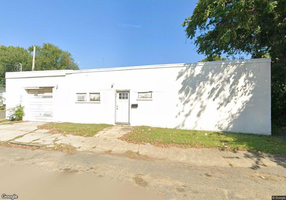
59 4th Ave Unit 65 Long Branch, NJ 07740
Estimated Value: $297,857
--
Bed
--
Bath
3,450
Sq Ft
$86/Sq Ft
Est. Value
About This Home
This home is located at 59 4th Ave Unit 65, Long Branch, NJ 07740 and is currently estimated at $297,857, approximately $86 per square foot. 59 4th Ave Unit 65 is a home located in Monmouth County with nearby schools including Long Branch High School and Holy Trinity School.
Ownership History
Date
Name
Owned For
Owner Type
Purchase Details
Closed on
Jan 8, 2017
Sold by
Branchport Properties Llc
Bought by
Tmf Commerical Properties Llc
Current Estimated Value
Home Financials for this Owner
Home Financials are based on the most recent Mortgage that was taken out on this home.
Original Mortgage
$100,000
Interest Rate
3.93%
Mortgage Type
New Conventional
Create a Home Valuation Report for This Property
The Home Valuation Report is an in-depth analysis detailing your home's value as well as a comparison with similar homes in the area
Home Values in the Area
Average Home Value in this Area
Purchase History
| Date | Buyer | Sale Price | Title Company |
|---|---|---|---|
| Tmf Commerical Properties Llc | $150,000 | Fidelity National Title |
Source: Public Records
Mortgage History
| Date | Status | Borrower | Loan Amount |
|---|---|---|---|
| Previous Owner | Tmf Commerical Properties Llc | $100,000 |
Source: Public Records
Tax History Compared to Growth
Tax History
| Year | Tax Paid | Tax Assessment Tax Assessment Total Assessment is a certain percentage of the fair market value that is determined by local assessors to be the total taxable value of land and additions on the property. | Land | Improvement |
|---|---|---|---|---|
| 2025 | $4,808 | $350,000 | $248,100 | $101,900 |
| 2024 | $3,782 | $312,800 | $218,100 | $94,700 |
| 2023 | $3,782 | $243,500 | $178,100 | $65,400 |
| 2022 | $4,018 | $211,100 | $143,100 | $68,000 |
| 2021 | $4,018 | $200,800 | $124,100 | $76,700 |
| 2020 | $4,071 | $194,800 | $123,100 | $71,700 |
| 2019 | $3,885 | $184,800 | $113,100 | $71,700 |
| 2018 | $4,319 | $204,300 | $105,100 | $99,200 |
| 2017 | $3,963 | $192,300 | $93,100 | $99,200 |
| 2016 | $3,987 | $197,300 | $98,100 | $99,200 |
| 2015 | $4,089 | $183,600 | $98,600 | $85,000 |
| 2014 | $4,122 | $195,100 | $110,100 | $85,000 |
Source: Public Records
Map
Nearby Homes
- 39 Slocum Place
- 144 Westwood Ave
- 145 Stokes Place
- 14 Slocum Place
- 176 Chelsea Ave
- 167 Chelsea Ave
- 143 Stokes Place
- 170 Franklin Ave
- 158 Franklin Ave
- 152 Franklin Ave
- 150 Franklin Ave Unit 5
- 40 N 5th Ave
- 166 Franklin Ave Unit 8
- 103 Franklin Ave
- 399 Willow Ave
- 237 3rd Ave Unit 1-4
- 61 Pavilion Ave
- 55 Melrose Terrace Unit 209
- 55 Melrose Terrace Unit 112
- 215 Cleveland Ave