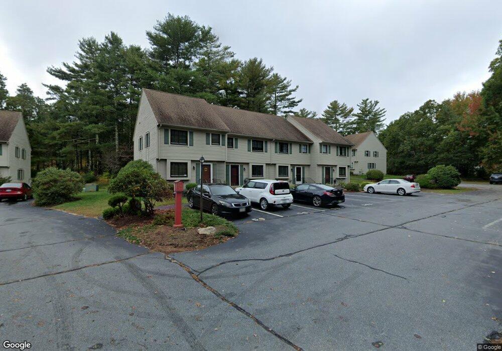
59 Minot Ave Unit B Wareham, MA 02571
Estimated Value: $369,000 - $379,000
2
Beds
2
Baths
1,197
Sq Ft
$312/Sq Ft
Est. Value
About This Home
This home is located at 59 Minot Ave Unit B, Wareham, MA 02571 and is currently estimated at $373,839, approximately $312 per square foot. 59 Minot Ave Unit B is a home located in Plymouth County.
Ownership History
Date
Name
Owned For
Owner Type
Purchase Details
Closed on
Dec 29, 2017
Sold by
Mallowes William J
Bought by
Raye Marina
Current Estimated Value
Home Financials for this Owner
Home Financials are based on the most recent Mortgage that was taken out on this home.
Original Mortgage
$146,400
Outstanding Balance
$122,999
Interest Rate
3.95%
Mortgage Type
New Conventional
Estimated Equity
$250,840
Purchase Details
Closed on
Jul 6, 2012
Sold by
Mallowes Evelyn
Bought by
Mallomes William J
Purchase Details
Closed on
Feb 18, 1998
Sold by
Brun Robin A
Bought by
Mallowes Evelyn
Home Financials for this Owner
Home Financials are based on the most recent Mortgage that was taken out on this home.
Original Mortgage
$59,200
Interest Rate
6.9%
Mortgage Type
Purchase Money Mortgage
Create a Home Valuation Report for This Property
The Home Valuation Report is an in-depth analysis detailing your home's value as well as a comparison with similar homes in the area
Purchase History
| Date | Buyer | Sale Price | Title Company |
|---|---|---|---|
| Raye Marina | $183,000 | -- | |
| Raye Marina | $183,000 | -- | |
| Raye Marina | $183,000 | -- | |
| Mallomes William J | -- | -- | |
| Mallomes William J | -- | -- | |
| Mallowes Evelyn | $79,000 | -- | |
| Mallowes Evelyn | $79,000 | -- |
Source: Public Records
Mortgage History
| Date | Status | Borrower | Loan Amount |
|---|---|---|---|
| Open | Raye Marina | $146,400 | |
| Closed | Raye Marina | $146,400 | |
| Previous Owner | Mallowes Evelyn | $59,200 |
Source: Public Records
Tax History
| Year | Tax Paid | Tax Assessment Tax Assessment Total Assessment is a certain percentage of the fair market value that is determined by local assessors to be the total taxable value of land and additions on the property. | Land | Improvement |
|---|---|---|---|---|
| 2025 | $2,724 | $261,400 | $0 | $261,400 |
| 2024 | $3,002 | $267,300 | $0 | $267,300 |
| 2023 | $2,768 | $230,100 | $0 | $230,100 |
| 2022 | $2,654 | $201,400 | $0 | $201,400 |
| 2021 | $2,572 | $191,200 | $0 | $191,200 |
| 2020 | $2,415 | $182,100 | $0 | $182,100 |
| 2019 | $2,378 | $178,900 | $0 | $178,900 |
| 2018 | $2,500 | $183,400 | $0 | $183,400 |
| 2017 | $2,467 | $183,400 | $0 | $183,400 |
| 2016 | $2,163 | $159,900 | $0 | $159,900 |
| 2015 | $2,275 | $174,100 | $0 | $174,100 |
| 2014 | $2,348 | $182,700 | $0 | $182,700 |
Source: Public Records
Map
Nearby Homes
- 55 Minot Ave Unit 55
- 10 Oak St
- 156 Sandwich Rd
- 124 Minot Ave Unit 1
- 3 Hazel St
- 2697 Cranberry Hwy Unit 23
- 7 Knowles Ave
- 103 Kimberly Ct
- 2838 Cranberry Hwy
- 2711 Cranberry Hwy
- 106 Circuit Ave
- 0 Squaw's Path
- 9 Old Glen Charlie Rd
- 391 Onset Ave
- 2645 Cranberry Hwy Unit A
- 110 Mayflower Ridge Dr
- 15 Broadmarsh Ave
- 6 Allen Ave
- 2900 Cranberry Hwy Unit 17
- 437 Main St
- 59 Minot Ave Unit 7
- 59 Minot Ave Unit C
- 59 Minot Ave Unit A
- 59 Minot Ave
- 59 Minot Ave Unit 59
- 59 Minot Ave
- 61 Minot Ave Unit C
- 61 Minot Ave Unit B
- 61 Minot Ave Unit A
- 61 Minot Ave
- 61 Minot Ave Unit 61
- 61 Minot Ave Unit 1
- 57 Minot Ave
- 57 Minot Ave Unit C
- 57 Minot Ave Unit B
- 57 Minot Ave Unit A
- 57 Minot Ave
- 57 Minot Ave Unit 12
- 57 Minot Ave
- 57 Minot Ave Unit 9
Your Personal Tour Guide
Ask me questions while you tour the home.