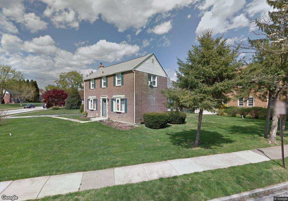
59 Nield Rd Springfield, PA 19064
Estimated Value: $437,466 - $471,000
3
Beds
1
Bath
1,484
Sq Ft
$310/Sq Ft
Est. Value
About This Home
This home is located at 59 Nield Rd, Springfield, PA 19064 and is currently estimated at $460,367, approximately $310 per square foot. 59 Nield Rd is a home located in Delaware County with nearby schools including Springfield High School, Holy Cross School, and Sonshine Christian Academy.
Ownership History
Date
Name
Owned For
Owner Type
Purchase Details
Closed on
Feb 14, 2005
Sold by
Zito Geraldine E
Bought by
Laughlin Thomas and Laughlin Mary
Current Estimated Value
Home Financials for this Owner
Home Financials are based on the most recent Mortgage that was taken out on this home.
Original Mortgage
$82,000
Interest Rate
5.16%
Mortgage Type
Fannie Mae Freddie Mac
Purchase Details
Closed on
Sep 17, 2002
Sold by
Zito Michael F and Zito Geraldine E
Bought by
Zito Michael F and Zito Geraldine E
Create a Home Valuation Report for This Property
The Home Valuation Report is an in-depth analysis detailing your home's value as well as a comparison with similar homes in the area
Home Values in the Area
Average Home Value in this Area
Purchase History
| Date | Buyer | Sale Price | Title Company |
|---|---|---|---|
| Laughlin Thomas | $247,000 | -- | |
| Zito Michael F | -- | -- |
Source: Public Records
Mortgage History
| Date | Status | Borrower | Loan Amount |
|---|---|---|---|
| Closed | Laughlin Thomas | $82,000 |
Source: Public Records
Tax History
| Year | Tax Paid | Tax Assessment Tax Assessment Total Assessment is a certain percentage of the fair market value that is determined by local assessors to be the total taxable value of land and additions on the property. | Land | Improvement |
|---|---|---|---|---|
| 2025 | $7,695 | $273,780 | $96,870 | $176,910 |
| 2024 | $7,695 | $273,780 | $96,870 | $176,910 |
| 2023 | $7,410 | $273,780 | $96,870 | $176,910 |
| 2022 | $7,249 | $273,780 | $96,870 | $176,910 |
| 2021 | $11,227 | $273,780 | $96,870 | $176,910 |
| 2020 | $6,051 | $133,530 | $46,570 | $86,960 |
| 2019 | $5,909 | $133,530 | $46,570 | $86,960 |
| 2018 | $5,824 | $133,530 | $0 | $0 |
| 2017 | $5,689 | $133,530 | $0 | $0 |
| 2016 | $733 | $133,530 | $0 | $0 |
| 2015 | $733 | $133,530 | $0 | $0 |
| 2014 | $733 | $133,530 | $0 | $0 |
Source: Public Records
Map
Nearby Homes
- 616 Wayne Ave
- 225 N Bishop Ave
- 207 N Bishop Ave
- 624 E Springfield Rd
- 401 N Sycamore Ave
- 343 Westpark Ln
- 325 Westpark Ln
- 399 N Sycamore Ave
- 107 N Bishop Ave
- 472 Larchwood Rd
- 465 Hawarden Rd
- 329 N Oak Ave
- 424 N Springfield Rd
- 265 W Wyncliffe Ave
- 251 Revere Rd
- 514 Springview Ln
- 616 Hey Ln
- 5125 Palmer Mill Rd
- 354 E Springfield Rd
- 403 N Sycamore Ave
Your Personal Tour Guide
Ask me questions while you tour the home.