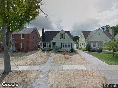
59 Piper Ave Battle Creek, MI 49017
Estimated Value: $163,000 - $195,000
3
Beds
2
Baths
1,677
Sq Ft
$105/Sq Ft
Est. Value
About This Home
This home is located at 59 Piper Ave, Battle Creek, MI 49017 and is currently estimated at $176,785, approximately $105 per square foot. 59 Piper Ave is a home located in Calhoun County with nearby schools including Verona Elementary School, Northwestern Middle School, and Battle Creek Central High School.
Ownership History
Date
Name
Owned For
Owner Type
Purchase Details
Closed on
Mar 21, 2008
Sold by
Downing Martressa and Laszyca Betty A
Bought by
Gauze Emily J and Gauze Kenneth F
Current Estimated Value
Home Financials for this Owner
Home Financials are based on the most recent Mortgage that was taken out on this home.
Original Mortgage
$83,000
Outstanding Balance
$55,429
Interest Rate
6.1%
Mortgage Type
Purchase Money Mortgage
Estimated Equity
$113,478
Purchase Details
Closed on
Sep 15, 2003
Sold by
Merriam George A
Create a Home Valuation Report for This Property
The Home Valuation Report is an in-depth analysis detailing your home's value as well as a comparison with similar homes in the area
Home Values in the Area
Average Home Value in this Area
Purchase History
| Date | Buyer | Sale Price | Title Company |
|---|---|---|---|
| Gauze Emily J | $83,000 | Devon Title Agency | |
| -- | -- | -- |
Source: Public Records
Mortgage History
| Date | Status | Borrower | Loan Amount |
|---|---|---|---|
| Open | Gauze Emily J | $83,000 |
Source: Public Records
Tax History Compared to Growth
Tax History
| Year | Tax Paid | Tax Assessment Tax Assessment Total Assessment is a certain percentage of the fair market value that is determined by local assessors to be the total taxable value of land and additions on the property. | Land | Improvement |
|---|---|---|---|---|
| 2024 | $1,618 | $62,126 | $0 | $0 |
| 2023 | $1,849 | $53,708 | $0 | $0 |
| 2022 | $1,461 | $48,135 | $0 | $0 |
| 2021 | $1,744 | $43,046 | $0 | $0 |
| 2020 | $1,641 | $44,607 | $0 | $0 |
| 2019 | $1,634 | $39,412 | $0 | $0 |
| 2018 | $1,634 | $39,174 | $1,354 | $37,820 |
| 2017 | $1,584 | $42,165 | $0 | $0 |
| 2016 | $1,582 | $36,102 | $0 | $0 |
| 2015 | $1,603 | $34,158 | $2,456 | $31,702 |
| 2014 | $1,603 | $34,796 | $2,456 | $32,340 |
Source: Public Records
Map
Nearby Homes
- 131 Mckinley Ave N
- 120 Radley St
- 38 East Ave N
- 140 East Ave N
- 176 Union St N
- 132 Union St N
- 25 East Ave S
- 48 Union St N
- 261 Emmett St E
- 229 Laurel Dr
- 227 Laurel Dr
- 207 Laurel Dr
- 15 Broad St S
- 28 Convis St
- 723 Capital Ave NE
- 29 Wren St
- 84 Magnolia Ave
- 28 Orchard Place
- 31 Orchard Place
- 25 Orchard Place