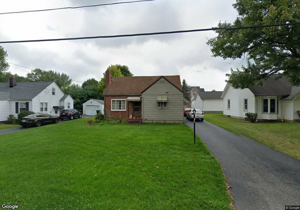
59 Woodrow Ave Youngstown, OH 44512
Estimated Value: $98,000 - $132,000
3
Beds
1
Bath
828
Sq Ft
$134/Sq Ft
Est. Value
About This Home
This home is located at 59 Woodrow Ave, Youngstown, OH 44512 and is currently estimated at $111,225, approximately $134 per square foot. 59 Woodrow Ave is a home located in Mahoning County with nearby schools including Boardman Glenwood Junior High School, Boardman High School, and Youngstown Christian School.
Ownership History
Date
Name
Owned For
Owner Type
Purchase Details
Closed on
Apr 25, 2018
Sold by
Williams John R
Bought by
Lane Deborah and Daughter Her
Current Estimated Value
Purchase Details
Closed on
Sep 14, 2013
Sold by
Govantes Kristen Denise
Bought by
Williams John R
Purchase Details
Closed on
Feb 15, 1979
Sold by
Kosola William and Kosola Martha
Bought by
Kosola John W
Purchase Details
Closed on
Jan 29, 1971
Sold by
Kosola Martha A
Bought by
Kosola William and Kosola Martha
Create a Home Valuation Report for This Property
The Home Valuation Report is an in-depth analysis detailing your home's value as well as a comparison with similar homes in the area
Home Values in the Area
Average Home Value in this Area
Purchase History
| Date | Buyer | Sale Price | Title Company |
|---|---|---|---|
| Lane Deborah | -- | None Available | |
| Williams John R | $47,000 | Attorney | |
| Kosola John W | -- | -- | |
| Kosola William | -- | -- |
Source: Public Records
Tax History Compared to Growth
Tax History
| Year | Tax Paid | Tax Assessment Tax Assessment Total Assessment is a certain percentage of the fair market value that is determined by local assessors to be the total taxable value of land and additions on the property. | Land | Improvement |
|---|---|---|---|---|
| 2024 | $897 | $27,300 | $3,650 | $23,650 |
| 2023 | $916 | $27,300 | $3,650 | $23,650 |
| 2022 | $753 | $19,650 | $3,650 | $16,000 |
| 2021 | $754 | $19,650 | $3,650 | $16,000 |
| 2020 | $758 | $19,650 | $3,650 | $16,000 |
| 2019 | $678 | $17,230 | $3,200 | $14,030 |
| 2018 | $1,095 | $17,230 | $3,200 | $14,030 |
| 2017 | $1,105 | $17,230 | $3,200 | $14,030 |
| 2016 | $1,118 | $17,460 | $3,470 | $13,990 |
| 2015 | $1,096 | $17,460 | $3,470 | $13,990 |
| 2014 | $1,099 | $17,460 | $3,470 | $13,990 |
| 2013 | $1,116 | $17,460 | $3,470 | $13,990 |
Source: Public Records
Map
Nearby Homes
- 26 Marlindale Ave
- 103 Wildwood Dr
- 197 Mathews Rd Unit B
- 44 Gertrude Ave
- 6511 Pembrooke Place
- 6001 Applecrest Dr
- 96 Aylesboro Ave
- 149 Argyle Ave
- 6726 Glendale Ave
- 0 Mathews Rd Unit 5038026
- 169 Wolcott Dr
- 642 Oakridge Dr
- 242 Oakley Ave
- 167 Afton Ave
- 6785 Tanglewood Dr
- 235 Wolcott Dr
- 33 Crestline Place
- 81 Melrose Ave
- 7110 Amherst Ave
- 127 Melrose Ave