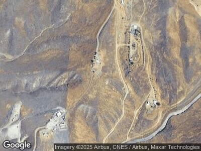
590 Lazy Rb Ranch Rd Bakersfield, CA 93307
Estimated Value: $498,000 - $761,000
4
Beds
3
Baths
2,761
Sq Ft
$239/Sq Ft
Est. Value
About This Home
This home is located at 590 Lazy Rb Ranch Rd, Bakersfield, CA 93307 and is currently estimated at $660,988, approximately $239 per square foot. 590 Lazy Rb Ranch Rd is a home located in Kern County with nearby schools including Cesar E. Chavez Elementary School, Paul L. Cato Middle School, and Foothill High School.
Ownership History
Date
Name
Owned For
Owner Type
Purchase Details
Closed on
Oct 21, 2002
Sold by
Burgess Ron
Bought by
Colvin Ronald N
Current Estimated Value
Home Financials for this Owner
Home Financials are based on the most recent Mortgage that was taken out on this home.
Original Mortgage
$47,000
Interest Rate
6.05%
Create a Home Valuation Report for This Property
The Home Valuation Report is an in-depth analysis detailing your home's value as well as a comparison with similar homes in the area
Home Values in the Area
Average Home Value in this Area
Purchase History
| Date | Buyer | Sale Price | Title Company |
|---|---|---|---|
| Colvin Ronald N | $47,000 | -- |
Source: Public Records
Mortgage History
| Date | Status | Borrower | Loan Amount |
|---|---|---|---|
| Open | Colvin Ronald Norman | $77,851 | |
| Open | Colvin Ronald N | $420,916 | |
| Closed | Colvin Ronald N | $47,000 |
Source: Public Records
Tax History Compared to Growth
Tax History
| Year | Tax Paid | Tax Assessment Tax Assessment Total Assessment is a certain percentage of the fair market value that is determined by local assessors to be the total taxable value of land and additions on the property. | Land | Improvement |
|---|---|---|---|---|
| 2024 | $5,802 | $503,610 | $66,724 | $436,886 |
| 2023 | $5,642 | $493,736 | $65,416 | $428,320 |
| 2022 | $5,535 | $484,056 | $64,134 | $419,922 |
| 2021 | $5,417 | $474,566 | $62,877 | $411,689 |
| 2020 | $5,388 | $469,702 | $62,233 | $407,469 |
| 2019 | $5,271 | $469,702 | $62,233 | $407,469 |
| 2018 | $5,185 | $451,466 | $59,817 | $391,649 |
| 2017 | $5,139 | $442,616 | $58,645 | $383,971 |
| 2016 | $4,683 | $433,939 | $57,496 | $376,443 |
| 2015 | $4,701 | $427,422 | $56,633 | $370,789 |
| 2014 | $4,546 | $419,050 | $55,524 | $363,526 |
Source: Public Records
Map
Nearby Homes
- 10836 Lot:8lot8 Recorder's Map Ref: Pm 10836
- 5609 Levanto St
- 5612 Levanto St
- 0 Kern Canyon Rd Unit 202501606
- 9800 Kern Canyon Rd
- 8700 Kern Canyon Rd
- 0 Apn 179-040-19 Unit 202400320
- 5507 Via Venezia
- 5804 Levanto St
- 6011 De la Guerra Terrace
- 5808 Levanto St
- 6215 De la Guerra Terrace
- 6212 De la Guerra Terrace
- 14914 Colonia de Las Rosas
- 6506 Marbrisas Ct
- 5000 Grand Cypress Way
- 14707 Via Messina Dr
- 6414 Bellorita Dr
- 0 Tarina Ct Unit 202503281
- 0 Tarina Ct Unit 202502779
