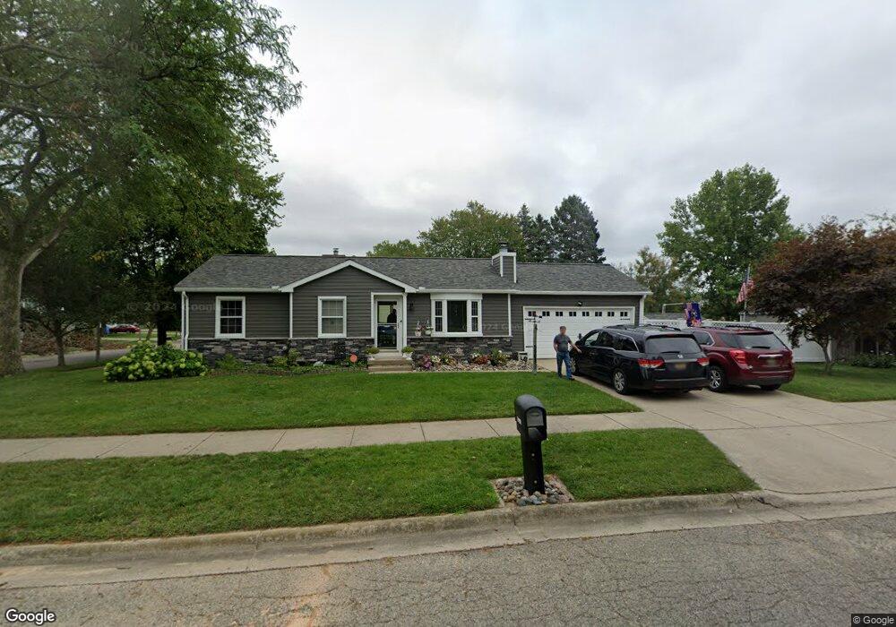
5901 Laporte Dr Lansing, MI 48911
Southern Lansing NeighborhoodEstimated Value: $161,495 - $207,000
Studio
--
Bath
973
Sq Ft
$194/Sq Ft
Est. Value
About This Home
This home is located at 5901 Laporte Dr, Lansing, MI 48911 and is currently estimated at $189,124, approximately $194 per square foot. 5901 Laporte Dr is a home located in Ingham County with nearby schools including North Elementary School, Everett High School, and Immaculate Heart of Mary/St Casimir School.
Ownership History
Date
Name
Owned For
Owner Type
Purchase Details
Closed on
Jul 24, 2009
Sold by
Prieur Duane L
Bought by
Pricur Duane L and Cooper Stephen J
Current Estimated Value
Purchase Details
Closed on
Jan 14, 2000
Sold by
Colthorp Thomas and Colthorp Phyllis
Bought by
Prieur Duane L
Home Financials for this Owner
Home Financials are based on the most recent Mortgage that was taken out on this home.
Original Mortgage
$75,100
Outstanding Balance
$23,861
Interest Rate
7.84%
Mortgage Type
Purchase Money Mortgage
Estimated Equity
$165,263
Purchase Details
Closed on
Mar 1, 1995
Purchase Details
Closed on
Mar 1, 1994
Create a Home Valuation Report for This Property
The Home Valuation Report is an in-depth analysis detailing your home's value as well as a comparison with similar homes in the area
Home Values in the Area
Average Home Value in this Area
Purchase History
| Date | Buyer | Sale Price | Title Company |
|---|---|---|---|
| Pricur Duane L | -- | None Available | |
| Prieur Duane L | $93,900 | First American Title Ins Co | |
| -- | $78,500 | -- | |
| -- | $73,000 | -- |
Source: Public Records
Mortgage History
| Date | Status | Borrower | Loan Amount |
|---|---|---|---|
| Open | Prieur Duane L | $75,100 |
Source: Public Records
Tax History
| Year | Tax Paid | Tax Assessment Tax Assessment Total Assessment is a certain percentage of the fair market value that is determined by local assessors to be the total taxable value of land and additions on the property. | Land | Improvement |
|---|---|---|---|---|
| 2025 | $3,044 | $82,900 | $13,600 | $69,300 |
| 2024 | $24 | $72,600 | $13,600 | $59,000 |
| 2023 | $2,854 | $68,800 | $13,600 | $55,200 |
| 2022 | $2,573 | $59,200 | $11,900 | $47,300 |
| 2021 | $2,520 | $55,800 | $10,500 | $45,300 |
| 2020 | $2,504 | $52,500 | $10,500 | $42,000 |
| 2019 | $2,401 | $47,500 | $10,500 | $37,000 |
| 2018 | $2,250 | $46,700 | $10,500 | $36,200 |
| 2017 | $2,154 | $46,700 | $10,500 | $36,200 |
| 2016 | $2,060 | $40,900 | $10,500 | $30,400 |
| 2015 | $2,060 | $37,600 | $21,083 | $16,517 |
| 2014 | $2,060 | $36,500 | $24,484 | $12,016 |
Source: Public Records
Map
Nearby Homes
- 218 Raritan Rd
- 6029 Ellendale Dr
- 208 E Northrup St
- 5636 Ellendale Dr
- 5902 Hilliard Rd
- 5620 Kaynorth Rd
- 5808 Orchard Ct
- 6429 Rosedale Rd
- 6444 Sommerset Rd
- 510 Sawyer Rd
- 6421 S Washington Ave
- 1015 Brad St
- 5221 Tulip Ave
- 1020 R G Curtiss Ave
- 226 W Jolly Rd
- 1014 W Northrup St
- 6240 Beechfield Dr Unit 101
- 6232 Beechfield Dr Unit 113
- 201 E Syringa Dr
- 4800 Ora St
- 208 E Claremore Dr
- 5907 Laporte Dr
- 214 E Claremore Dr
- 5900 Laporte Dr
- 5827 Laporte Dr
- 207 E Claremore Dr
- 220 E Claremore Dr
- 5915 Laporte Dr
- 5908 Laporte Dr
- 120 E Claremore Dr
- 5826 Laporte Dr
- 215 E Claremore Dr
- 226 E Claremore Dr
- 5914 Laporte Dr
- 5821 Laporte Dr
- 5923 Laporte Dr
- 121 E Claremore Dr
- 5828 Barren Dr
- 5920 Laporte Dr
- 5835 Coulson Ct