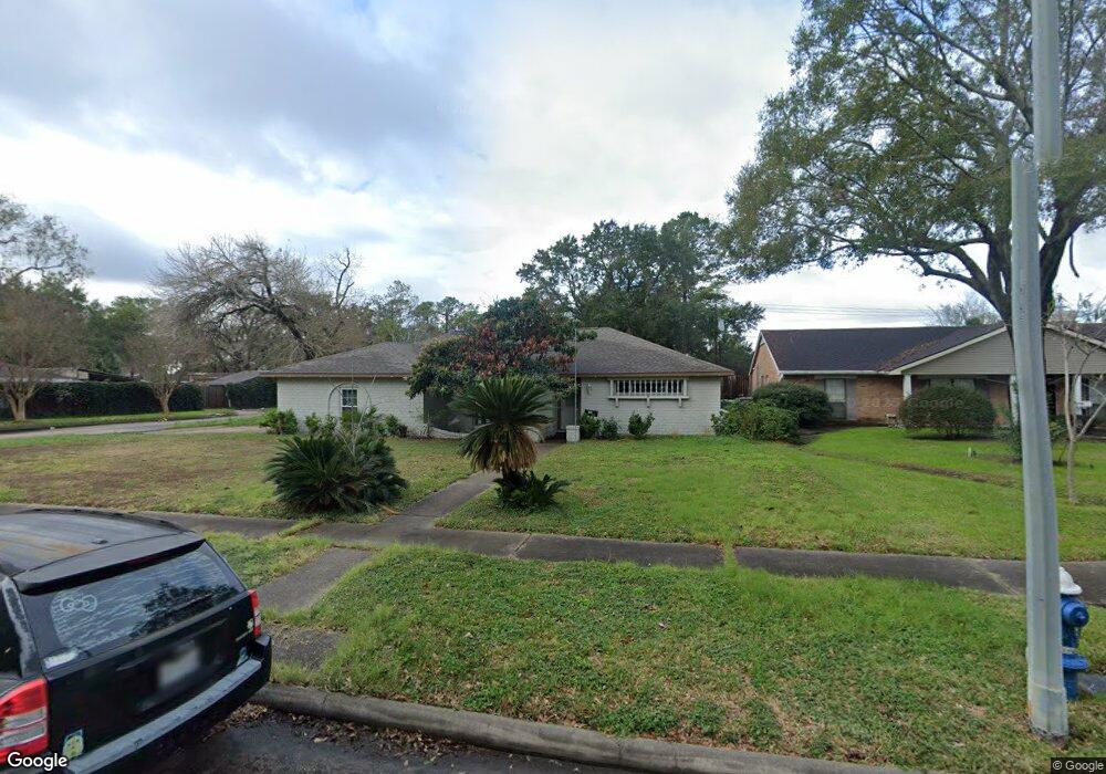
5910 Burning Tree Dr Houston, TX 77036
Sharpstown NeighborhoodEstimated Value: $306,727 - $339,000
4
Beds
2
Baths
2,151
Sq Ft
$150/Sq Ft
Est. Value
About This Home
This home is located at 5910 Burning Tree Dr, Houston, TX 77036 and is currently estimated at $322,182, approximately $149 per square foot. 5910 Burning Tree Dr is a home located in Harris County with nearby schools including Emerson Elementary School, Paul Revere Middle School, and Wisdom High School.
Ownership History
Date
Name
Owned For
Owner Type
Purchase Details
Closed on
Jul 8, 2005
Sold by
7902 Prestwood St Llp
Bought by
Martin Benjamin and Martin Maria O
Current Estimated Value
Home Financials for this Owner
Home Financials are based on the most recent Mortgage that was taken out on this home.
Original Mortgage
$300,000
Outstanding Balance
$156,097
Interest Rate
5.61%
Mortgage Type
Purchase Money Mortgage
Estimated Equity
$166,085
Purchase Details
Closed on
Jul 2, 1998
Sold by
Nguyen Danh C and Phan Hoang T
Bought by
Escobar Angel M
Home Financials for this Owner
Home Financials are based on the most recent Mortgage that was taken out on this home.
Original Mortgage
$80,900
Interest Rate
7.13%
Purchase Details
Closed on
Jul 5, 1996
Sold by
Siegfried Charles G and Albarelli Siegfried Anne
Bought by
Nguyen Danh C
Home Financials for this Owner
Home Financials are based on the most recent Mortgage that was taken out on this home.
Original Mortgage
$66,400
Interest Rate
8.05%
Create a Home Valuation Report for This Property
The Home Valuation Report is an in-depth analysis detailing your home's value as well as a comparison with similar homes in the area
Home Values in the Area
Average Home Value in this Area
Purchase History
| Date | Buyer | Sale Price | Title Company |
|---|---|---|---|
| Martin Benjamin | -- | Ameripoint Title Company | |
| Escobar Angel M | -- | Chicago Title | |
| Nguyen Danh C | -- | Fidelity National Title |
Source: Public Records
Mortgage History
| Date | Status | Borrower | Loan Amount |
|---|---|---|---|
| Open | Martin Benjamin | $300,000 | |
| Previous Owner | Escobar Angel M | $80,900 | |
| Previous Owner | Nguyen Danh C | $66,400 |
Source: Public Records
Tax History Compared to Growth
Tax History
| Year | Tax Paid | Tax Assessment Tax Assessment Total Assessment is a certain percentage of the fair market value that is determined by local assessors to be the total taxable value of land and additions on the property. | Land | Improvement |
|---|---|---|---|---|
| 2025 | $657 | $298,130 | $72,733 | $225,397 |
| 2024 | $657 | $273,092 | $72,733 | $200,359 |
| 2023 | $657 | $301,454 | $72,733 | $228,721 |
| 2022 | $5,777 | $279,541 | $72,733 | $206,808 |
| 2021 | $5,364 | $246,763 | $64,940 | $181,823 |
| 2020 | $5,234 | $209,243 | $54,550 | $154,693 |
| 2019 | $5,456 | $209,243 | $54,550 | $154,693 |
| 2018 | $3,564 | $190,000 | $54,550 | $135,450 |
| 2017 | $5,021 | $216,839 | $54,550 | $162,289 |
| 2016 | $4,564 | $193,106 | $54,550 | $138,556 |
| 2015 | $2,810 | $193,106 | $54,550 | $138,556 |
| 2014 | $2,810 | $174,755 | $54,550 | $120,205 |
Source: Public Records
Map
Nearby Homes
- 8579 Sands Point Dr Unit 102
- 8543 Sands Point Dr
- 8555 Sands Point Dr Unit 90
- 8435 Sands Point Dr
- 8411 Sands Point Dr Unit 18
- 6411 Redding Rd
- 8359 Sands Point Dr Unit 218
- 8275 Sands Point Dr Unit 176
- 8267 Sands Point Dr Unit 172
- 8257 Sands Point Dr Unit 167
- 8231 Sands Point Dr Unit 154
- 4001 Tanglewilde St Unit 1103
- 4001 Tanglewilde St Unit 1204
- 4001 Tanglewilde St Unit 1402
- 8153 Sands Point Dr Unit 115
- 3800 Tanglewilde St Unit 803
- 3800 Tanglewilde St Unit 605
- 3800 Tanglewilde St Unit 504
- 3800 Tanglewilde St Unit 607
- 6602 Harbor Town Dr Unit 1207
- 6002 Burning Tree Dr
- 5911 Redding Rd
- 5907 Redding Rd
- 5904 Burning Tree Dr
- 6003 Redding Rd
- 5911 Burning Tree Dr
- 6006 Burning Tree Dr
- 5907 Burning Tree Dr
- 5902 Burning Tree Dr
- 6007 Redding Rd
- 5903 Burning Tree Dr
- 6010 Burning Tree Dr
- 6005 Burning Tree Dr
- 6011 Redding Rd
- 5902 Redding Rd
- 5910 Redding Rd
- 6102 Burning Tree Dr
- 5906 Redding Rd
- 6002 Redding Rd
- 6103 Redding Rd