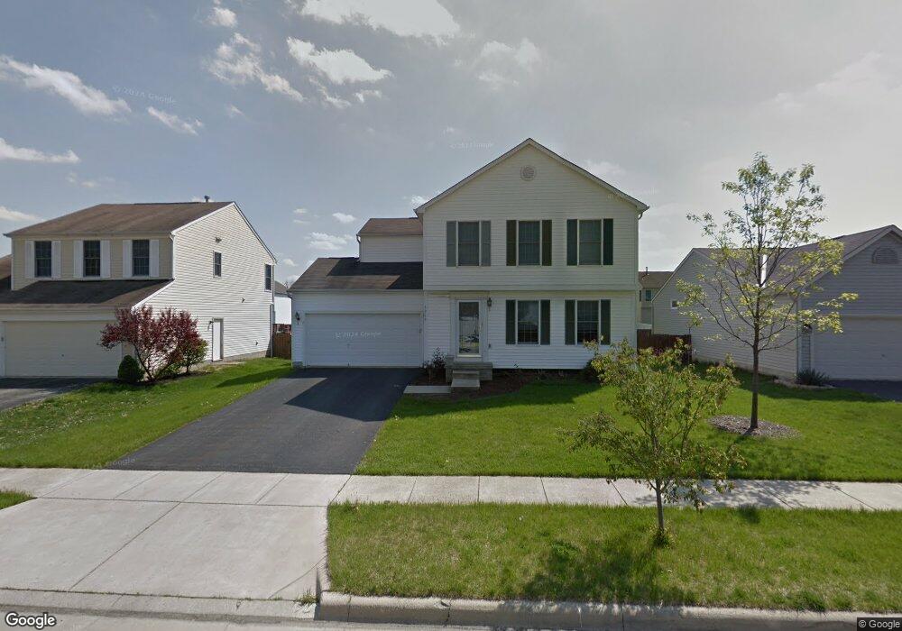
5913 Westbend Dr Galloway, OH 43119
Galloway Ridge NeighborhoodEstimated Value: $320,665 - $343,000
4
Beds
3
Baths
1,506
Sq Ft
$220/Sq Ft
Est. Value
About This Home
This home is located at 5913 Westbend Dr, Galloway, OH 43119 and is currently estimated at $331,916, approximately $220 per square foot. 5913 Westbend Dr is a home located in Franklin County with nearby schools including Galloway Ridge Intermediate School, Darby Woods Elementary School, and Norton Middle School.
Ownership History
Date
Name
Owned For
Owner Type
Purchase Details
Closed on
Oct 25, 2001
Sold by
Dominion Homes Inc
Bought by
Benner Rebecca A
Current Estimated Value
Home Financials for this Owner
Home Financials are based on the most recent Mortgage that was taken out on this home.
Original Mortgage
$165,545
Outstanding Balance
$61,847
Interest Rate
6.72%
Mortgage Type
FHA
Estimated Equity
$270,069
Create a Home Valuation Report for This Property
The Home Valuation Report is an in-depth analysis detailing your home's value as well as a comparison with similar homes in the area
Home Values in the Area
Average Home Value in this Area
Purchase History
| Date | Buyer | Sale Price | Title Company |
|---|---|---|---|
| Benner Rebecca A | $167,600 | Alliance Title |
Source: Public Records
Mortgage History
| Date | Status | Borrower | Loan Amount |
|---|---|---|---|
| Open | Benner Rebecca A | $165,545 |
Source: Public Records
Tax History
| Year | Tax Paid | Tax Assessment Tax Assessment Total Assessment is a certain percentage of the fair market value that is determined by local assessors to be the total taxable value of land and additions on the property. | Land | Improvement |
|---|---|---|---|---|
| 2025 | $3,367 | $92,340 | $28,950 | $63,390 |
| 2024 | $3,367 | $92,340 | $28,950 | $63,390 |
| 2023 | $3,307 | $92,330 | $28,945 | $63,385 |
| 2022 | $2,795 | $57,260 | $10,080 | $47,180 |
| 2021 | $2,851 | $57,260 | $10,080 | $47,180 |
| 2020 | $2,835 | $57,260 | $10,080 | $47,180 |
| 2019 | $2,696 | $48,060 | $8,400 | $39,660 |
| 2018 | $2,731 | $48,060 | $8,400 | $39,660 |
| 2017 | $2,671 | $48,060 | $8,400 | $39,660 |
| 2016 | $2,778 | $45,920 | $8,610 | $37,310 |
| 2015 | $2,778 | $45,920 | $8,610 | $37,310 |
| 2014 | $2,781 | $45,920 | $8,610 | $37,310 |
| 2013 | $1,452 | $48,335 | $9,065 | $39,270 |
Source: Public Records
Map
Nearby Homes
- 5773 Westbank Dr
- 376 Galloway Ridge Dr
- 5713 Larksdale Dr
- 5910 Bucksburn Dr
- 5919 Bucksburn Dr
- 6100 Federalist Dr Unit 149
- 5965 Tully Cross Dr
- 5843 Tully Cross Dr
- 5409 Longworth Dr
- 5488 Cypress Chase Unit 5488
- 296 Rye St Unit Lot 48
- 281 Fortune Dr Unit Lot 114
- 5621 Cedar Springs Unit 5621
- 286 Fortune Dr Unit Lot 145
- 289 Fortune Dr Unit Lot 113
- 294 Fortune Dr Unit Lot 144
- 5412 Cedar Springs Unit 5412A
- 320 Rye St Unit Lot 51
- 69 Lawrence Ave
- 310 Fortune Dr Unit Lot 142
- 5919 Westbend Dr
- 5907 Westbend Dr
- 5925 Westbend Dr
- 5901 Westbend Dr
- 5912 Weston Woods Dr
- 5918 Weston Woods Dr
- 5906 Weston Woods Dr
- 5924 Weston Woods Dr
- 5914 Westbend Dr
- 5900 Weston Woods Dr
- 5931 Westbend Dr
- 5920 Westbend Dr
- 5895 Westbend Dr
- 5930 Weston Woods Dr
- 5906 Westbend Dr
- 5926 Westbend Dr
- 5894 Weston Woods Dr
- 5936 Weston Woods Dr
- 5936 Weston Woods Dr Unit 302
- 5937 Westbend Dr
Your Personal Tour Guide
Ask me questions while you tour the home.