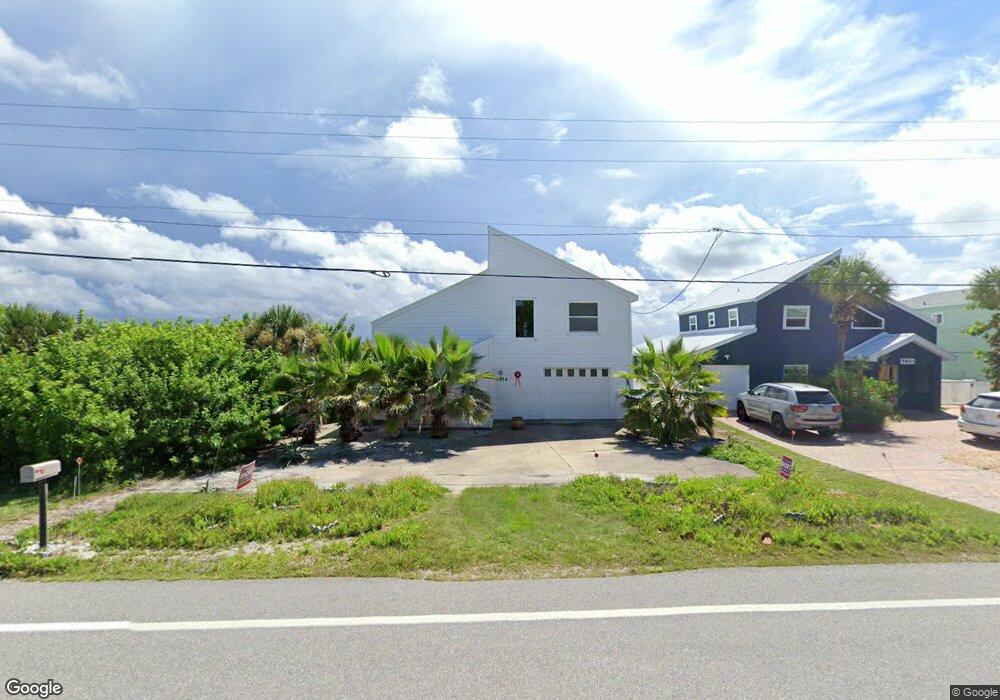
5914 S Atlantic Ave New Smyrna Beach, FL 32169
Bethune Beach NeighborhoodEstimated Value: $611,000 - $733,000
3
Beds
2
Baths
1,758
Sq Ft
$380/Sq Ft
Est. Value
About This Home
This home is located at 5914 S Atlantic Ave, New Smyrna Beach, FL 32169 and is currently estimated at $668,002, approximately $379 per square foot. 5914 S Atlantic Ave is a home located in Volusia County with nearby schools including Coronado Beach Elementary School, New Smyrna Beach Middle School, and New Smyrna Beach High School.
Ownership History
Date
Name
Owned For
Owner Type
Purchase Details
Closed on
May 20, 2011
Sold by
Uspenski Maria
Bought by
Lackey Nancy M and Njmsl Revocable Trust
Current Estimated Value
Purchase Details
Closed on
Jul 5, 2003
Sold by
Uspenski Natasha
Bought by
Uspenski Natasha and Uspenski Maria
Purchase Details
Closed on
May 19, 1988
Sold by
Hall Frank E
Bought by
Uspenski Alexander and Uspenski Natasha
Purchase Details
Closed on
May 15, 1981
Bought by
Lackey Nancy M Tr
Purchase Details
Closed on
Dec 15, 1978
Bought by
Lackey Nancy M Tr
Purchase Details
Closed on
Mar 15, 1977
Bought by
Lackey Nancy M Tr
Create a Home Valuation Report for This Property
The Home Valuation Report is an in-depth analysis detailing your home's value as well as a comparison with similar homes in the area
Home Values in the Area
Average Home Value in this Area
Purchase History
| Date | Buyer | Sale Price | Title Company |
|---|---|---|---|
| Lackey Nancy M | $225,000 | First American Title Ins Co | |
| Uspenski Natasha | -- | -- | |
| Uspenski Alexander | $175,650 | -- | |
| Lackey Nancy M Tr | $68,500 | -- | |
| Lackey Nancy M Tr | $53,000 | -- | |
| Lackey Nancy M Tr | $48,700 | -- |
Source: Public Records
Tax History Compared to Growth
Tax History
| Year | Tax Paid | Tax Assessment Tax Assessment Total Assessment is a certain percentage of the fair market value that is determined by local assessors to be the total taxable value of land and additions on the property. | Land | Improvement |
|---|---|---|---|---|
| 2025 | $3,236 | $249,402 | -- | -- |
| 2024 | $3,236 | $242,374 | -- | -- |
| 2023 | $3,236 | $235,315 | $0 | $0 |
| 2022 | $3,154 | $228,461 | $0 | $0 |
| 2021 | $3,218 | $221,807 | $0 | $0 |
| 2020 | $3,164 | $218,745 | $0 | $0 |
| 2019 | $3,202 | $213,827 | $0 | $0 |
| 2018 | $3,165 | $209,840 | $0 | $0 |
| 2017 | $3,148 | $205,524 | $0 | $0 |
| 2016 | $3,266 | $201,297 | $0 | $0 |
| 2015 | $3,353 | $199,898 | $0 | $0 |
| 2014 | $3,320 | $198,312 | $0 | $0 |
Source: Public Records
Map
Nearby Homes
- 881 Catfish Ave
- 0 Turtlemound Rd Unit MFRNS1082782
- 0 Turtlemound Rd Unit 1205070
- 6102 S Atlantic Ave
- 0 Bass Ave Unit MFRNS1081705
- 0 Bass Ave Unit 1206470
- 798 Angelfish Ave
- 5501 S Atlantic Ave Unit 409
- 5501 S Atlantic Ave Unit 4150
- 0 River Rd Unit MFRNS1083561
- 0 River Rd Unit 1209026
- 6260 S Atlantic Ave
- 6245 Engram Rd
- 5301 S Atlantic Ave Unit 520
- 5301 S Atlantic Ave Unit 140
- 5301 S Atlantic Ave Unit 630
- 5301 S Atlantic Ave Unit 52
- 6311 River Rd
- 6318 Turtlemound Rd
- 6320 S Atlantic Ave
- 5910 S Atlantic Ave
- 5906 S Atlantic Ave
- 0 S A1a-Turtlemound Rd Rd Unit 1058057
- 0 S A1a-Turtlemound Rd Rd Unit 1058054
- 0 S Turtlemound A1a Unit 1016516
- 5900 S Atlantic Ave
- 6007 S Atlantic Ave
- 6005 S Atlantic Ave
- 6003 S Atlantic Ave
- 6013 S Atlantic Ave
- 5917 S Atlantic Ave
- 6017 S Atlantic Ave
- 6031 S Atlantic Ave
- 5891 S Atlantic Ave
- 886 Catfish Ave
- 892 Catfish Ave
- 6019 S Atlantic Ave
- 884 Catfish Ave
- 880 Catfish Ave
- 5825 S Atlantic Ave