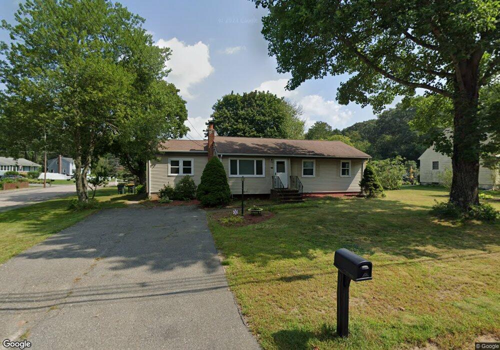
593 Maple St Franklin, MA 02038
Estimated Value: $647,000 - $679,000
About This Home
This home is located at 593 Maple St, Franklin, MA 02038 and is currently estimated at $661,555, approximately $395 per square foot. 593 Maple St is a home located in Norfolk County with nearby schools including John F. Kennedy Memorial School, Horace Mann Middle School, and Franklin High School.
Ownership History
We collect this data history from publicly available records. To have your information removed, we recommend requesting removal directly through your county’s website.
Purchase Details
Home Financials for this Owner
Home Financials are based on the most recent Mortgage that was taken out on this home.Purchase History
We collect this data history from publicly available records. To have your information removed, we recommend requesting removal directly through your county’s website.
| Date | Buyer | Sale Price | Title Company |
|---|---|---|---|
| $326,000 | -- | ||
| $326,000 | -- |
Mortgage History
We collect this data history from publicly available records. To have your information removed, we recommend requesting removal directly through your county’s website.
| Date | Status | Borrower | Loan Amount |
|---|---|---|---|
| Open | $260,800 | ||
| Closed | $260,800 | ||
| Previous Owner | $60,000 | ||
| Previous Owner | $20,000 |
Tax History
We collect this data history from publicly available records. To have your information removed, we recommend requesting removal directly through your county’s website.
| Year | Tax Paid | Tax Assessment Tax Assessment Total Assessment is a certain percentage of the fair market value that is determined by local assessors to be the total taxable value of land and additions on the property. | Land | Improvement |
|---|---|---|---|---|
| 2025 | $6,460 | $555,900 | $242,700 | $313,200 |
| 2024 | $6,184 | $524,500 | $242,700 | $281,800 |
| 2023 | $6,022 | $478,700 | $253,200 | $225,500 |
| 2022 | $5,744 | $408,800 | $209,300 | $199,500 |
| 2021 | $5,352 | $365,300 | $205,200 | $160,100 |
| 2020 | $5,412 | $373,000 | $220,500 | $152,500 |
| 2019 | $5,157 | $351,800 | $199,400 | $152,400 |
| 2018 | $5,072 | $346,200 | $209,000 | $137,200 |
| 2017 | $4,797 | $329,000 | $191,800 | $137,200 |
| 2016 | $4,708 | $324,700 | $204,700 | $120,000 |
| 2015 | $4,464 | $300,800 | $180,800 | $120,000 |
| 2014 | $4,199 | $290,600 | $170,600 | $120,000 |
Map
- 15 Winthrop Dr
- 6 Hancock Rd
- 45 Baron Rd
- 472 Coronation Dr
- 2 Downingwood Dr
- 9 Catherine Ave
- 3 Thomas Dr
- 2 Anchorage Rd
- 67 Bridle Path
- 85 Pine St
- 18 Anchorage Rd
- 734 Lincoln St
- 6 Teresa Cir
- 18 Leanne Way Unit 18
- 90 Oliver Pond Cir Unit 43
- 89 Oliver Pond Cir Unit 4
- 81 Oliver Pond Cir Unit 8
- 77 Oliver Pond Cir Unit 10
- 6 Haverstock Rd
- 6 Edmunds Way
- 588 Maple St
- 586 Maple St
- 590 Maple St
- 589 Maple St
- 584 Maple St
- 591 Maple St
- 585 Maple St
- 0 Lot 14 Tanglewood Dr Unit 50396858
- 0 Lot 15 Tanglewood Dr Unit 50497878
- 0 Lot 1 Tanglewood Dr Unit 50396857
- 0 Lot 2 Tanglewood Dr Unit 50396868
- 582 Maple St
- 4 Tanglewood Dr
- 598 Maple St
- 581 Maple St
- 1 Laurel Ct
- 8 Tanglewood Dr
- 597 Maple St
- 580 Maple St
- 3 Laurel Ct
Ask me questions while you tour the home.