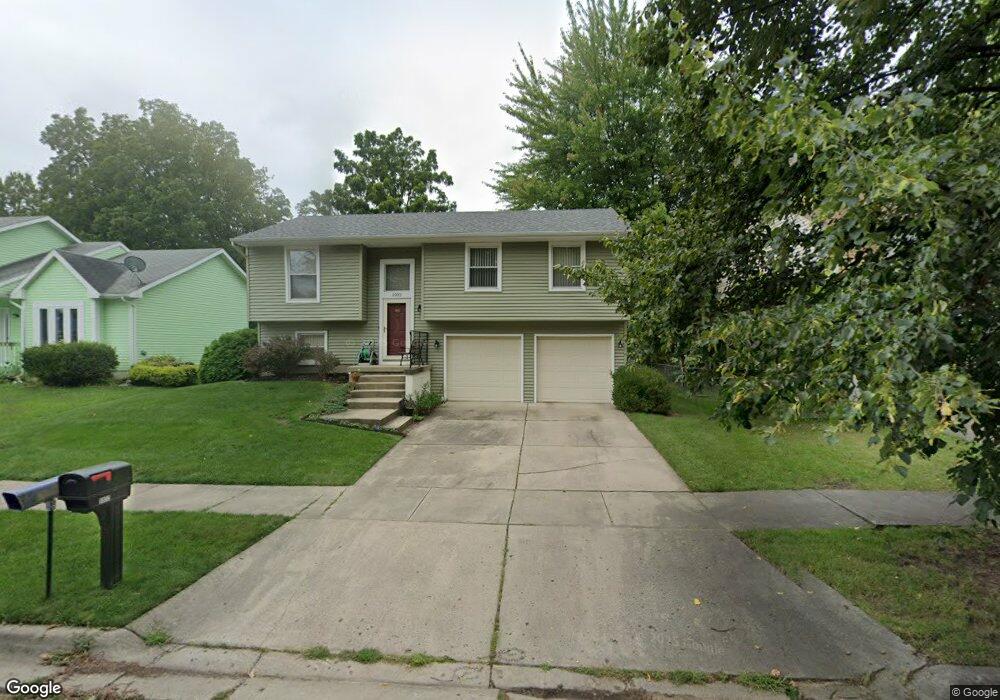
5932 Laporte Dr Lansing, MI 48911
Southern Lansing NeighborhoodEstimated Value: $184,827 - $233,000
--
Bed
--
Bath
1,530
Sq Ft
$138/Sq Ft
Est. Value
About This Home
This home is located at 5932 Laporte Dr, Lansing, MI 48911 and is currently estimated at $210,707, approximately $137 per square foot. 5932 Laporte Dr is a home located in Ingham County with nearby schools including North Elementary School, Everett High School, and Immaculate Heart of Mary/St Casimir School.
Ownership History
Date
Name
Owned For
Owner Type
Purchase Details
Closed on
Aug 14, 2000
Sold by
Mcfall Ryan L and Mcfall Leanne K
Bought by
Moore Michelle R
Current Estimated Value
Home Financials for this Owner
Home Financials are based on the most recent Mortgage that was taken out on this home.
Original Mortgage
$115,660
Outstanding Balance
$41,641
Interest Rate
8.12%
Mortgage Type
Purchase Money Mortgage
Estimated Equity
$169,066
Purchase Details
Closed on
Nov 22, 1996
Sold by
Thomas Edward A and Thomas Crystal L
Bought by
Mcfall Leaane K and Mcfall Ryan
Create a Home Valuation Report for This Property
The Home Valuation Report is an in-depth analysis detailing your home's value as well as a comparison with similar homes in the area
Home Values in the Area
Average Home Value in this Area
Purchase History
| Date | Buyer | Sale Price | Title Company |
|---|---|---|---|
| Moore Michelle R | $121,750 | First American Title Ins Co | |
| Mcfall Leaane K | $90,000 | -- |
Source: Public Records
Mortgage History
| Date | Status | Borrower | Loan Amount |
|---|---|---|---|
| Open | Moore Michelle R | $115,660 |
Source: Public Records
Tax History Compared to Growth
Tax History
| Year | Tax Paid | Tax Assessment Tax Assessment Total Assessment is a certain percentage of the fair market value that is determined by local assessors to be the total taxable value of land and additions on the property. | Land | Improvement |
|---|---|---|---|---|
| 2025 | $3,012 | $88,200 | $12,000 | $76,200 |
| 2024 | $24 | $76,800 | $12,000 | $64,800 |
| 2023 | $2,824 | $72,600 | $12,000 | $60,600 |
| 2022 | $2,546 | $62,400 | $10,500 | $51,900 |
| 2021 | $2,493 | $58,800 | $9,300 | $49,500 |
| 2020 | $2,478 | $54,500 | $9,300 | $45,200 |
| 2019 | $2,375 | $49,100 | $9,300 | $39,800 |
| 2018 | $2,226 | $47,000 | $9,300 | $37,700 |
| 2017 | $2,131 | $47,000 | $9,300 | $37,700 |
| 2016 | $2,038 | $41,000 | $9,300 | $31,700 |
| 2015 | $2,038 | $37,500 | $18,600 | $18,900 |
| 2014 | $2,038 | $36,100 | $21,600 | $14,500 |
Source: Public Records
Map
Nearby Homes
- 5730 Laporte Dr
- 218 Raritan Rd
- 6029 Ellendale Dr
- 5727 Annapolis Dr
- 6246 Gardenia Ave
- 208 E Northrup St
- 5636 Ellendale Dr
- 5902 Hilliard Rd
- 129 Village Dr
- 6001 Joshua St
- 5751 Joshua St
- 6429 Rosedale Rd
- 5808 Orchard Ct
- 5750 Orchard Ct
- 5724 Orchard Ct
- 6444 Sommerset Rd
- 6270 S Washington Ave
- 6421 S Washington Ave
- 1020 R G Curtiss Ave
- 1014 W Northrup St
- 5926 Laporte Dr
- 6000 Laporte Dr
- 5927 Coulson Ct
- 5920 Laporte Dr
- 6008 Laporte Dr
- 5923 Coulson Ct
- 6003 Coulson Ct
- 5917 Coulson Ct
- 5914 Laporte Dr
- 5931 Laporte Dr
- 6014 Laporte Dr
- 5923 Laporte Dr
- 6001 Laporte Dr
- 6009 Coulson Ct
- 5915 Laporte Dr
- 6009 Laporte Dr
- 5909 Coulson Ct
- 5908 Laporte Dr
- 6015 Coulson Ct
- 6022 Laporte Dr