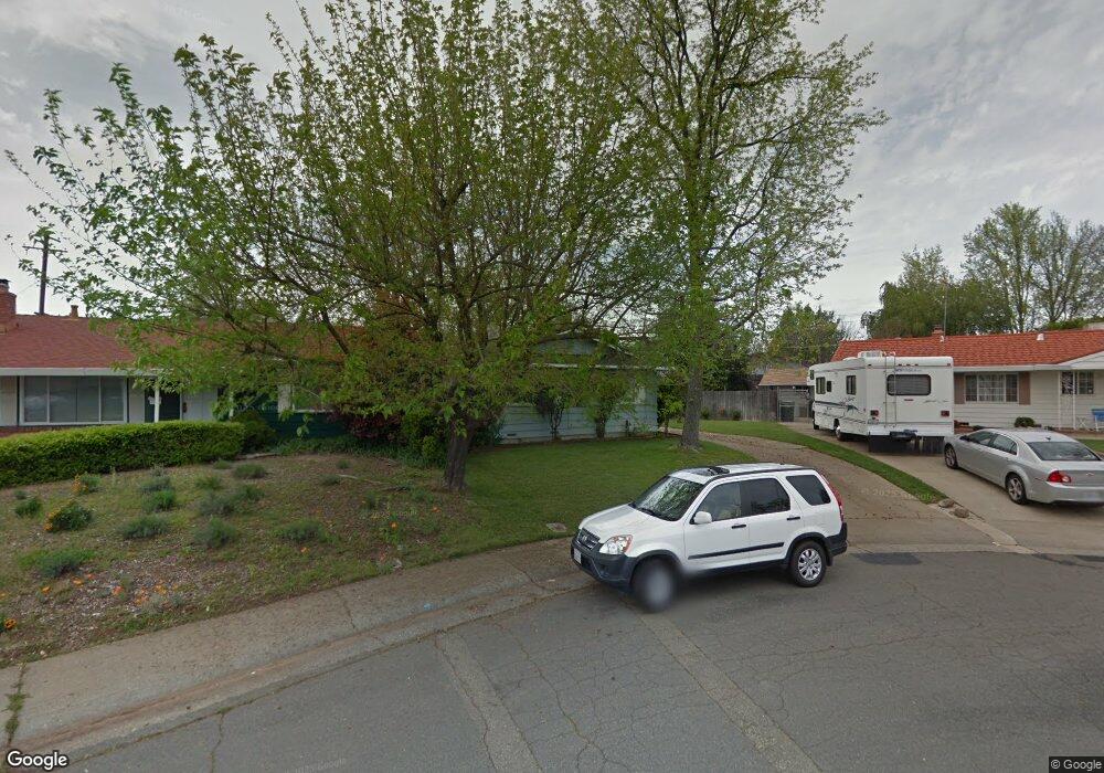
5941 Deary Way Orangevale, CA 95662
Estimated Value: $382,998 - $445,000
3
Beds
1
Bath
960
Sq Ft
$431/Sq Ft
Est. Value
About This Home
This home is located at 5941 Deary Way, Orangevale, CA 95662 and is currently estimated at $414,000, approximately $431 per square foot. 5941 Deary Way is a home located in Sacramento County with nearby schools including Twin Lakes Elementary School, Andrew Carnegie Middle School, and Bella Vista High School.
Ownership History
Date
Name
Owned For
Owner Type
Purchase Details
Closed on
Jun 1, 2020
Sold by
Damrell Linda J
Bought by
Damrell Linda J and The Linda L Damrell 2002 Revoc
Current Estimated Value
Purchase Details
Closed on
Jul 27, 2010
Sold by
Anderson Lois E and The Bruce W Anderson Irrevocab
Bought by
Damrell Linda Jean and The Bruce W Anderson Irrevocab
Purchase Details
Closed on
Jan 28, 1997
Sold by
Bruce W & Lois E Anderson Trust and Lois E
Bought by
Anderson Lois E and Bruce W Anderson Irrevocable T
Create a Home Valuation Report for This Property
The Home Valuation Report is an in-depth analysis detailing your home's value as well as a comparison with similar homes in the area
Home Values in the Area
Average Home Value in this Area
Purchase History
| Date | Buyer | Sale Price | Title Company |
|---|---|---|---|
| Damrell Linda J | -- | None Available | |
| Damrell Linda J | -- | None Available | |
| Damrell Linda Jean | -- | None Available | |
| Anderson Lois E | -- | -- |
Source: Public Records
Tax History
| Year | Tax Paid | Tax Assessment Tax Assessment Total Assessment is a certain percentage of the fair market value that is determined by local assessors to be the total taxable value of land and additions on the property. | Land | Improvement |
|---|---|---|---|---|
| 2025 | $681 | $52,029 | $10,997 | $41,032 |
| 2024 | $681 | $51,010 | $10,782 | $40,228 |
| 2023 | $666 | $50,011 | $10,571 | $39,440 |
| 2022 | $663 | $49,031 | $10,364 | $38,667 |
| 2021 | $653 | $48,070 | $10,161 | $37,909 |
| 2020 | $642 | $47,578 | $10,057 | $37,521 |
| 2019 | $630 | $46,646 | $9,860 | $36,786 |
| 2018 | $624 | $45,732 | $9,667 | $36,065 |
| 2017 | $618 | $44,836 | $9,478 | $35,358 |
| 2016 | $582 | $43,958 | $9,293 | $34,665 |
| 2015 | $573 | $43,299 | $9,154 | $34,145 |
| 2014 | $563 | $42,460 | $8,977 | $33,483 |
Source: Public Records
Map
Nearby Homes
- 9505 Tonkin Dr
- 6132 Main Ave Unit 43
- 6132 Main Ave Unit 28
- 5943 Main Ave Unit A
- 9757 Beachwood Dr
- 9666 Lake Natoma Dr
- 5725 Mangrove Ct
- 5947 Main Ave Unit A
- 5948 Sirl Way
- 9340 Orangevale Ave Unit 26
- 9340 Orangevale Ave Unit 38
- 9340 Orangevale Ave Unit 27
- 9431 Canyon Lake Ln
- 5607 Walnut Ave Unit 10
- 104 Winding Canyon Ln
- 9237 Madison Ave
- 116 Pheasant Ln
- 9348 Blue Oak Dr
- 9200 Madison Ave Unit 151
- 5250 Butterwood Cir
- 5939 Deary Way
- 5943 Deary Way
- 6004 Anthony Dr
- 6020 Anthony Dr
- 6000 Anthony Dr
- 6016 Anthony Dr
- 5937 Deary Way
- 6024 Anthony Dr
- 5950 Anthony Dr
- 5946 Deary Way
- 6028 Anthony Dr
- 5947 Deary Way
- 5931 Deary Way
- 5936 Deary Way
- 6032 Anthony Dr
- 5944 Anthony Dr
- 6021 Anthony Dr
- 5949 Deary Way
- 6036 Anthony Dr
- 6015 Anthony Dr
Your Personal Tour Guide
Ask me questions while you tour the home.