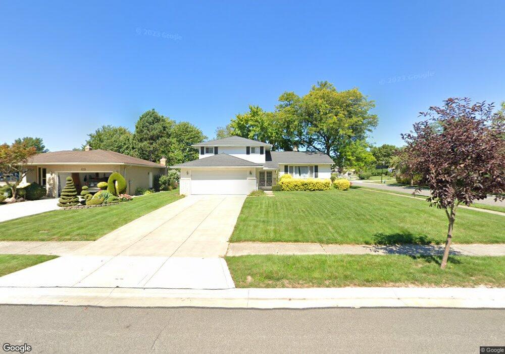
5943 Cantwell Dr Cleveland, OH 44124
Estimated Value: $309,000 - $349,000
3
Beds
2
Baths
2,056
Sq Ft
$158/Sq Ft
Est. Value
About This Home
This home is located at 5943 Cantwell Dr, Cleveland, OH 44124 and is currently estimated at $324,292, approximately $157 per square foot. 5943 Cantwell Dr is a home located in Cuyahoga County with nearby schools including Mayfield High School, Corpus Christi Academy, and Gilmour Academy.
Ownership History
Date
Name
Owned For
Owner Type
Purchase Details
Closed on
Jul 16, 2007
Sold by
Bendoly Lynne
Bought by
Rocco Scott D and Rocco Jasmine C
Current Estimated Value
Home Financials for this Owner
Home Financials are based on the most recent Mortgage that was taken out on this home.
Original Mortgage
$142,800
Outstanding Balance
$88,881
Interest Rate
6.42%
Mortgage Type
Purchase Money Mortgage
Estimated Equity
$235,411
Purchase Details
Closed on
Nov 29, 1979
Sold by
Bendoly Avram
Bought by
Bendoly Lynne
Purchase Details
Closed on
May 25, 1978
Sold by
Linder Gerald and Linder Myrna J
Bought by
Bendoly Avram
Purchase Details
Closed on
Jan 1, 1975
Bought by
Linder Gerald and Linder Myrna J
Create a Home Valuation Report for This Property
The Home Valuation Report is an in-depth analysis detailing your home's value as well as a comparison with similar homes in the area
Home Values in the Area
Average Home Value in this Area
Purchase History
| Date | Buyer | Sale Price | Title Company |
|---|---|---|---|
| Rocco Scott D | $178,500 | Attorney | |
| Bendoly Lynne | -- | -- | |
| Bendoly Avram | $82,200 | -- | |
| Linder Gerald | -- | -- |
Source: Public Records
Mortgage History
| Date | Status | Borrower | Loan Amount |
|---|---|---|---|
| Open | Rocco Scott D | $142,800 |
Source: Public Records
Tax History Compared to Growth
Tax History
| Year | Tax Paid | Tax Assessment Tax Assessment Total Assessment is a certain percentage of the fair market value that is determined by local assessors to be the total taxable value of land and additions on the property. | Land | Improvement |
|---|---|---|---|---|
| 2024 | $6,564 | $100,800 | $16,240 | $84,560 |
| 2023 | $5,259 | $73,960 | $16,870 | $57,090 |
| 2022 | $5,391 | $73,960 | $16,870 | $57,090 |
| 2021 | $5,335 | $73,960 | $16,870 | $57,090 |
| 2020 | $4,976 | $63,210 | $14,420 | $48,790 |
| 2019 | $4,821 | $180,600 | $41,200 | $139,400 |
| 2018 | $4,794 | $63,210 | $14,420 | $48,790 |
| 2017 | $4,669 | $57,540 | $12,600 | $44,940 |
| 2016 | $4,633 | $57,540 | $12,600 | $44,940 |
| 2015 | $4,281 | $57,540 | $12,600 | $44,940 |
| 2014 | $4,281 | $57,540 | $12,600 | $44,940 |
Source: Public Records
Map
Nearby Homes
- 5960 Cantwell Dr
- 5831 Alberta Dr
- 1737 Mayfair Blvd
- 1722 Hawthorne Dr
- 1839 Caronia Dr
- 1763 Temple Ave
- 6132 Westerham Rd
- 5824 Tiffany Ct Unit 5824
- 5814 Tiffany Ct
- S/L 1 Bridgeport Way
- 1856 Bremerton Rd
- 43 Bridgeport Way
- 46 Bridgeport Way
- 1857 Brainard Rd
- 5688 Shawnee Dr
- 1775 Brainard Rd
- 2401 Edgewood Trace
- 2405 Edgewood Trace
- 5931 Mayberry Ave
- 2522 Edgewood Trace
- 5937 Cantwell Dr
- 1856 Drayton Dr
- 5955 Cantwell Dr
- 5929 Cantwell Dr
- 1850 Drayton Dr
- 5961 Cantwell Dr
- 5942 Cantwell Dr
- 5948 Cantwell Dr
- 1847 Drayton Dr
- 5936 Cantwell Dr
- 1871 Euston Dr
- 5923 Cantwell Dr
- 5954 Cantwell Dr
- 1844 Drayton Dr
- 5930 Cantwell Dr
- 5967 Cantwell Dr
- 1863 Euston Dr
- 1845 Drayton Dr
- 5924 Cantwell Dr
- 1855 Euston Dr