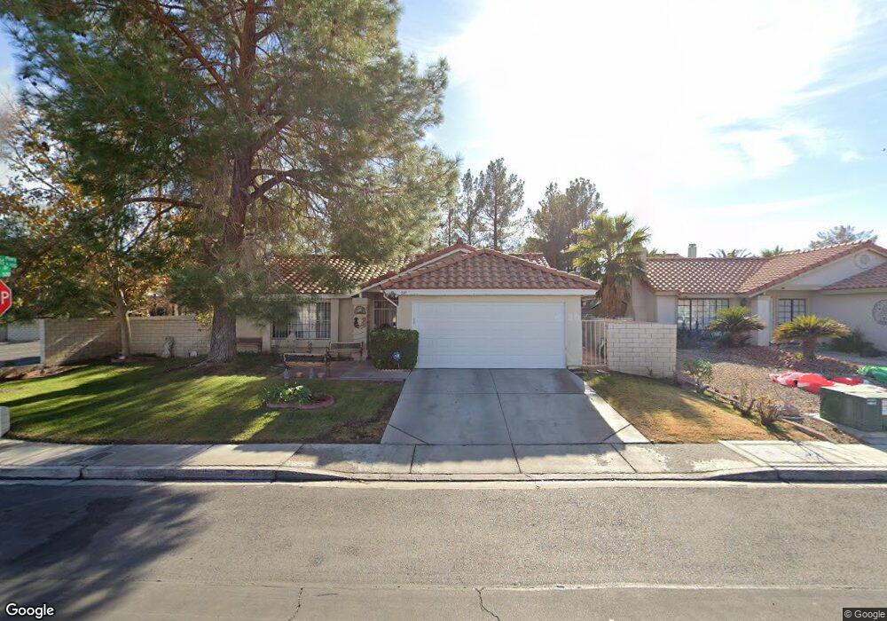
597 MacBrey Dr Las Vegas, NV 89123
Silverado Ranch NeighborhoodEstimated Value: $406,308 - $423,000
3
Beds
2
Baths
1,266
Sq Ft
$327/Sq Ft
Est. Value
About This Home
This home is located at 597 MacBrey Dr, Las Vegas, NV 89123 and is currently estimated at $414,077, approximately $327 per square foot. 597 MacBrey Dr is a home located in Clark County with nearby schools including John R Beatty Elementary School, Jack Lund Schofield Middle School, and Silverado High School.
Ownership History
Date
Name
Owned For
Owner Type
Purchase Details
Closed on
Jul 10, 2025
Sold by
Fenelon Angelique M
Bought by
Fenelon Angelique M and Will Stephen
Current Estimated Value
Purchase Details
Closed on
Nov 25, 2019
Sold by
Fenelon Angelique M
Bought by
Fenelon Angelique M
Purchase Details
Closed on
Mar 5, 2008
Sold by
Fenelon Andrea M
Bought by
Fenelon Andrea M and The Andrea M Fenelon Living Trust
Create a Home Valuation Report for This Property
The Home Valuation Report is an in-depth analysis detailing your home's value as well as a comparison with similar homes in the area
Home Values in the Area
Average Home Value in this Area
Purchase History
| Date | Buyer | Sale Price | Title Company |
|---|---|---|---|
| Fenelon Angelique M | -- | Title Deeds & Needs | |
| Fenelon Angelique M | -- | None Available | |
| Fenelon Andrea M | -- | None Available |
Source: Public Records
Tax History Compared to Growth
Tax History
| Year | Tax Paid | Tax Assessment Tax Assessment Total Assessment is a certain percentage of the fair market value that is determined by local assessors to be the total taxable value of land and additions on the property. | Land | Improvement |
|---|---|---|---|---|
| 2025 | $1,316 | $72,315 | $35,000 | $37,315 |
| 2024 | $1,279 | $72,315 | $35,000 | $37,315 |
| 2023 | $1,279 | $69,937 | $33,950 | $35,987 |
| 2022 | $1,241 | $60,913 | $27,650 | $33,263 |
| 2021 | $1,205 | $57,082 | $25,200 | $31,882 |
| 2020 | $1,167 | $57,094 | $25,200 | $31,894 |
| 2019 | $1,133 | $54,456 | $22,750 | $31,706 |
| 2018 | $1,100 | $50,065 | $19,250 | $30,815 |
| 2017 | $1,405 | $47,798 | $16,450 | $31,348 |
| 2016 | $1,043 | $45,129 | $13,300 | $31,829 |
| 2015 | $1,040 | $39,000 | $10,850 | $28,150 |
| 2014 | $1,009 | $33,281 | $7,000 | $26,281 |
Source: Public Records
Map
Nearby Homes
- 0 Maulding Unit 2719024
- 0 Maulding Unit 2367874
- 8504 Manalang Rd Unit 6
- 636 Whispering Palms Dr
- 498 Paulson Dr
- 745 Diamond Bend Ave
- 861 Clear Diamond Ave
- 8402 Yamhill St
- 8698 Waterford Bend St
- 8431 Jeremiah Grove St
- 896 Clear Diamond Ave
- 920 Clear Diamond Ave
- 8208 Palmada Dr
- 927 Clear Diamond Ave
- 8820 Manalang Rd
- 960 Clear Diamond Ave
- 8840 Quintane Ln
- 8379 Drop Camp St
- 8138 Palmada Dr
- 973 Park Walk Ave
- 591 MacBrey Dr
- 596 Kelsford Dr Unit 7
- 0 Pebble Unit 2649733
- 0 Pebble Unit 2633338
- 0 Maulding Unit 2610519
- 0 Robindale Rd Unit 2317925
- 0 Pebble Unit 2568068
- 0 Pebble Unit 1566072
- 0 Robindale Rd Unit 1600710
- 0 Pebble Unit 1868706
- 0 Pebble Unit 2320119
- 0 Robindale Rd Unit 2330785
- 0 Pebble Unit 2434816
- 0 Pebble Unit 2433848
- 0 Robindale Rd Unit 2287395
- 0000 Jo Rae Ave
- 581 MacBrey Dr
- 590 Kelsford Dr
- 598 MacBrey Dr Unit 7
- 592 MacBrey Dr