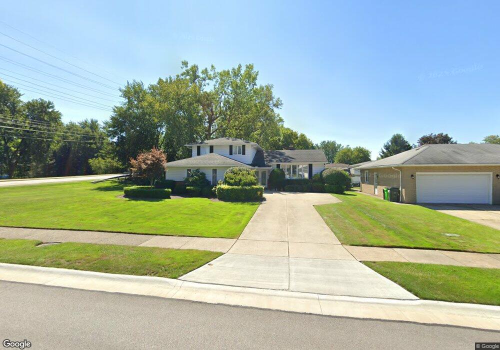
5986 Ashcroft Dr Cleveland, OH 44124
Estimated Value: $312,000 - $359,000
3
Beds
2
Baths
2,136
Sq Ft
$155/Sq Ft
Est. Value
About This Home
This home is located at 5986 Ashcroft Dr, Cleveland, OH 44124 and is currently estimated at $330,839, approximately $154 per square foot. 5986 Ashcroft Dr is a home located in Cuyahoga County with nearby schools including Mayfield High School, Corpus Christi Academy, and Gilmour Academy.
Ownership History
Date
Name
Owned For
Owner Type
Purchase Details
Closed on
Jun 13, 1988
Sold by
Bluestone Richard A and Bluestone Atalie
Bought by
Bluestone Natalie S
Current Estimated Value
Purchase Details
Closed on
Mar 20, 1985
Sold by
Bluestone Natalie
Bought by
Bluestone Richard A and Bluestone Atalie
Purchase Details
Closed on
Feb 5, 1982
Sold by
Bluestone Richard A and Bluestone N
Bought by
Bluestone Natalie
Purchase Details
Closed on
Jan 1, 1975
Bought by
Bluestone Richard A and Bluestone N
Create a Home Valuation Report for This Property
The Home Valuation Report is an in-depth analysis detailing your home's value as well as a comparison with similar homes in the area
Home Values in the Area
Average Home Value in this Area
Purchase History
| Date | Buyer | Sale Price | Title Company |
|---|---|---|---|
| Bluestone Natalie S | -- | -- | |
| Bluestone Richard A | -- | -- | |
| Bluestone Natalie | -- | -- | |
| Bluestone Richard A | -- | -- |
Source: Public Records
Tax History Compared to Growth
Tax History
| Year | Tax Paid | Tax Assessment Tax Assessment Total Assessment is a certain percentage of the fair market value that is determined by local assessors to be the total taxable value of land and additions on the property. | Land | Improvement |
|---|---|---|---|---|
| 2024 | $6,358 | $107,240 | $17,395 | $89,845 |
| 2023 | $5,057 | $80,290 | $18,060 | $62,230 |
| 2022 | $5,225 | $80,290 | $18,060 | $62,230 |
| 2021 | $5,171 | $80,290 | $18,060 | $62,230 |
| 2020 | $4,729 | $68,640 | $15,440 | $53,200 |
| 2019 | $4,582 | $196,100 | $44,100 | $152,000 |
| 2018 | $4,084 | $68,640 | $15,440 | $53,200 |
| 2017 | $3,965 | $57,230 | $13,480 | $43,750 |
| 2016 | $3,935 | $57,230 | $13,480 | $43,750 |
| 2015 | $3,638 | $57,230 | $13,480 | $43,750 |
| 2014 | $3,638 | $57,230 | $13,480 | $43,750 |
Source: Public Records
Map
Nearby Homes
- 1737 Mayfair Blvd
- 5960 Cantwell Dr
- 6132 Westerham Rd
- 5831 Alberta Dr
- 1763 Temple Ave
- 5931 Mayberry Ave
- 1575 Lander Rd
- 1839 Caronia Dr
- 1572 Crestwood Rd
- 5688 Shawnee Dr
- 1590 Longwood Dr
- 1574 Hawthorne Dr
- 43 Bridgeport Way
- 46 Bridgeport Way
- 1856 Bremerton Rd
- S/L 1 Bridgeport Way
- 1775 Brainard Rd
- 210 Teal Trace Unit 210
- 1857 Brainard Rd
- 140 Fox Hollow Dr Unit 201A
- 5980 Ashcroft Dr
- 5974 Ashcroft Dr
- 6002 Cantwell Dr
- 5989 Ashcroft Dr
- 5991 Cantwell Dr
- 5983 Ashcroft Dr
- 5968 Ashcroft Dr
- 5977 Ashcroft Dr
- 5996 Cantwell Dr
- 6010 Catalano Dr
- 5971 Ashcroft Dr
- 5962 Ashcroft Dr
- 5985 Cantwell Dr
- 6009 Lander Rd
- 5965 Ashcroft Dr
- 1806 Lander Rd
- 5990 Cantwell Dr
- 6016 Catalano Dr
- 5956 Ashcroft Dr
- 5979 Cantwell Dr