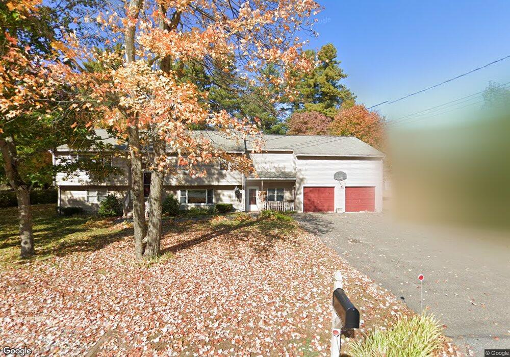
6 Ansel St Salem, NH 03079
Millville NeighborhoodEstimated Value: $578,000 - $677,000
4
Beds
3
Baths
1,296
Sq Ft
$491/Sq Ft
Est. Value
About This Home
This home is located at 6 Ansel St, Salem, NH 03079 and is currently estimated at $636,058, approximately $490 per square foot. 6 Ansel St is a home located in Rockingham County with nearby schools including William T. Barron Elementary School, Woodbury School, and Salem High School.
Ownership History
Date
Name
Owned For
Owner Type
Purchase Details
Closed on
Jan 28, 2021
Sold by
Pietrantonio Antonio F
Bought by
Pietrantonio Barry and Pietrantonio Patricia M
Current Estimated Value
Create a Home Valuation Report for This Property
The Home Valuation Report is an in-depth analysis detailing your home's value as well as a comparison with similar homes in the area
Home Values in the Area
Average Home Value in this Area
Purchase History
| Date | Buyer | Sale Price | Title Company |
|---|---|---|---|
| Pietrantonio Barry | -- | None Available |
Source: Public Records
Tax History Compared to Growth
Tax History
| Year | Tax Paid | Tax Assessment Tax Assessment Total Assessment is a certain percentage of the fair market value that is determined by local assessors to be the total taxable value of land and additions on the property. | Land | Improvement |
|---|---|---|---|---|
| 2024 | $9,571 | $543,800 | $170,500 | $373,300 |
| 2023 | $9,247 | $545,200 | $170,500 | $374,700 |
| 2022 | $8,750 | $545,200 | $170,500 | $374,700 |
| 2021 | $8,712 | $545,200 | $170,500 | $374,700 |
| 2020 | $7,885 | $358,100 | $121,800 | $236,300 |
| 2019 | $7,871 | $358,100 | $121,800 | $236,300 |
| 2018 | $7,739 | $358,100 | $121,800 | $236,300 |
| 2017 | $7,371 | $353,700 | $121,800 | $231,900 |
| 2016 | $7,140 | $349,500 | $121,800 | $227,700 |
| 2015 | $6,740 | $315,100 | $121,100 | $194,000 |
| 2014 | $6,551 | $315,100 | $121,100 | $194,000 |
| 2013 | $6,447 | $315,100 | $121,100 | $194,000 |
Source: Public Records
Map
Nearby Homes
- 8 Senter St
- 15 Linwood Ave
- 4 Mulberry Rd
- 10 Evelyn Rd
- 2 Renaissance Cir
- 59 Cluff Rd Unit 50
- 59 Cluff Rd Unit 7
- 59 Cluff Rd Unit 41
- 48 Pond St
- 30 Hagop Rd
- 17 Garrison Rd
- 12 Stillwater Cir
- 11 Tiffany Rd Unit 1
- 0 Hampshire Rd
- 12 Braemoor Woods Rd Unit 206
- 19 Hampshire Rd Unit 304
- 117 Cluff Crossing Rd Unit 7
- 21 Hampshire Rd Unit 412
- 6 Lancelot Ct Unit 2
- 55 Crestwood Cir