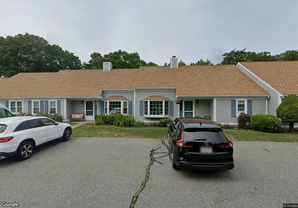
6 Browning Ct Unit B Pocasset, MA 02559
Pocasset NeighborhoodEstimated Value: $475,035 - $536,000
3
Beds
3
Baths
1,566
Sq Ft
$316/Sq Ft
Est. Value
About This Home
This home is located at 6 Browning Ct Unit B, Pocasset, MA 02559 and is currently estimated at $494,259, approximately $315 per square foot. 6 Browning Ct Unit B is a home located in Barnstable County with nearby schools including Bourne High School, Cadence Academy Preschool - Bourne, and St Margaret Regional School.
Ownership History
Date
Name
Owned For
Owner Type
Purchase Details
Closed on
Aug 14, 2019
Sold by
Robert & Carol Theroux Ret
Bought by
Pentland Graeme and Pentland Maureen
Current Estimated Value
Purchase Details
Closed on
Mar 10, 2015
Sold by
Theroux Robert D and Theroux Carol M
Bought by
Carol Robert and Carol Theroux R
Purchase Details
Closed on
Jan 27, 2011
Sold by
Mccarthy Mary J
Bought by
Theroux Robert D and Theroux Carol M
Purchase Details
Closed on
Mar 1, 2000
Sold by
Howe Frederick Jr Est
Bought by
Mccarthy Maryjane
Purchase Details
Closed on
Oct 1, 1999
Sold by
Est Howe Katherine A and Howe Frederick H
Bought by
Mccarthy Mary Jane
Purchase Details
Closed on
Jul 7, 1995
Sold by
Pjm Rt and Medeiros Paul J
Bought by
Howe Katherine A
Create a Home Valuation Report for This Property
The Home Valuation Report is an in-depth analysis detailing your home's value as well as a comparison with similar homes in the area
Home Values in the Area
Average Home Value in this Area
Purchase History
| Date | Buyer | Sale Price | Title Company |
|---|---|---|---|
| Pentland Graeme | $333,000 | -- | |
| Carol Robert | -- | -- | |
| Theroux Robert D | $230,000 | -- | |
| Mccarthy Maryjane | $135,000 | -- | |
| Mccarthy Mary Jane | $150,000 | -- | |
| Howe Katherine A | $108,000 | -- |
Source: Public Records
Mortgage History
| Date | Status | Borrower | Loan Amount |
|---|---|---|---|
| Previous Owner | Howe Katherine A | $199,000 |
Source: Public Records
Tax History Compared to Growth
Tax History
| Year | Tax Paid | Tax Assessment Tax Assessment Total Assessment is a certain percentage of the fair market value that is determined by local assessors to be the total taxable value of land and additions on the property. | Land | Improvement |
|---|---|---|---|---|
| 2025 | $3,424 | $438,400 | $0 | $438,400 |
| 2024 | $3,255 | $405,900 | $0 | $405,900 |
| 2023 | $3,164 | $359,100 | $0 | $359,100 |
| 2022 | $3,154 | $312,600 | $0 | $312,600 |
| 2021 | $3,117 | $289,400 | $0 | $289,400 |
| 2020 | $2,846 | $265,000 | $0 | $265,000 |
| 2019 | $2,393 | $227,700 | $0 | $227,700 |
| 2018 | $2,360 | $223,900 | $0 | $223,900 |
| 2017 | $2,268 | $220,200 | $0 | $220,200 |
| 2016 | $2,045 | $201,300 | $0 | $201,300 |
| 2015 | $2,027 | $201,300 | $0 | $201,300 |
Source: Public Records
Map
Nearby Homes
- 7 Portside Dr
- 7 4th Ave
- 15 1st St
- 174 Barlows Landing Rd
- 940 County Rd
- 709 County Rd
- 940 County Rd
- 254 Barlows Landing Rd
- 39 Bennets Neck Dr
- 16 Tara Terrace
- 93 Valley Bars Rd
- 515 County Rd
- 501 County Rd
- 30 Howard Ave
- 112 Clay Pond Rd
- 2 Westerly Dr
- 159 Clay Pond Rd
- 105 Clay Pond Rd
- 159 Clay Pond Rd
- 1094 County Rd
- 6 Browning Ct Unit D
- 6 Browning Ct Unit C
- 6 Browning Ct Unit A
- 6 Browning Ct Unit 6C
- 6 D Browning Ct Unit 6D
- 6B Browning Ct
- 6B Browning Ct Unit 6B
- 0 Browning Ct Unit 3C 2017464
- 0 Browning Ct
- 3 Browning Ct Unit D
- 3 Browning Ct Unit C
- 3 Browning Ct Unit B
- 3 Browning Ct Unit A
- 3D Browning Ct Unit 3D
- 3 Browning Ct Unit 3A
- 3A Browning Ct Unit A
- 4 Browning Ct Unit D
- 4 Browning Ct Unit C
- 4 Browning Ct Unit B
- 4 Browning Ct Unit 4A