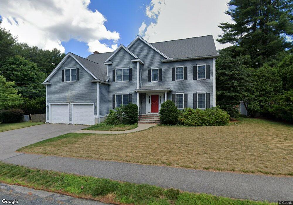
6 Elmwood Rd Needham, MA 02492
Estimated Value: $1,522,000 - $2,288,000
5
Beds
4
Baths
1,646
Sq Ft
$1,265/Sq Ft
Est. Value
About This Home
This home is located at 6 Elmwood Rd, Needham, MA 02492 and is currently estimated at $2,081,581, approximately $1,264 per square foot. 6 Elmwood Rd is a home located in Norfolk County with nearby schools including Broadmeadow Elementary School, High Rock Middle School, and Pollard Middle School.
Ownership History
Date
Name
Owned For
Owner Type
Purchase Details
Closed on
Jun 8, 2001
Sold by
John E Malone Rt
Bought by
Lusardi Philip P and Lusardi Mary N
Current Estimated Value
Home Financials for this Owner
Home Financials are based on the most recent Mortgage that was taken out on this home.
Original Mortgage
$640,000
Interest Rate
7.08%
Mortgage Type
Purchase Money Mortgage
Create a Home Valuation Report for This Property
The Home Valuation Report is an in-depth analysis detailing your home's value as well as a comparison with similar homes in the area
Home Values in the Area
Average Home Value in this Area
Purchase History
| Date | Buyer | Sale Price | Title Company |
|---|---|---|---|
| Lusardi Philip P | $800,000 | -- |
Source: Public Records
Mortgage History
| Date | Status | Borrower | Loan Amount |
|---|---|---|---|
| Open | Lusardi Philip P | $411,000 | |
| Closed | Lusardi Philip P | $417,000 | |
| Closed | Lusardi Philip P | $640,000 |
Source: Public Records
Tax History
| Year | Tax Paid | Tax Assessment Tax Assessment Total Assessment is a certain percentage of the fair market value that is determined by local assessors to be the total taxable value of land and additions on the property. | Land | Improvement |
|---|---|---|---|---|
| 2025 | $20,030 | $1,889,600 | $804,300 | $1,085,300 |
| 2024 | $20,633 | $1,648,000 | $584,000 | $1,064,000 |
| 2023 | $20,406 | $1,564,900 | $584,000 | $980,900 |
| 2022 | $19,645 | $1,469,300 | $541,000 | $928,300 |
| 2021 | $19,145 | $1,469,300 | $541,000 | $928,300 |
| 2020 | $18,014 | $1,442,300 | $541,000 | $901,300 |
| 2019 | $16,995 | $1,371,700 | $492,100 | $879,600 |
| 2018 | $15,593 | $1,312,500 | $492,100 | $820,400 |
| 2017 | $14,325 | $1,204,800 | $492,100 | $712,700 |
| 2016 | $13,903 | $1,204,800 | $492,100 | $712,700 |
| 2015 | $13,602 | $1,204,800 | $492,100 | $712,700 |
| 2014 | $12,945 | $1,112,100 | $428,300 | $683,800 |
Source: Public Records
Map
Nearby Homes
- 78 Birds Hill Ave
- 883 Greendale Ave
- 97 Great Plain Ave
- 37 Cottage Cir
- 37 Cottage Cir Unit 37
- 26 Pinewood Rd
- 1202 Greendale Ave Unit 133
- 701 Greendale Ave
- 1206 Greendale Ave Unit 201
- 242 Valley Rd
- 26 Gordon Rd
- 40 Otis St Unit L
- 1011 Webster St
- 68 Pleasant St Unit 68
- 233 Warren St
- 90 Norfolk St
- 638 Webster St
- 638 Webster St Unit 638
- 168 Richdale Rd
- 175 Schoolmaster Ln
- 9 Elmwood Rd
- 14 Elmwood Rd
- 371 Great Plain Ave
- 349 Great Plain Ave
- 20 Elmwood Rd
- 50 Fuller Rd
- 50 Fuller Rd Unit 1
- 341 Great Plain Ave
- 26 Elmwood Rd
- 44 Fuller Rd
- 337 Great Plain Ave
- 32 Elmwood Rd
- 38 Fuller Rd
- 33 Elmwood Rd
- 38 Elmwood Rd
- 329 Great Plain Ave
- 30 Fuller Rd
- 37 Fuller Rd
- 275 Broad Meadow Rd
- 254 Broad Meadow Rd
Your Personal Tour Guide
Ask me questions while you tour the home.