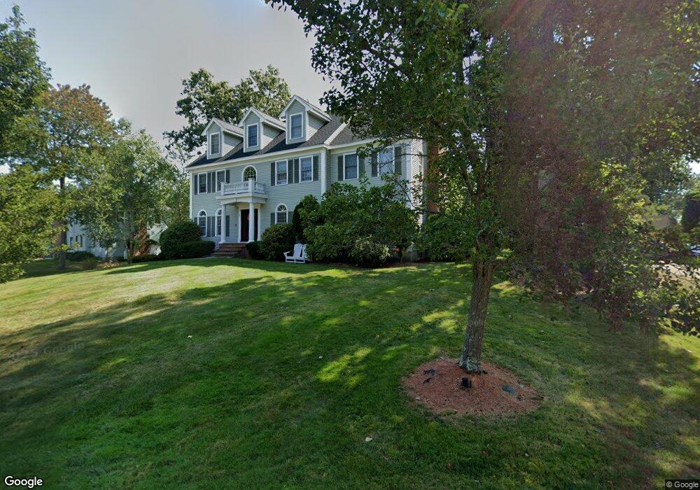
6 Juniper Ln Hampton, NH 03842
Estimated Value: $1,074,569 - $1,238,000
4
Beds
3
Baths
2,896
Sq Ft
$405/Sq Ft
Est. Value
About This Home
This home is located at 6 Juniper Ln, Hampton, NH 03842 and is currently estimated at $1,174,142, approximately $405 per square foot. 6 Juniper Ln is a home located in Rockingham County with nearby schools including Hampton Centre School, Adeline C. Marston Elementary School, and Hampton Academy.
Ownership History
Date
Name
Owned For
Owner Type
Purchase Details
Closed on
Oct 15, 2021
Sold by
Pelletier Philip J and Pelletier Kristine D
Bought by
Cronan Ryan and Cronan Heather J
Current Estimated Value
Home Financials for this Owner
Home Financials are based on the most recent Mortgage that was taken out on this home.
Original Mortgage
$700,000
Outstanding Balance
$632,768
Interest Rate
2.8%
Mortgage Type
Purchase Money Mortgage
Estimated Equity
$541,374
Purchase Details
Closed on
Jun 17, 1997
Sold by
Green & Co Bldg & Dev
Bought by
Pelletier Philip J and Pelletier Kristine D
Home Financials for this Owner
Home Financials are based on the most recent Mortgage that was taken out on this home.
Original Mortgage
$200,000
Interest Rate
7.97%
Create a Home Valuation Report for This Property
The Home Valuation Report is an in-depth analysis detailing your home's value as well as a comparison with similar homes in the area
Home Values in the Area
Average Home Value in this Area
Purchase History
| Date | Buyer | Sale Price | Title Company |
|---|---|---|---|
| Cronan Ryan | $800,000 | None Available | |
| Pelletier Philip J | $318,000 | -- | |
| Green & Co Bldg & Dev | $85,000 | -- |
Source: Public Records
Mortgage History
| Date | Status | Borrower | Loan Amount |
|---|---|---|---|
| Open | Cronan Ryan | $700,000 | |
| Previous Owner | Green & Co Bldg & Dev | $112,210 | |
| Previous Owner | Green & Co Bldg & Dev | $5,000 | |
| Previous Owner | Green & Co Bldg & Dev | $200,000 |
Source: Public Records
Tax History
| Year | Tax Paid | Tax Assessment Tax Assessment Total Assessment is a certain percentage of the fair market value that is determined by local assessors to be the total taxable value of land and additions on the property. | Land | Improvement |
|---|---|---|---|---|
| 2024 | $12,829 | $1,041,300 | $490,300 | $551,000 |
| 2023 | $10,836 | $646,900 | $281,300 | $365,600 |
| 2022 | $10,247 | $646,900 | $281,300 | $365,600 |
| 2021 | $10,247 | $646,900 | $281,300 | $365,600 |
| 2020 | $10,302 | $646,700 | $281,300 | $365,400 |
| 2019 | $10,354 | $646,700 | $281,300 | $365,400 |
| 2018 | $10,392 | $610,600 | $255,600 | $355,000 |
| 2017 | $9,996 | $610,600 | $255,600 | $355,000 |
| 2016 | $9,818 | $610,600 | $255,600 | $355,000 |
| 2015 | $9,427 | $492,000 | $209,600 | $282,400 |
| 2014 | $8,988 | $490,900 | $209,600 | $281,300 |
Source: Public Records
Map
Nearby Homes
- 00 Ocean Blvd
- 61 Acorn Rd
- 975 Ocean Blvd Unit 10
- 943 Ocean Blvd Unit 21
- 190 Kings Hwy Unit A1
- 12 Runnymede Dr
- 15 Atlantic Ave
- 27 Dunvegan Woods
- 139 Atlantic Ave
- 7 Redman St
- 11 Redman St
- 745 Ocean Blvd
- 36 Milbern Ave
- 29 Thorwald Ave
- 550 Winnacunnet Rd Unit 318
- 550 Winnacunnet Rd Unit 218
- 558 Winnacunnet Rd
- 580 Winnacunnet Rd Unit 305
- 2 Hilliard Dr
- 38 Mill Rd