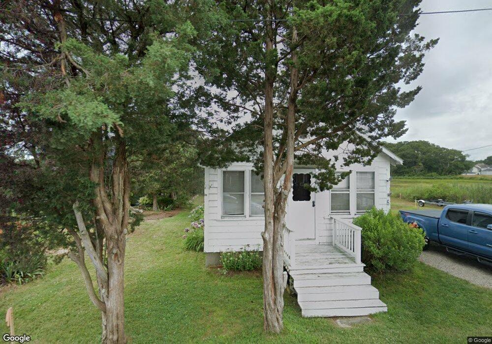
6 Massasoit St Pocasset, MA 2559
Pocasset NeighborhoodEstimated Value: $587,000 - $662,000
2
Beds
1
Bath
630
Sq Ft
$982/Sq Ft
Est. Value
About This Home
This home is located at 6 Massasoit St, Pocasset, MA 2559 and is currently estimated at $618,883, approximately $982 per square foot. 6 Massasoit St is a home located in Barnstable County with nearby schools including Bourne High School and Cadence Academy Preschool - Bourne.
Ownership History
Date
Name
Owned For
Owner Type
Purchase Details
Closed on
Mar 22, 2013
Sold by
Thorpe Dorothy M and Thorpe Frederick A
Bought by
Briscoe T T and Briscoe B
Current Estimated Value
Purchase Details
Closed on
Dec 28, 2012
Sold by
Thorpe Richard F and Thorpe Robert L
Bought by
Thorpe Dorothy M and Thorpe Frederick A
Purchase Details
Closed on
Aug 3, 2012
Sold by
Johnson Russell J
Bought by
Johnson R M R and Johnson John E
Purchase Details
Closed on
May 25, 2007
Sold by
Thorpe Dorothy M and Thorpe Frederick A
Bought by
Thorpe Dorothy M and Thorpe Frederick A
Create a Home Valuation Report for This Property
The Home Valuation Report is an in-depth analysis detailing your home's value as well as a comparison with similar homes in the area
Home Values in the Area
Average Home Value in this Area
Purchase History
| Date | Buyer | Sale Price | Title Company |
|---|---|---|---|
| Briscoe T T | $218,000 | -- | |
| Briscoe T T | $218,000 | -- | |
| Thorpe Dorothy M | -- | -- | |
| Thorpe Dorothy M | -- | -- | |
| Johnson R M R | -- | -- | |
| Johnson R M R | -- | -- | |
| Thorpe Dorothy M | -- | -- | |
| Thorpe Dorothy M | -- | -- |
Source: Public Records
Tax History
| Year | Tax Paid | Tax Assessment Tax Assessment Total Assessment is a certain percentage of the fair market value that is determined by local assessors to be the total taxable value of land and additions on the property. | Land | Improvement |
|---|---|---|---|---|
| 2025 | $4,382 | $561,100 | $503,000 | $58,100 |
| 2024 | $4,285 | $534,300 | $479,000 | $55,300 |
| 2023 | $4,166 | $472,900 | $423,900 | $49,000 |
| 2022 | $3,580 | $354,800 | $315,900 | $38,900 |
| 2021 | $2,954 | $274,300 | $233,600 | $40,700 |
| 2020 | $2,900 | $270,000 | $231,400 | $38,600 |
| 2019 | $2,815 | $267,800 | $231,400 | $36,400 |
| 2018 | $2,748 | $260,700 | $226,000 | $34,700 |
| 2017 | $2,659 | $258,200 | $223,900 | $34,300 |
| 2016 | $2,493 | $245,400 | $212,700 | $32,700 |
| 2015 | $2,302 | $228,600 | $195,900 | $32,700 |
Source: Public Records
Map
Nearby Homes
- 6 Massasoit Ave
- 10 Massasoit St
- 16 Massasoit Ave
- 4 Massasoit St
- 322 Circuit Ave
- 320 Circuit Ave
- 316 Circuit Ave
- 310 Circuit Ave
- 326 Circuit Ave
- 26 Massasoit Ave
- 332 Circuit Ave
- 26 Massasoit St
- 306 Circuit Ave
- 311 Circuit Ave
- 1 Hope Ave
- 30 Massasoit Ave
- 30 Massasoit St
- 340 Circuit Ave
- 305 Circuit Ave
- 331 Circuit Ave
Your Personal Tour Guide
Ask me questions while you tour the home.