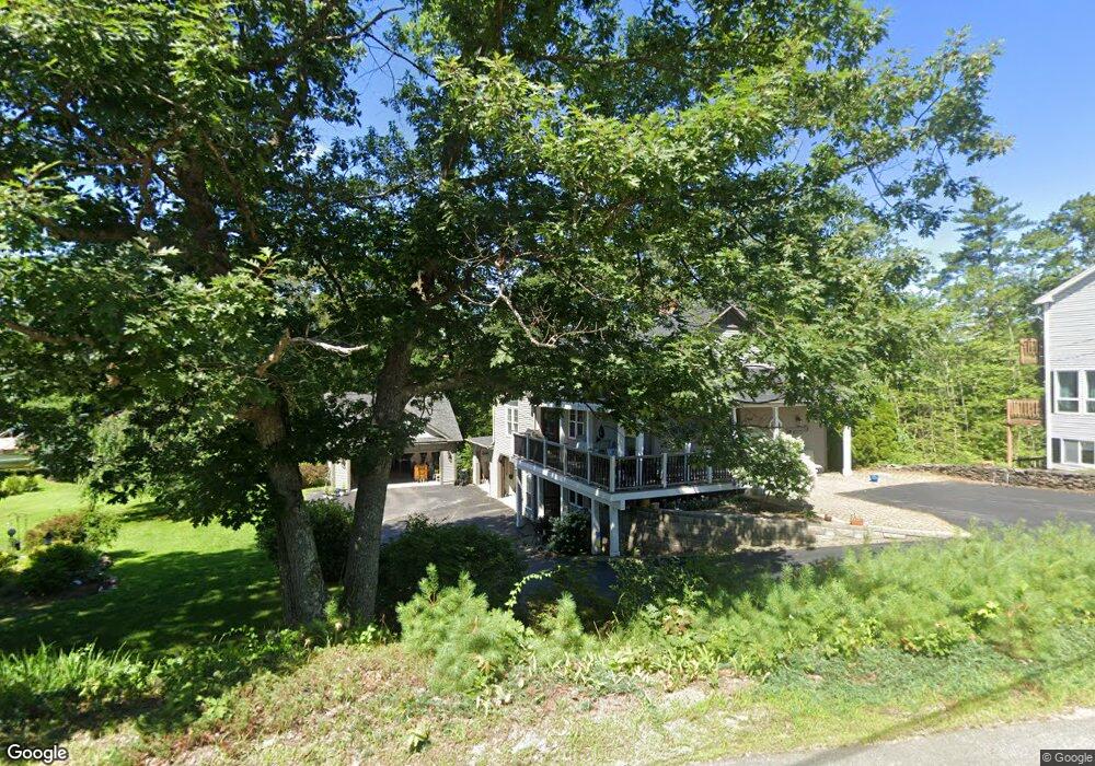
6 Morrison Ave Meredith, NH 03253
Estimated Value: $642,000 - $1,144,000
3
Beds
3
Baths
1,312
Sq Ft
$610/Sq Ft
Est. Value
About This Home
This home is located at 6 Morrison Ave, Meredith, NH 03253 and is currently estimated at $800,518, approximately $610 per square foot. 6 Morrison Ave is a home located in Belknap County with nearby schools including Inter-Lakes Elementary School and Lakeland School.
Ownership History
Date
Name
Owned For
Owner Type
Purchase Details
Closed on
Aug 18, 2020
Sold by
Barrett Stephen D
Bought by
Lal Property 1 Llc
Current Estimated Value
Purchase Details
Closed on
Jan 31, 1997
Sold by
Paplaskas Peter and Paplaskas Mildred M
Bought by
Barrett Walter P and Barrett Frances J
Home Financials for this Owner
Home Financials are based on the most recent Mortgage that was taken out on this home.
Original Mortgage
$39,900
Interest Rate
7.65%
Mortgage Type
Purchase Money Mortgage
Create a Home Valuation Report for This Property
The Home Valuation Report is an in-depth analysis detailing your home's value as well as a comparison with similar homes in the area
Home Values in the Area
Average Home Value in this Area
Purchase History
| Date | Buyer | Sale Price | Title Company |
|---|---|---|---|
| Lal Property 1 Llc | $155,000 | None Available | |
| Barrett Walter P | $49,900 | -- |
Source: Public Records
Mortgage History
| Date | Status | Borrower | Loan Amount |
|---|---|---|---|
| Previous Owner | Barrett Walter P | $39,900 |
Source: Public Records
Tax History Compared to Growth
Tax History
| Year | Tax Paid | Tax Assessment Tax Assessment Total Assessment is a certain percentage of the fair market value that is determined by local assessors to be the total taxable value of land and additions on the property. | Land | Improvement |
|---|---|---|---|---|
| 2024 | $6,620 | $645,200 | $207,700 | $437,500 |
| 2023 | $6,358 | $642,900 | $207,700 | $435,200 |
| 2022 | $5,293 | $378,900 | $102,700 | $276,200 |
| 2021 | $5,089 | $378,900 | $102,700 | $276,200 |
| 2020 | $5,312 | $378,900 | $102,700 | $276,200 |
| 2019 | $4,864 | $306,100 | $59,300 | $246,800 |
| 2018 | $4,781 | $306,100 | $59,300 | $246,800 |
| 2016 | $3,910 | $282,900 | $71,000 | $211,900 |
| 2015 | $4,125 | $271,400 | $71,000 | $200,400 |
| 2014 | $4,025 | $271,400 | $71,000 | $200,400 |
| 2013 | $3,911 | $271,400 | $71,000 | $200,400 |
Source: Public Records
Map
Nearby Homes
- 7 Mudgett Ave
- 111 Nh Route 25
- 11 Highland St
- 99 Pleasant St
- 15 Highland St
- 12 Highland St
- 8 Water St Unit 2
- 11 & 12 Highland St
- 142 Nh Route 25
- 8 Kelly Ln
- 20 True Rd Unit 85
- 20 True Rd Unit 101
- 20 True Rd Unit 63
- 32 Boynton Rd
- 21 Upper Ladd Hill Rd Unit D
- 21 Upper Ladd Hill Rd Unit A
- 21 Upper Ladd Hill Rd Unit E
- 21 Upper Ladd Hill Rd Unit C
- 21 Upper Ladd Hill Rd Unit B
- 4 Pike Island Rd
- 10 Morrison Ave
- 0 Morrison Ave
- 24 Pleasant St
- 22 Pleasant St
- 22 Pleasant Street Meredith Yacht Club
- 5 Morrison Ave
- 20 Pleasant St
- 9 Morrison Ave
- 26 Pleasant St
- 18 Pleasant St
- 6 Gould Ave
- 28 Pleasant St
- 25 Pleasant St
- 8 Gould Ave
- 14 Pleasant St
- 5 Gould Ave
- 5 Gould Ave Unit 1
- 16 Gould Ave
- 10 Gould Ave
- 30 Pleasant St