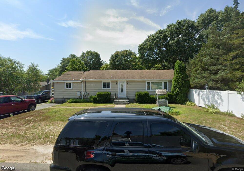
6 Partridge Path Wareham, MA 02571
Estimated Value: $548,000 - $624,000
4
Beds
2
Baths
2,116
Sq Ft
$271/Sq Ft
Est. Value
About This Home
This home is located at 6 Partridge Path, Wareham, MA 02571 and is currently estimated at $573,663, approximately $271 per square foot. 6 Partridge Path is a home.
Ownership History
Date
Name
Owned For
Owner Type
Purchase Details
Closed on
Sep 9, 2025
Sold by
Areano Ronald J and Areano Judith
Bought by
Areano Ronald J and Areano Judith
Current Estimated Value
Purchase Details
Closed on
Jun 21, 2010
Sold by
Areano Ronald J
Bought by
Areano Ronald J and Areano Judith
Home Financials for this Owner
Home Financials are based on the most recent Mortgage that was taken out on this home.
Original Mortgage
$259,715
Interest Rate
4.87%
Mortgage Type
FHA
Create a Home Valuation Report for This Property
The Home Valuation Report is an in-depth analysis detailing your home's value as well as a comparison with similar homes in the area
Purchase History
| Date | Buyer | Sale Price | Title Company |
|---|---|---|---|
| Areano Ronald J | $35,800 | -- | |
| Areano Ronald J | $35,800 | -- | |
| Areano Ronald J | -- | -- | |
| Areano Ronald J | -- | -- | |
| Areano Ronald J | -- | -- |
Source: Public Records
Mortgage History
| Date | Status | Borrower | Loan Amount |
|---|---|---|---|
| Previous Owner | Areano Ronald J | $259,715 |
Source: Public Records
Tax History
| Year | Tax Paid | Tax Assessment Tax Assessment Total Assessment is a certain percentage of the fair market value that is determined by local assessors to be the total taxable value of land and additions on the property. | Land | Improvement |
|---|---|---|---|---|
| 2025 | $5,196 | $498,700 | $109,900 | $388,800 |
| 2024 | $5,203 | $463,300 | $86,000 | $377,300 |
| 2023 | $4,696 | $416,700 | $78,100 | $338,600 |
| 2022 | $4,696 | $356,300 | $78,100 | $278,200 |
| 2021 | $4,639 | $344,900 | $78,100 | $266,800 |
| 2020 | $4,324 | $326,100 | $78,100 | $248,000 |
| 2019 | $3,772 | $283,800 | $75,300 | $208,500 |
| 2018 | $3,512 | $257,700 | $75,300 | $182,400 |
| 2017 | $3,216 | $239,100 | $75,300 | $163,800 |
| 2016 | $2,902 | $214,500 | $73,000 | $141,500 |
| 2015 | $2,804 | $214,500 | $73,000 | $141,500 |
| 2014 | $2,679 | $208,500 | $69,300 | $139,200 |
Source: Public Records
Map
Nearby Homes
- 2697 Cranberry Hwy Unit 23
- 2711 Cranberry Hwy
- 156 Sandwich Rd
- 2645 Cranberry Hwy Unit A
- 103 Kimberly Ct
- 2783 Cranberry Hwy
- 25 Linwood Ave
- 55 Minot Ave Unit 55
- 110 Mayflower Ridge Dr
- 10 Oak St
- 2838 Cranberry Hwy
- 437 Main St
- 124 Minot Ave Unit 1
- 0 Charge Pond Rd
- 7 Knowles Ave
- 9 Old Glen Charlie Rd
- 91 Agawam Lake Shore Dr
- 106 Circuit Ave
- 102 Maple Springs Rd
- 4 Ross Ave
- 4 Partridge Path
- 5 Partridge Path
- 3 Partridge Path
- 7 Partridge Path
- 10 Partridge Path
- 17 Meadowlark Dr
- 19 Meadowlark Dr
- 15 Meadowlark Dr
- 14 Pheasant Ave
- 14 Whipoorwill Way
- 9 Partridge Path
- 0 Meadowlark Dr Unit 7B
- 16 Whipoorwill Way
- 12 Whippoorwill Way
- 21 Meadowlark Dr
- 16 Whippoorwill Way
- 10 Whippoorwill Way
- 10 Whipoorwill Way
- 16 Pheasant Ave
- 13 Meadowlark Dr
Your Personal Tour Guide
Ask me questions while you tour the home.