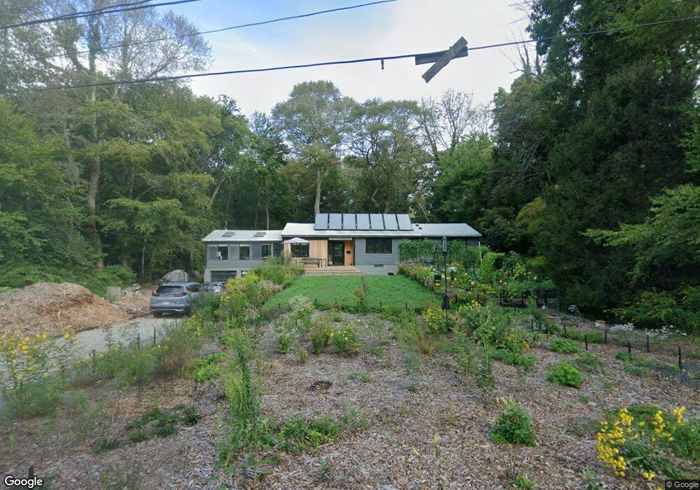
6 Pine Brook Ln Scituate, MA 02066
Estimated Value: $1,001,989 - $1,165,000
3
Beds
2
Baths
2,287
Sq Ft
$472/Sq Ft
Est. Value
About This Home
This home is located at 6 Pine Brook Ln, Scituate, MA 02066 and is currently estimated at $1,080,497, approximately $472 per square foot. 6 Pine Brook Ln is a home located in Plymouth County with nearby schools including Cushing Elementary School, Lester J. Gates Middle School, and Scituate High School.
Ownership History
Date
Name
Owned For
Owner Type
Purchase Details
Closed on
Sep 17, 2020
Sold by
Leasure Rubin Lt
Bought by
Malinowski Matthew and Rubon Caitlin J
Current Estimated Value
Home Financials for this Owner
Home Financials are based on the most recent Mortgage that was taken out on this home.
Original Mortgage
$400,000
Outstanding Balance
$354,315
Interest Rate
2.8%
Mortgage Type
New Conventional
Estimated Equity
$726,182
Purchase Details
Closed on
Apr 13, 2017
Sold by
Leaseure Patricia A and Rubin Michael R
Bought by
Leasure Rubin Lt
Purchase Details
Closed on
Nov 28, 2016
Sold by
Julia Ryan Leasure Ret
Bought by
Leasure Patricia A
Create a Home Valuation Report for This Property
The Home Valuation Report is an in-depth analysis detailing your home's value as well as a comparison with similar homes in the area
Home Values in the Area
Average Home Value in this Area
Purchase History
| Date | Buyer | Sale Price | Title Company |
|---|---|---|---|
| Malinowski Matthew | $400,000 | None Available | |
| Leasure Rubin Lt | -- | -- | |
| Leasure Patricia A | -- | -- | |
| Julia Ryan Leasure Ret | -- | -- |
Source: Public Records
Mortgage History
| Date | Status | Borrower | Loan Amount |
|---|---|---|---|
| Open | Malinowski Matthew | $400,000 |
Source: Public Records
Tax History
| Year | Tax Paid | Tax Assessment Tax Assessment Total Assessment is a certain percentage of the fair market value that is determined by local assessors to be the total taxable value of land and additions on the property. | Land | Improvement |
|---|---|---|---|---|
| 2025 | $8,185 | $819,300 | $374,000 | $445,300 |
| 2024 | $7,824 | $755,200 | $340,000 | $415,200 |
| 2023 | $7,568 | $680,000 | $326,200 | $353,800 |
| 2022 | $7,470 | $591,900 | $294,900 | $297,000 |
| 2021 | $6,997 | $524,900 | $280,800 | $244,100 |
| 2020 | $6,977 | $516,800 | $270,000 | $246,800 |
| 2019 | $6,882 | $500,900 | $264,700 | $236,200 |
| 2018 | $6,395 | $458,400 | $264,900 | $193,500 |
| 2017 | $6,305 | $447,500 | $253,900 | $193,600 |
| 2016 | $6,015 | $425,400 | $231,800 | $193,600 |
| 2015 | $5,429 | $414,400 | $220,800 | $193,600 |
Source: Public Records
Map
Nearby Homes
- 54 Woodland Rd
- 629 Country Way
- 33 Rosas Ln
- 74 Branch St Unit 15
- 11 Forest Ln
- 9 Forest Ln Unit 9
- 7 3 Ring Rd
- 537 First Parish Rd
- 20 Lee Ave
- 20 Grace Way Unit 20
- 1 Grace Way Unit 1
- 6 Grace Way Unit 6
- 27 Grace Way
- 26 Mordecai Lincoln Rd
- 115 Elm St
- 111 Elm St
- 627 First Parish Rd
- 17 Bradford Ave
- 817 Country Way
- 38 Lauren Ln
- 33 Whittier Dr
- 10 Pine Brook Ln
- 39 Whittier Dr
- 39 Whittier Dr
- 11 Pine Brook Ln
- 25 Whittier Dr
- 9 Pine Brook Ln
- 43 Whittier Dr
- 34 Whittier Dr
- 40 Whittier Dr
- 30 Whittier Dr
- 4 Westgate Ln
- 24 Whittier Dr
- 49 Whittier Dr
- 44 Whittier Dr
- 9 Blanchard Farm Ln
- 20 Whittier Dr
- 7 Blanchard Farm Ln
- 9 Westgate Ln
- 11 Whittier Dr