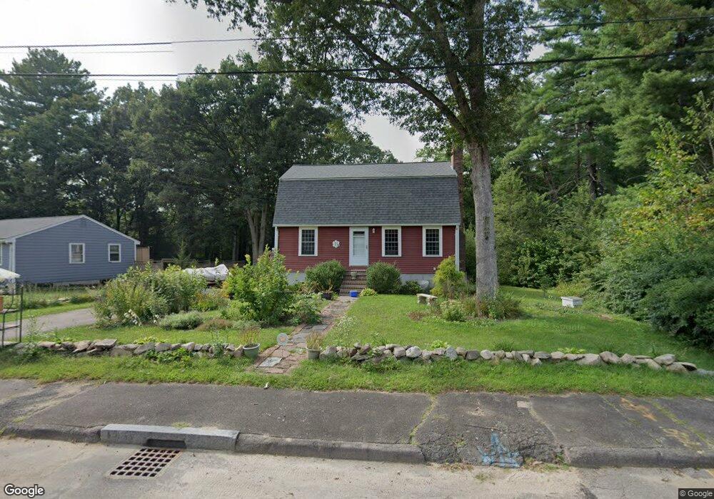
6 Richard Ln Franklin, MA 02038
Estimated Value: $624,000 - $692,000
2
Beds
2
Baths
1,498
Sq Ft
$439/Sq Ft
Est. Value
About This Home
This home is located at 6 Richard Ln, Franklin, MA 02038 and is currently estimated at $657,911, approximately $439 per square foot. 6 Richard Ln is a home located in Norfolk County with nearby schools including John F. Kennedy Memorial School, Horace Mann Middle School, and Franklin High School.
Ownership History
Date
Name
Owned For
Owner Type
Purchase Details
Closed on
Aug 1, 2007
Sold by
Mcmahon Peter J and Mcmahon Catherine C
Bought by
Basignani Philip N and Basignani Diedre T
Current Estimated Value
Home Financials for this Owner
Home Financials are based on the most recent Mortgage that was taken out on this home.
Original Mortgage
$274,000
Interest Rate
6.73%
Mortgage Type
Purchase Money Mortgage
Purchase Details
Closed on
Jul 14, 1988
Sold by
Moore Louis G
Bought by
Mcmahon Peter J
Create a Home Valuation Report for This Property
The Home Valuation Report is an in-depth analysis detailing your home's value as well as a comparison with similar homes in the area
Home Values in the Area
Average Home Value in this Area
Purchase History
| Date | Buyer | Sale Price | Title Company |
|---|---|---|---|
| Basignani Philip N | $345,000 | -- | |
| Mcmahon Peter J | $173,000 | -- |
Source: Public Records
Mortgage History
| Date | Status | Borrower | Loan Amount |
|---|---|---|---|
| Open | Mcmahon Peter J | $297,105 | |
| Closed | Basignani Philip N | $274,000 | |
| Closed | Basignani Philip N | $20,000 | |
| Previous Owner | Mcmahon Peter J | $23,000 | |
| Previous Owner | Mcmahon Peter J | $101,950 |
Source: Public Records
Tax History Compared to Growth
Tax History
| Year | Tax Paid | Tax Assessment Tax Assessment Total Assessment is a certain percentage of the fair market value that is determined by local assessors to be the total taxable value of land and additions on the property. | Land | Improvement |
|---|---|---|---|---|
| 2025 | $6,972 | $600,000 | $243,900 | $356,100 |
| 2024 | $6,507 | $551,900 | $243,900 | $308,000 |
| 2023 | $6,304 | $501,100 | $254,400 | $246,700 |
| 2022 | $6,022 | $428,600 | $210,300 | $218,300 |
| 2021 | $5,592 | $381,700 | $206,200 | $175,500 |
| 2020 | $5,641 | $388,800 | $221,600 | $167,200 |
| 2019 | $5,389 | $367,600 | $200,400 | $167,200 |
| 2018 | $5,284 | $360,700 | $210,100 | $150,600 |
| 2017 | $5,005 | $343,300 | $192,700 | $150,600 |
| 2016 | $4,730 | $326,200 | $205,600 | $120,600 |
| 2015 | $4,485 | $302,200 | $181,600 | $120,600 |
| 2014 | $4,218 | $291,900 | $171,300 | $120,600 |
Source: Public Records
Map
Nearby Homes
- 2 Noanet Brook Ln
- 17 Pine St
- 214 Conlyn Ave
- 951 Pond St
- 208 Irondequoit Rd
- 14 Hawthorne Village Unit D
- 41 Kimberlee Ave
- 18 Mary Anne Dr
- 1805 Franklin Crossing Rd
- 2211 Franklin Crossing Rd Unit 2211
- 159 Highwood Dr
- 336 Maple St
- 605 Franklin Crossing Rd
- 66 Highwood Dr
- 2 Kayla Dr
- 31 Highwood Dr
- 455 Hartford Ave
- 21 Riverside Rd
- 33 Stone Ridge Rd Unit 33
- 0 Old Log Lane (Farm St) Unit 73416329