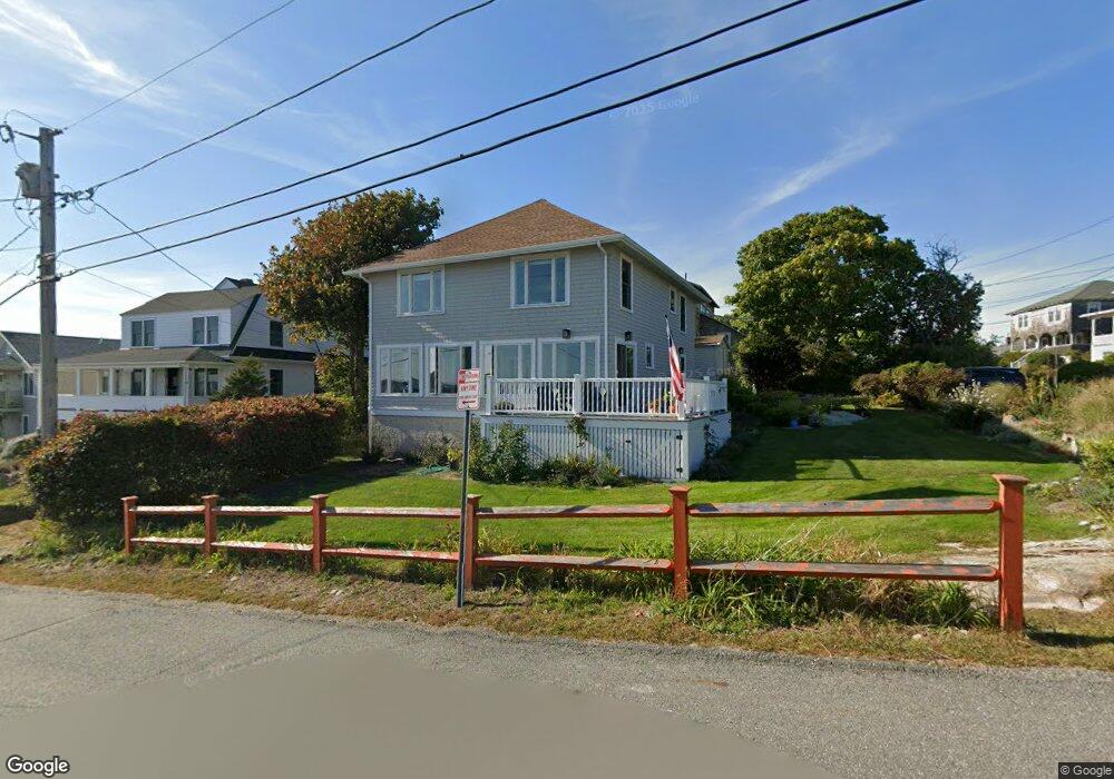
6 Salt Island Rd Gloucester, MA 01930
East Gloucester NeighborhoodEstimated Value: $1,413,000 - $1,841,000
5
Beds
2
Baths
1,600
Sq Ft
$1,010/Sq Ft
Est. Value
About This Home
This home is located at 6 Salt Island Rd, Gloucester, MA 01930 and is currently estimated at $1,616,237, approximately $1,010 per square foot. 6 Salt Island Rd is a home located in Essex County with nearby schools including East Gloucester Elementary School, Ralph B O'maley Middle School, and Gloucester High School.
Ownership History
Date
Name
Owned For
Owner Type
Purchase Details
Closed on
Dec 28, 2016
Sold by
John W Burke Sr 1985 T W and John Burke
Bought by
Burke Christopher J and Vu Traci T
Current Estimated Value
Home Financials for this Owner
Home Financials are based on the most recent Mortgage that was taken out on this home.
Original Mortgage
$736,800
Outstanding Balance
$588,176
Interest Rate
3.94%
Mortgage Type
Purchase Money Mortgage
Estimated Equity
$1,028,061
Purchase Details
Closed on
Apr 1, 1979
Bought by
Burke J W
Create a Home Valuation Report for This Property
The Home Valuation Report is an in-depth analysis detailing your home's value as well as a comparison with similar homes in the area
Home Values in the Area
Average Home Value in this Area
Purchase History
| Date | Buyer | Sale Price | Title Company |
|---|---|---|---|
| Burke Christopher J | $950,000 | -- | |
| Burke J W | -- | -- |
Source: Public Records
Mortgage History
| Date | Status | Borrower | Loan Amount |
|---|---|---|---|
| Open | Burke Christopher J | $736,800 |
Source: Public Records
Tax History
| Year | Tax Paid | Tax Assessment Tax Assessment Total Assessment is a certain percentage of the fair market value that is determined by local assessors to be the total taxable value of land and additions on the property. | Land | Improvement |
|---|---|---|---|---|
| 2025 | $13,083 | $1,346,000 | $815,000 | $531,000 |
| 2024 | $12,121 | $1,245,700 | $776,300 | $469,400 |
| 2023 | $11,692 | $1,104,100 | $693,000 | $411,100 |
| 2022 | $11,305 | $963,800 | $602,700 | $361,100 |
| 2021 | $10,912 | $877,200 | $547,800 | $329,400 |
| 2020 | $10,425 | $845,500 | $516,500 | $329,000 |
| 2019 | $10,327 | $813,800 | $516,500 | $297,300 |
| 2018 | $10,229 | $791,100 | $516,500 | $274,600 |
| 2017 | $9,932 | $753,000 | $492,100 | $260,900 |
| 2016 | $9,409 | $691,300 | $467,200 | $224,100 |
| 2015 | $8,200 | $600,700 | $393,400 | $207,300 |
Source: Public Records
Map
Nearby Homes
- 78 Thatcher Rd Unit 6
- 25 Salt Island Rd
- 70 Old Nugent Farm Rd
- 32 Witham St Unit B
- 26 Marina Dr
- 5 Wise Place
- 87 Atlantic Rd Unit 2
- 3 Mondello Square
- 148 Long Beach
- 36 Eastern Ave
- 33 Highview Rd
- 197 E Main St Unit 1
- 139A Prospect St
- 15 Mount Vernon St
- 19 Trask St Unit 2
- 10 Seaview Rd
- 50 Warner St
- 60 Rocky Neck Ave Unit 202
- 73 Rocky Neck Ave Unit 2
- 175 South St
- 4 Salt Island Rd
- 4 Barberry Way
- 2 Salt Island Rd Unit 3
- 2 Salt Island Rd
- 2 Salt Island Rd Unit 1
- 2 Salt Island Rd Unit 2
- 2 Salt Island Road: Winter Unit 2
- 5 Salt Island Rd
- 3 Barberry Way
- 0 Salt Island Rd Unit 72208602
- 7 Salt Island Rd
- 1 Salt Island Rd
- 88 Witham St
- 8 Salt Island Rd
- 5 Barberry Way
- 11 Barberry Way
- 10 Salt Island Rd
- 8 Barberry Way
- 86 Witham St
- 11 Barberry Way
Your Personal Tour Guide
Ask me questions while you tour the home.