6 Santuit Pond Rd Mashpee, MA 02649
Estimated payment $3,209/month
Highlights
- Spa
- Colonial Architecture
- Corner Lot
- Mashpee High School Rated A-
- 1 Fireplace
- Home Office
About This Home
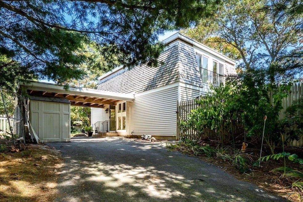
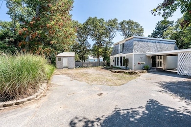
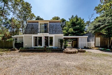
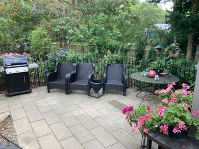
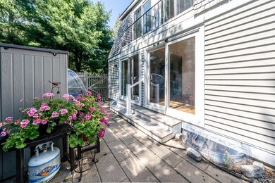
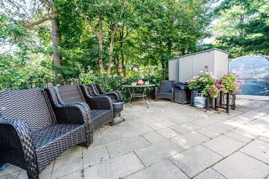
Welcome home to Santuit Pond Estates. This updated contemporary colonial creates an atmosphere of openness, bathed in natural light, both inside and out. The double sliders in the dining room and family room transition to the outdoor oasis with a generous patio, perennial gardens and a fenced in yard, great for entertaining and relaxing. The kitchen, an office room, the fireplaced living room, and a 1/2 bath complete the first floor. The second floor consists of three bedrooms, and a custom tiled full bathroom. Need more space? The full basement is partially finished and there is a 10'x24' storage shed and a 10'x12' shed. The updates in the home showcase premium custom tile work throughout the kitchen, bathrooms, foyer, and other rooms and hallways. Also LVP flooring in some rooms. The Santuit Pond Estates Association provides a ball field, tennis court, basketball court cranberry bog and a sandy beach on Santuit Pond.
Home Details
Home Type
- Single Family
Est. Annual Taxes
- $3,527
Year Built
- Built in 1971
Lot Details
- 0.3 Acre Lot
- Fenced Yard
- Corner Lot
- Garden
- Property is zoned R5
HOA Fees
- $7 Monthly HOA Fees
Home Design
- Colonial Architecture
- Contemporary Architecture
- Frame Construction
- Rubber Roof
- Concrete Perimeter Foundation
Interior Spaces
- 1,688 Sq Ft Home
- 1 Fireplace
- Home Office
- Electric Dryer Hookup
Kitchen
- Range
- Dishwasher
Flooring
- Carpet
- Laminate
- Tile
- Vinyl
Bedrooms and Bathrooms
- 3 Bedrooms
- Primary bedroom located on second floor
Partially Finished Basement
- Basement Fills Entire Space Under The House
- Interior Basement Entry
- Block Basement Construction
- Laundry in Basement
Parking
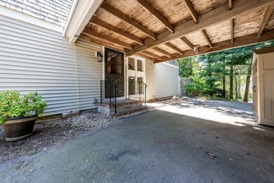
- Carport
- 6 Car Parking Spaces
- Driveway
- Paved Parking
- Open Parking
- Off-Street Parking
Outdoor Features
- Spa
- Walking Distance to Water
- Bulkhead
- Patio
- Outdoor Storage
Utilities
- 3+ Cooling Systems Mounted To A Wall/Window
- Central Heating
- 3 Heating Zones
- Heating System Uses Natural Gas
- Baseboard Heating
- Gas Water Heater
- Sewer Inspection Required for Sale
- Private Sewer
Community Details
- Santuit Pond Estates Subdivision
Listing and Financial Details
- Assessor Parcel Number M:17 B:14 L:0,2348149
Map
Home Values in the Area
Average Home Value in this Area
Tax History
| Year | Tax Paid | Tax Assessment Tax Assessment Total Assessment is a certain percentage of the fair market value that is determined by local assessors to be the total taxable value of land and additions on the property. | Land | Improvement |
|---|---|---|---|---|
| 2025 | $3,527 | $532,800 | $214,100 | $318,700 |
| 2024 | $3,204 | $498,300 | $194,600 | $303,700 |
| 2023 | $3,021 | $431,000 | $185,300 | $245,700 |
| 2022 | $2,871 | $351,400 | $150,700 | $200,700 |
| 2021 | $2,823 | $311,300 | $135,700 | $175,600 |
| 2020 | $6,405 | $301,800 | $130,500 | $171,300 |
| 2019 | $6,092 | $289,300 | $130,500 | $158,800 |
| 2018 | $5,514 | $271,200 | $124,900 | $146,300 |
| 2017 | $2,367 | $257,600 | $124,900 | $132,700 |
| 2016 | $2,293 | $248,200 | $124,900 | $123,300 |
| 2015 | $2,200 | $241,500 | $124,900 | $116,600 |
| 2014 | $2,264 | $241,100 | $124,600 | $116,500 |
Property History
| Date | Event | Price | List to Sale | Price per Sq Ft |
|---|---|---|---|---|
| 12/05/2025 12/05/25 | For Sale | $554,500 | 0.0% | $328 / Sq Ft |
| 11/19/2025 11/19/25 | Off Market | $554,500 | -- | -- |
| 09/25/2025 09/25/25 | Price Changed | $554,500 | -0.8% | $328 / Sq Ft |
| 08/28/2025 08/28/25 | Price Changed | $559,000 | -3.5% | $331 / Sq Ft |
| 08/08/2025 08/08/25 | For Sale | $579,000 | -- | $343 / Sq Ft |
Purchase History
| Date | Type | Sale Price | Title Company |
|---|---|---|---|
| Deed | $128,009 | -- | |
| Deed | $111,000 | -- |
Mortgage History
| Date | Status | Loan Amount | Loan Type |
|---|---|---|---|
| Open | $127,914 | No Value Available | |
| Closed | $127,914 | Purchase Money Mortgage | |
| Previous Owner | $110,941 | Purchase Money Mortgage | |
| Previous Owner | $69,000 | No Value Available |
Source: MLS Property Information Network (MLS PIN)
MLS Number: 73415727
APN: MASH-000017-000014
- 89 Eisenhower Dr
- 70 Cape Dr Unit 4C
- 766 Putnam Ave
- 5 Anthonys Way
- 18 Sandy Valley Rd
- 3040 Falmouth Rd Unit 3
- 20 Brigantine Ave
- 3 Kensington Dr
- 35 Ocean View Ave
- 14 Pga Ln
- 50 Hane Rd
- 5 Andersen Ave
- 94 Doran Dr Unit n/a
- 94 Doran Dr
- 422 Massachusetts 6a Unit 2
- 101 Longfellow Dr
- 93 Twin Hill Rd Unit 2
- 310 White Oak Trail
- 310 White Oak Trail Unit B
- 45 Moco Rd
