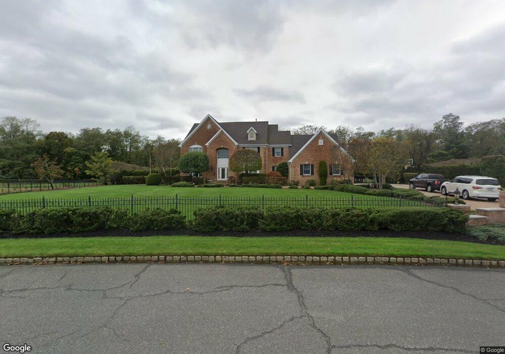
6 Shady Tree Ln Colts Neck, NJ 07722
Estimated Value: $2,019,000 - $2,265,865
4
Beds
5
Baths
5,140
Sq Ft
$421/Sq Ft
Est. Value
About This Home
This home is located at 6 Shady Tree Ln, Colts Neck, NJ 07722 and is currently estimated at $2,165,966, approximately $421 per square foot. 6 Shady Tree Ln is a home located in Monmouth County with nearby schools including Conover Road School, Cedar Drive Middle School, and Colts Neck High School.
Ownership History
Date
Name
Owned For
Owner Type
Purchase Details
Closed on
Aug 10, 1998
Sold by
Aspen Building
Bought by
Diorio Joseph
Current Estimated Value
Home Financials for this Owner
Home Financials are based on the most recent Mortgage that was taken out on this home.
Original Mortgage
$436,800
Outstanding Balance
$91,125
Interest Rate
6.92%
Estimated Equity
$2,074,841
Create a Home Valuation Report for This Property
The Home Valuation Report is an in-depth analysis detailing your home's value as well as a comparison with similar homes in the area
Home Values in the Area
Average Home Value in this Area
Purchase History
| Date | Buyer | Sale Price | Title Company |
|---|---|---|---|
| Diorio Joseph | $582,500 | -- |
Source: Public Records
Mortgage History
| Date | Status | Borrower | Loan Amount |
|---|---|---|---|
| Open | Diorio Joseph | $436,800 |
Source: Public Records
Tax History Compared to Growth
Tax History
| Year | Tax Paid | Tax Assessment Tax Assessment Total Assessment is a certain percentage of the fair market value that is determined by local assessors to be the total taxable value of land and additions on the property. | Land | Improvement |
|---|---|---|---|---|
| 2025 | $25,925 | $1,881,500 | $801,400 | $1,080,100 |
| 2024 | $24,355 | $1,739,900 | $648,400 | $1,091,500 |
| 2023 | $24,355 | $1,565,200 | $533,400 | $1,031,800 |
| 2022 | $19,938 | $1,409,600 | $448,400 | $961,200 |
| 2021 | $19,938 | $1,141,900 | $367,100 | $774,800 |
| 2020 | $20,007 | $1,134,200 | $387,100 | $747,100 |
| 2019 | $19,811 | $1,125,000 | $387,100 | $737,900 |
| 2018 | $19,779 | $1,114,300 | $377,100 | $737,200 |
| 2017 | $19,519 | $1,103,400 | $367,100 | $736,300 |
| 2016 | $19,136 | $1,105,500 | $365,500 | $740,000 |
| 2015 | $19,349 | $1,115,200 | $378,000 | $737,200 |
| 2014 | $22,628 | $1,341,300 | $528,000 | $813,300 |
Source: Public Records
Map
Nearby Homes
- 0 Hominy Hill Rd
- 152 Bucks Mill Rd
- 5 Pheasant Rd
- 24 Willow Lake Dr
- 40 New St
- 4 Brookside Dr
- 8 Holling Rd
- 10 Driftwood Ln
- 97 Stone Hill Rd
- 2 Blacksmith Pass
- 249 County Road 537
- 8 Culpeper Key
- 703 Quail Hill Rd
- 145 Heulitt Rd
- 4 Queens Pass
- 39 Primrose Ln
- 21 Holly Hill Rd
- 4 Oxford Key
- 10 Nicholson Key
- 151 Dutch Lane Rd
- 4 Shady Tree Ln
- 8 Shady Tree Ln
- 91 County Road 537
- 2 Shady Tree Ln
- 7 Shady Tree Ln
- 3 Shady Tree Ln
- 10 Shady Tree Ln
- 156 County Road 537 W
- 160 County Road 537 W
- 79 Route 537
- 1 Shady Tree Ln
- 9 Shady Tree Ln
- 164 County Road 537 W
- 75 Route 537
- 21 Manor Rd
- 29 Manor Rd
- 12 Shady Tree Ln
- 11 Shady Tree Ln
- 17 Manor Rd
- 13 Manor Rd