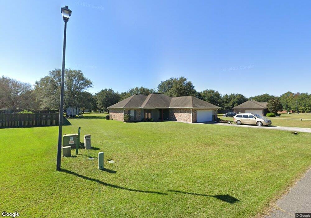
6 Taos Ln Picayune, MS 39466
Estimated Value: $238,000 - $250,445
4
Beds
2
Baths
1,665
Sq Ft
$147/Sq Ft
Est. Value
About This Home
This home is located at 6 Taos Ln, Picayune, MS 39466 and is currently estimated at $245,361, approximately $147 per square foot. 6 Taos Ln is a home located in Pearl River County with nearby schools including Pearl River Central Upper Elementary School, Pearl River Central Lower Elementary School, and Pearl River Central Middle School.
Ownership History
Date
Name
Owned For
Owner Type
Purchase Details
Closed on
Aug 29, 2025
Sold by
Neese Joshua M and Neese Tori L
Bought by
Baudier Clay
Current Estimated Value
Home Financials for this Owner
Home Financials are based on the most recent Mortgage that was taken out on this home.
Original Mortgage
$52,000
Outstanding Balance
$51,607
Interest Rate
0.65%
Mortgage Type
Construction
Estimated Equity
$193,754
Purchase Details
Closed on
Nov 25, 2019
Sold by
Us Bank
Bought by
Neese Tori and Neese Josh
Purchase Details
Closed on
Oct 8, 2008
Sold by
Oneals Homes Incorporated
Bought by
Fowler Brian W and Fowler Rickara
Create a Home Valuation Report for This Property
The Home Valuation Report is an in-depth analysis detailing your home's value as well as a comparison with similar homes in the area
Purchase History
| Date | Buyer | Sale Price | Title Company |
|---|---|---|---|
| Baudier Clay | $65,000 | Attorney Only | |
| Neese Tori | $164,000 | -- | |
| Fowler Brian W | -- | -- |
Source: Public Records
Mortgage History
| Date | Status | Borrower | Loan Amount |
|---|---|---|---|
| Open | Baudier Clay | $52,000 |
Source: Public Records
Tax History
| Year | Tax Paid | Tax Assessment Tax Assessment Total Assessment is a certain percentage of the fair market value that is determined by local assessors to be the total taxable value of land and additions on the property. | Land | Improvement |
|---|---|---|---|---|
| 2025 | $1,831 | $17,294 | $0 | $0 |
| 2024 | $1,831 | $17,362 | $0 | $0 |
| 2023 | $1,831 | $15,971 | $0 | $0 |
| 2022 | $1,666 | $15,971 | $0 | $0 |
| 2021 | $1,655 | $15,971 | $0 | $0 |
| 2020 | $1,663 | $15,971 | $0 | $0 |
| 2019 | $2,854 | $23,838 | $0 | $0 |
| 2018 | $2,835 | $23,838 | $0 | $0 |
| 2017 | $0 | $23,838 | $0 | $0 |
| 2016 | $2,668 | $23,838 | $0 | $0 |
| 2015 | -- | $21,501 | $0 | $0 |
| 2014 | -- | $21,912 | $0 | $0 |
Source: Public Records
Map
Nearby Homes
- 9 Timaquana Dr
- 15 Miami Ln
- 49 Mojave Ln
- 27 Spice St
- 24 Bear Path
- 17 Pointer Trail
- 52 Oak Dr
- 2 Arbor Ln
- 34 Leo Eaves Rd
- 34 Hidden Hills Dr E
- 131 Monk Mitchell Rd
- 33 Longbow Dr
- 116 Monk Mitchell Rd
- 1274 W Union Rd
- 1298 W Union Rd
- 730 Sycamore Rd
- 521 Old Kiln Rd
- 14 Acres F Z Goss Rd
- 42 J D Gill Rd
- 1290 W Union Rd
Your Personal Tour Guide
Ask me questions while you tour the home.