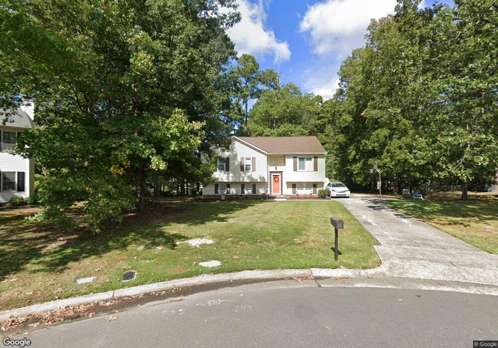
6 Woodsprite Ct Durham, NC 27703
Eastern Durham NeighborhoodEstimated Value: $305,000 - $348,000
3
Beds
3
Baths
2,057
Sq Ft
$158/Sq Ft
Est. Value
About This Home
This home is located at 6 Woodsprite Ct, Durham, NC 27703 and is currently estimated at $324,533, approximately $157 per square foot. 6 Woodsprite Ct is a home located in Durham County with nearby schools including Glenn Elementary, John W Neal Middle School, and Southern School of Energy & Sustainability.
Ownership History
Date
Name
Owned For
Owner Type
Purchase Details
Closed on
Jul 2, 2004
Sold by
Household Realty Corp
Bought by
Taylor Cheryl D
Current Estimated Value
Home Financials for this Owner
Home Financials are based on the most recent Mortgage that was taken out on this home.
Original Mortgage
$116,578
Outstanding Balance
$56,226
Interest Rate
6.24%
Mortgage Type
FHA
Estimated Equity
$268,307
Purchase Details
Closed on
Dec 9, 2003
Sold by
Rogers Stephanie D and Rogers Waldo A
Bought by
Household Realty Corp
Purchase Details
Closed on
Jun 6, 2000
Sold by
Wright Marion E and Wright Leatha S
Bought by
Rogers Waldo A and Rogers Stephanie D
Home Financials for this Owner
Home Financials are based on the most recent Mortgage that was taken out on this home.
Original Mortgage
$117,000
Interest Rate
11.55%
Create a Home Valuation Report for This Property
The Home Valuation Report is an in-depth analysis detailing your home's value as well as a comparison with similar homes in the area
Home Values in the Area
Average Home Value in this Area
Purchase History
| Date | Buyer | Sale Price | Title Company |
|---|---|---|---|
| Taylor Cheryl D | $118,000 | -- | |
| Household Realty Corp | $121,618 | -- | |
| Rogers Waldo A | $130,000 | -- |
Source: Public Records
Mortgage History
| Date | Status | Borrower | Loan Amount |
|---|---|---|---|
| Open | Taylor Cheryl D | $116,578 | |
| Previous Owner | Rogers Waldo A | $117,000 | |
| Closed | Rogers Waldo A | $6,500 |
Source: Public Records
Tax History
| Year | Tax Paid | Tax Assessment Tax Assessment Total Assessment is a certain percentage of the fair market value that is determined by local assessors to be the total taxable value of land and additions on the property. | Land | Improvement |
|---|---|---|---|---|
| 2025 | $2,248 | $313,134 | $65,565 | $247,569 |
| 2024 | $1,742 | $165,470 | $28,240 | $137,230 |
| 2023 | $1,649 | $165,470 | $28,240 | $137,230 |
| 2022 | $1,587 | $165,470 | $28,240 | $137,230 |
| 2021 | $1,398 | $165,470 | $28,240 | $137,230 |
| 2020 | $1,381 | $165,470 | $28,240 | $137,230 |
| 2019 | $1,381 | $165,470 | $28,240 | $137,230 |
| 2018 | $1,236 | $135,531 | $28,120 | $107,411 |
| 2017 | $1,223 | $135,531 | $28,120 | $107,411 |
| 2016 | $1,186 | $135,531 | $28,120 | $107,411 |
| 2015 | $1,350 | $129,969 | $28,431 | $101,538 |
| 2014 | $1,350 | $129,969 | $28,431 | $101,538 |
Source: Public Records
Map
Nearby Homes
- 8 Lost Tree Ct
- 2 Tarrywood Ct
- 4317 Marbrey Dr
- 7 Duxford Ct
- 4505 Tyne Dr
- 1034 Statler Dr
- 608 Chalcedony Ct
- 409 Magna Dr
- 1060 Gentle Reed Dr
- 1113 Homecoming Way
- 1113 Kindness Ln
- 416 Chivalry Dr
- 107 Crosswood Dr
- 502 Quartz Dr
- 509 Pebblestone Dr
- 1143 Sweet Cream Ct
- 521 Quartz Dr
- 3702 Turquoise Dr
- 1011 Homecoming Way
- 1742 Fletchers Chapel Rd
- 4 Woodsprite Ct
- 5813 Hadrian Dr
- 13 Birds Nest Ct
- 15 Birds Nest Ct
- 2 Woodsprite Ct
- 7 Woodsprite Ct
- 16 Birds Nest Ct
- 5815 Hadrian Dr
- 5 Woodsprite Ct
- 3 Woodsprite Ct
- 12 Lost Tree Ct
- 11 Birds Nest Ct
- 1 Woodsprite Ct
- 104 Wesker Cir
- 14 Birds Nest Ct
- 102 Wesker Cir
- 5817 Hadrian Dr
- 5808 Hadrian Dr
- 5810 Hadrian Dr
- 10 Lost Tree Ct
Your Personal Tour Guide
Ask me questions while you tour the home.
