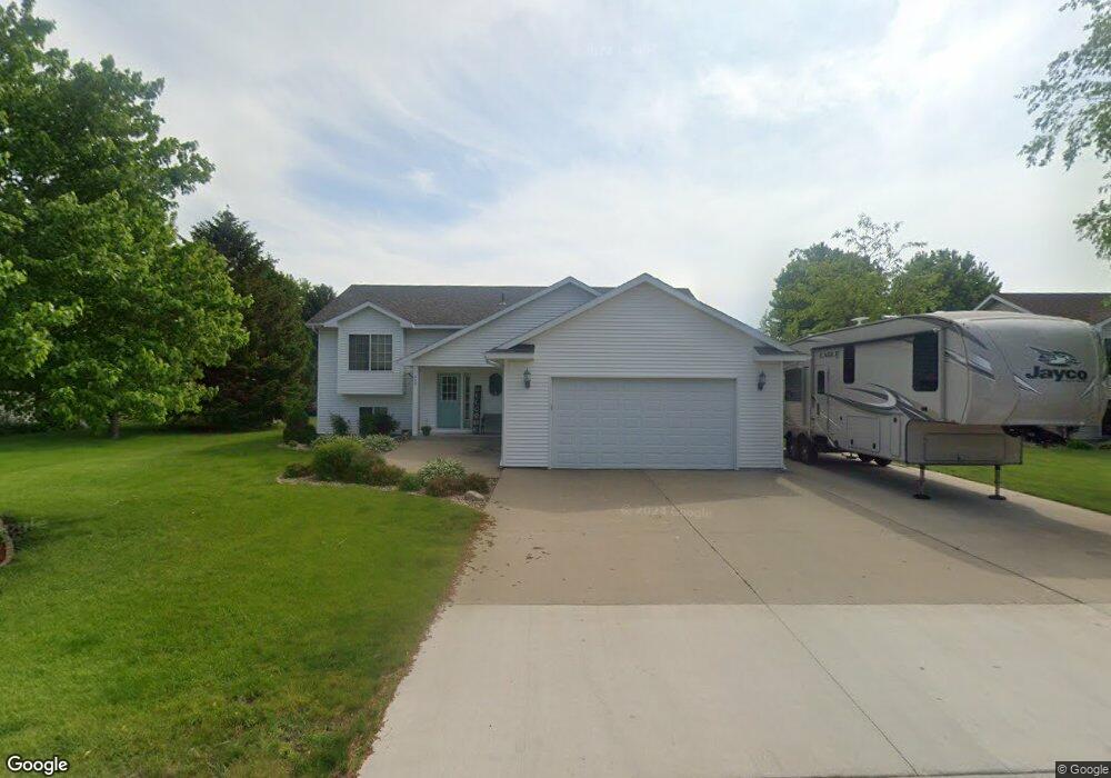
600 600 Palmer-Drive- St. Clair, MN 56080
Estimated Value: $262,000 - $372,000
5
Beds
2
Baths
1,468
Sq Ft
$218/Sq Ft
Est. Value
About This Home
This home is located at 600 600 Palmer-Drive-, St. Clair, MN 56080 and is currently estimated at $319,723, approximately $217 per square foot. 600 600 Palmer-Drive- is a home located in Blue Earth County with nearby schools including St. Clair Elementary School and St. Clair Secondary School.
Ownership History
Date
Name
Owned For
Owner Type
Purchase Details
Closed on
Mar 2, 2009
Sold by
Rustad Timothy D and Rustad Jessica J
Bought by
Nagel Dean and Nagel Lisa
Current Estimated Value
Home Financials for this Owner
Home Financials are based on the most recent Mortgage that was taken out on this home.
Original Mortgage
$153,200
Outstanding Balance
$97,208
Interest Rate
5.09%
Mortgage Type
New Conventional
Estimated Equity
$222,515
Purchase Details
Closed on
Sep 22, 2006
Sold by
Holm Samuel A and Holm Michelle R
Bought by
Rustad Timothy D and Rustad Jessica J
Create a Home Valuation Report for This Property
The Home Valuation Report is an in-depth analysis detailing your home's value as well as a comparison with similar homes in the area
Home Values in the Area
Average Home Value in this Area
Purchase History
| Date | Buyer | Sale Price | Title Company |
|---|---|---|---|
| Nagel Dean | $191,500 | -- | |
| Rustad Timothy D | $205,000 | -- |
Source: Public Records
Mortgage History
| Date | Status | Borrower | Loan Amount |
|---|---|---|---|
| Open | Nagel Dean | $153,200 |
Source: Public Records
Tax History Compared to Growth
Tax History
| Year | Tax Paid | Tax Assessment Tax Assessment Total Assessment is a certain percentage of the fair market value that is determined by local assessors to be the total taxable value of land and additions on the property. | Land | Improvement |
|---|---|---|---|---|
| 2025 | $4,722 | $323,300 | $22,400 | $300,900 |
| 2024 | $4,722 | $313,200 | $22,300 | $290,900 |
| 2023 | $4,842 | $320,000 | $22,300 | $297,700 |
| 2022 | $4,526 | $302,900 | $22,300 | $280,600 |
| 2021 | $3,810 | $250,000 | $22,300 | $227,700 |
| 2020 | $3,584 | $225,600 | $22,300 | $203,300 |
| 2019 | $3,560 | $225,600 | $22,300 | $203,300 |
| 2018 | $3,490 | $225,700 | $22,300 | $203,400 |
| 2017 | $3,222 | $225,700 | $22,300 | $203,400 |
| 2016 | $3,160 | $202,500 | $22,300 | $180,200 |
| 2015 | $30 | $194,200 | $22,300 | $171,900 |
| 2014 | $3,062 | $188,400 | $22,300 | $166,100 |
Source: Public Records
Map
Nearby Homes
- 301 Hilton Dr
- 506 Miller Ln
- 506 506 Miller Ln
- 120 120 S Front St
- TBD 200th St
- 0 200th St
- Tbd 200th St
- XXX 602nd Ave
- 602nd Avenue
- 510 River Hills Rd
- 60451 211th St
- 60639 211th St
- 0 Tbd Oak Dr
- 225 225 Oak Dr
- 225 Oak Dr
- 58560 Kirkwood Rd
- 205 Peregrine Ave
- 106 106 E Connie Ln Unit 106 Connie Lane E
- 57868 179th St
- 104 White Fox Path
- 600 Palmer Dr
- 602 602 Palmer Dr
- 602 Palmer Dr
- 508 508 Palmer Dr
- 307 Hilton Dr
- 601 Palmer Dr
- 506 506 Palmer Dr
- 10 10 Winslow-Circle-
- 10 10 Winslow Cir
- 10 Winslow Cir
- 10 Winslow Cir
- 303 303 Hilton Dr
- 303 Hilton Dr
- 509 509 Miller Ln
- 509 Miller Ln
- 504 Palmer Dr
- 507 Miller Ln
- 20 Winslow Cir
- 302 302 Hilton-Drive-
- 302 Hilton Dr