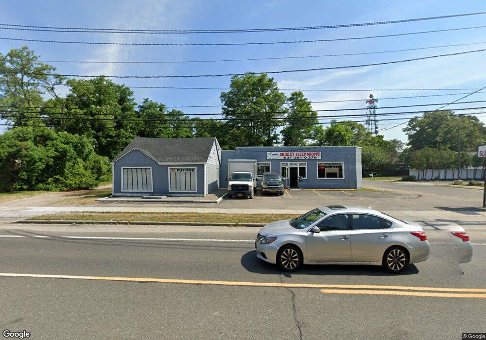
600 Montauk Hwy Shirley, NY 11967
Estimated Value: $935,171
--
Bed
--
Bath
2,232
Sq Ft
$419/Sq Ft
Est. Value
About This Home
This home is located at 600 Montauk Hwy, Shirley, NY 11967 and is currently estimated at $935,171, approximately $418 per square foot. 600 Montauk Hwy is a home located in Suffolk County with nearby schools including William Floyd Elementary School, William Floyd Middle School, and William Floyd High School.
Ownership History
Date
Name
Owned For
Owner Type
Purchase Details
Closed on
May 6, 2016
Sold by
600 Montauk Highway Property Llc
Bought by
600 Montauk Corp
Current Estimated Value
Home Financials for this Owner
Home Financials are based on the most recent Mortgage that was taken out on this home.
Original Mortgage
$375,000
Outstanding Balance
$297,843
Interest Rate
3.59%
Mortgage Type
Commercial
Estimated Equity
$637,328
Purchase Details
Closed on
Dec 31, 2012
Sold by
Montanez Anne J and Montanez Francisco
Bought by
600 Montauk Highway Property Llc
Create a Home Valuation Report for This Property
The Home Valuation Report is an in-depth analysis detailing your home's value as well as a comparison with similar homes in the area
Home Values in the Area
Average Home Value in this Area
Purchase History
| Date | Buyer | Sale Price | Title Company |
|---|---|---|---|
| 600 Montauk Corp | $500,000 | Fidelity National Title Insu | |
| 600 Montauk Highway Property Llc | -- | -- |
Source: Public Records
Mortgage History
| Date | Status | Borrower | Loan Amount |
|---|---|---|---|
| Open | 600 Montauk Corp | $375,000 |
Source: Public Records
Tax History Compared to Growth
Tax History
| Year | Tax Paid | Tax Assessment Tax Assessment Total Assessment is a certain percentage of the fair market value that is determined by local assessors to be the total taxable value of land and additions on the property. | Land | Improvement |
|---|---|---|---|---|
| 2024 | $13,188 | $3,300 | $1,070 | $2,230 |
| 2023 | $13,188 | $3,300 | $1,070 | $2,230 |
| 2022 | $14,094 | $3,300 | $1,070 | $2,230 |
| 2021 | $14,094 | $3,300 | $1,070 | $2,230 |
| 2020 | $14,993 | $3,300 | $1,070 | $2,230 |
| 2019 | $14,993 | $0 | $0 | $0 |
| 2018 | -- | $3,300 | $1,070 | $2,230 |
| 2017 | $14,420 | $3,300 | $1,070 | $2,230 |
| 2016 | $14,408 | $3,300 | $1,070 | $2,230 |
| 2015 | -- | $3,300 | $1,070 | $2,230 |
| 2014 | -- | $3,300 | $1,070 | $2,230 |
Source: Public Records
Map
Nearby Homes
- 0 Pinewood Dr Unit KEY867819
- 0 Moriches Mid Isl Rd Unit 3439402
- 0 Holly Ln Unit KEY894949
- 4 Olive Ln
- 42 Revilo Ave
- 8 Park Cir
- 45 Oak Ave
- 80 Heston Rd
- 65 Essex Cir
- 18 Merrick Rd
- 68 Ostend Cir
- 0 Mcgraw St Unit KEY868704
- 80 Grand Ave
- 120 River Rd
- 99 Forrest Ave
- V/L Versa Place
- 124 River Rd
- 20 Hounslow Rd
- 53 Corbin Ave
- 125 Grand Ave
- 6 Windsor Place
- 10 Windsor Place
- 574 Montauk Hwy
- 12 Windsor Place
- 3 Dorsett Place
- 14 Windsor Place
- 5 Dorsett Place
- 11 Dorsett Place
- 15 Windsor Place
- 15 Dorsett Place
- 18 Windsor Place
- 19 Dorsett Place
- 19 Windsor Place
- 21 Dorsett Place
- 24 Windsor Place
- N / C Birch Hollow Dr
- Vac Land Edwards Dr
- Nc Merrick Ave
- N/C Lockwood Dr
- V/L Ostend Cir