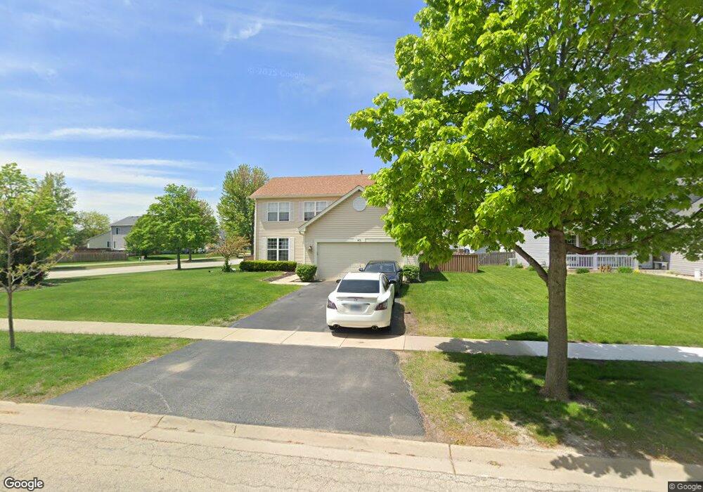
601 Brita Trail Minooka, IL 60447
Estimated Value: $310,000 - $378,000
4
Beds
3
Baths
1,998
Sq Ft
$178/Sq Ft
Est. Value
About This Home
This home is located at 601 Brita Trail, Minooka, IL 60447 and is currently estimated at $354,660, approximately $177 per square foot. 601 Brita Trail is a home located in Grundy County with nearby schools including Minooka Primary Center, Aux Sable Elementary School, and Minooka Junior High School.
Ownership History
Date
Name
Owned For
Owner Type
Purchase Details
Closed on
Feb 18, 2021
Sold by
Zurek Jennifer and Zurek Jason
Bought by
Kuhn Harold Edward and Kuhn Maria Zamarripa
Current Estimated Value
Home Financials for this Owner
Home Financials are based on the most recent Mortgage that was taken out on this home.
Original Mortgage
$243,000
Outstanding Balance
$217,524
Interest Rate
2.75%
Mortgage Type
Construction
Estimated Equity
$137,136
Create a Home Valuation Report for This Property
The Home Valuation Report is an in-depth analysis detailing your home's value as well as a comparison with similar homes in the area
Home Values in the Area
Average Home Value in this Area
Purchase History
| Date | Buyer | Sale Price | Title Company |
|---|---|---|---|
| Kuhn Harold Edward | $270,000 | Stewart Title |
Source: Public Records
Mortgage History
| Date | Status | Borrower | Loan Amount |
|---|---|---|---|
| Open | Kuhn Harold Edward | $243,000 |
Source: Public Records
Tax History Compared to Growth
Tax History
| Year | Tax Paid | Tax Assessment Tax Assessment Total Assessment is a certain percentage of the fair market value that is determined by local assessors to be the total taxable value of land and additions on the property. | Land | Improvement |
|---|---|---|---|---|
| 2024 | $7,071 | $88,149 | $11,060 | $77,089 |
| 2023 | $6,445 | $80,347 | $10,081 | $70,266 |
| 2022 | $5,511 | $74,706 | $9,373 | $65,333 |
| 2021 | $5,272 | $70,718 | $8,873 | $61,845 |
| 2020 | $5,638 | $67,648 | $8,488 | $59,160 |
| 2019 | $5,357 | $62,637 | $7,859 | $54,778 |
| 2018 | $5,428 | $61,936 | $7,771 | $54,165 |
| 2017 | $5,292 | $59,145 | $7,421 | $51,724 |
| 2016 | $4,971 | $55,519 | $6,966 | $48,553 |
| 2015 | $4,563 | $50,467 | $6,332 | $44,135 |
| 2014 | $4,417 | $53,420 | $11,150 | $42,270 |
| 2013 | $4,532 | $54,140 | $11,300 | $42,840 |
Source: Public Records
Map
Nearby Homes
- 825 Grant Dr
- 1404 Plantain Dr
- 1935 Waters Edge Dr
- 1941 Waters Edge Dr
- 324 Wabena Ct
- 1118 Burns Ln
- 1420 Marigold Ln
- 1468 Sedge Pass
- 1413 Sedge Pass
- 1074-1080 Clover Dr
- 1448 Sedge Pass
- 1224 Burns Ln
- 278,279,280,281 Clover Cir
- Lots 298-301 Clover Cir
- 605 High Grove Dr
- 802 Joanne Dr
- 2080 Waters Edge Dr
- 314 Golden Rod Dr
- 703 Stillwater Ct
- 246 Prairie Ridge Dr
- 601 Brita Trail
- 605 Brita Trail
- 000 Misty Creek Dr
- 609 Brita Trail
- 1300 Glenridge Ct N
- 801 Grant Dr
- 1304 Glenridge Ct N
- 600 Brita Trail
- 604 Brita Trail
- 1400 Glenridge Ct S
- 1308 Glenridge Ct N
- 608 Brita Trail
- 613 Brita Trail
- 805 Grant Dr
- 800 Grant Dr
- 612 Brita Trail
- 1312 Glenridge Ct N
- 1404 Glenridge Ct S
- 617 Brita Trail
- 804 Grant Dr