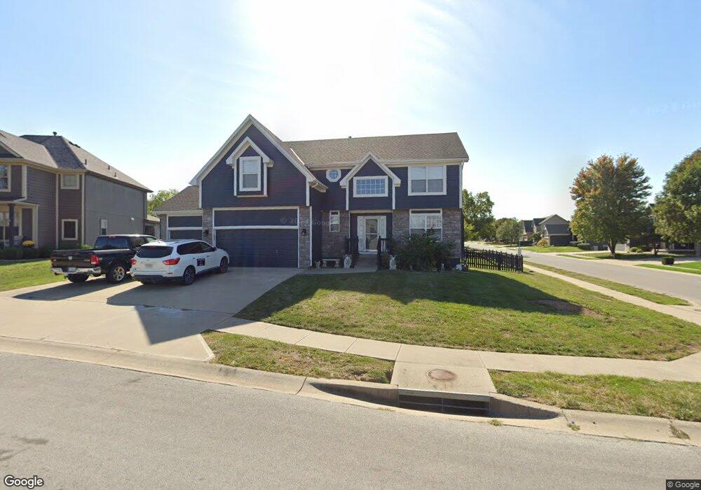
601 Duncan Cir Raymore, MO 64083
Estimated Value: $473,000 - $509,000
4
Beds
2
Baths
2,602
Sq Ft
$189/Sq Ft
Est. Value
About This Home
This home is located at 601 Duncan Cir, Raymore, MO 64083 and is currently estimated at $492,247, approximately $189 per square foot. 601 Duncan Cir is a home located in Cass County with nearby schools including Creekmoor Elementary School, Raymore-Peculiar East Middle School, and Raymore-Peculiar Senior High School.
Ownership History
Date
Name
Owned For
Owner Type
Purchase Details
Closed on
Oct 23, 2006
Sold by
Bristol Homes Inc
Bought by
Viets Bradley C and Viets Marisa A
Current Estimated Value
Home Financials for this Owner
Home Financials are based on the most recent Mortgage that was taken out on this home.
Original Mortgage
$226,575
Outstanding Balance
$134,129
Interest Rate
6.41%
Mortgage Type
New Conventional
Estimated Equity
$358,118
Create a Home Valuation Report for This Property
The Home Valuation Report is an in-depth analysis detailing your home's value as well as a comparison with similar homes in the area
Home Values in the Area
Average Home Value in this Area
Purchase History
| Date | Buyer | Sale Price | Title Company |
|---|---|---|---|
| Viets Bradley C | -- | -- |
Source: Public Records
Mortgage History
| Date | Status | Borrower | Loan Amount |
|---|---|---|---|
| Open | Viets Bradley C | $226,575 |
Source: Public Records
Tax History
| Year | Tax Paid | Tax Assessment Tax Assessment Total Assessment is a certain percentage of the fair market value that is determined by local assessors to be the total taxable value of land and additions on the property. | Land | Improvement |
|---|---|---|---|---|
| 2025 | $5,161 | $71,950 | $11,600 | $60,350 |
| 2024 | $5,161 | $63,420 | $10,550 | $52,870 |
| 2023 | $5,154 | $63,420 | $10,550 | $52,870 |
| 2022 | $4,671 | $57,100 | $10,550 | $46,550 |
| 2021 | $4,672 | $57,100 | $10,550 | $46,550 |
| 2020 | $4,566 | $54,810 | $10,550 | $44,260 |
| 2019 | $4,408 | $54,810 | $10,550 | $44,260 |
| 2018 | $4,383 | $52,630 | $10,550 | $42,080 |
| 2017 | $4,047 | $52,630 | $10,550 | $42,080 |
| 2016 | $4,047 | $50,450 | $10,550 | $39,900 |
| 2015 | $4,050 | $50,450 | $10,550 | $39,900 |
| 2014 | $4,052 | $50,450 | $10,550 | $39,900 |
| 2013 | -- | $50,450 | $10,550 | $39,900 |
Source: Public Records
Map
Nearby Homes
- 518 Andypaul Ct
- 1217 Hampton Dr
- 1323 W Johns Blvd
- 701 Hampstead Dr
- 1412 W Stone Blvd
- 602 Foxglove Ln
- 604 Foxglove Ln
- 502 Foxglove Ln
- 614 Foxglove Ln
- 851 Creekmoor Pond Ln
- 610 Wild Lupine Ln
- 610 Foxglove Ln
- 604 Wild Lupine Ln
- 606 Foxglove Ln
- 608 Foxglove Ln
- 609 Foxglove Ln
- 710 Blazing Star Dr
- 708 Blazing Star Dr
- 705 Red Clover Ct
- 701 Wood Sage Ct
- 603 Duncan Cir
- 1214 Wiltshire Blvd
- 1217 Wiltshire Blvd
- 1220 Wiltshire Blvd
- 1215 Wiltshire Blvd
- 1212 Wiltshire Blvd
- 1219 Wiltshire Blvd
- 605 Duncan Cir
- 1213 Wiltshire Blvd
- 0 Wiltshire Blvd
- 1221 Wiltshire Blvd
- 607 Duncan Cir
- 1210 Wiltshire Blvd
- 1222 Wiltshire Blvd
- 608 Duncan Cir
- 1223 Wiltshire Blvd
- 1211 Wiltshire Blvd
- 609 Duncan Cir
- 1208 Wiltshire Blvd
- 1224 Wiltshire Blvd
Your Personal Tour Guide
Ask me questions while you tour the home.